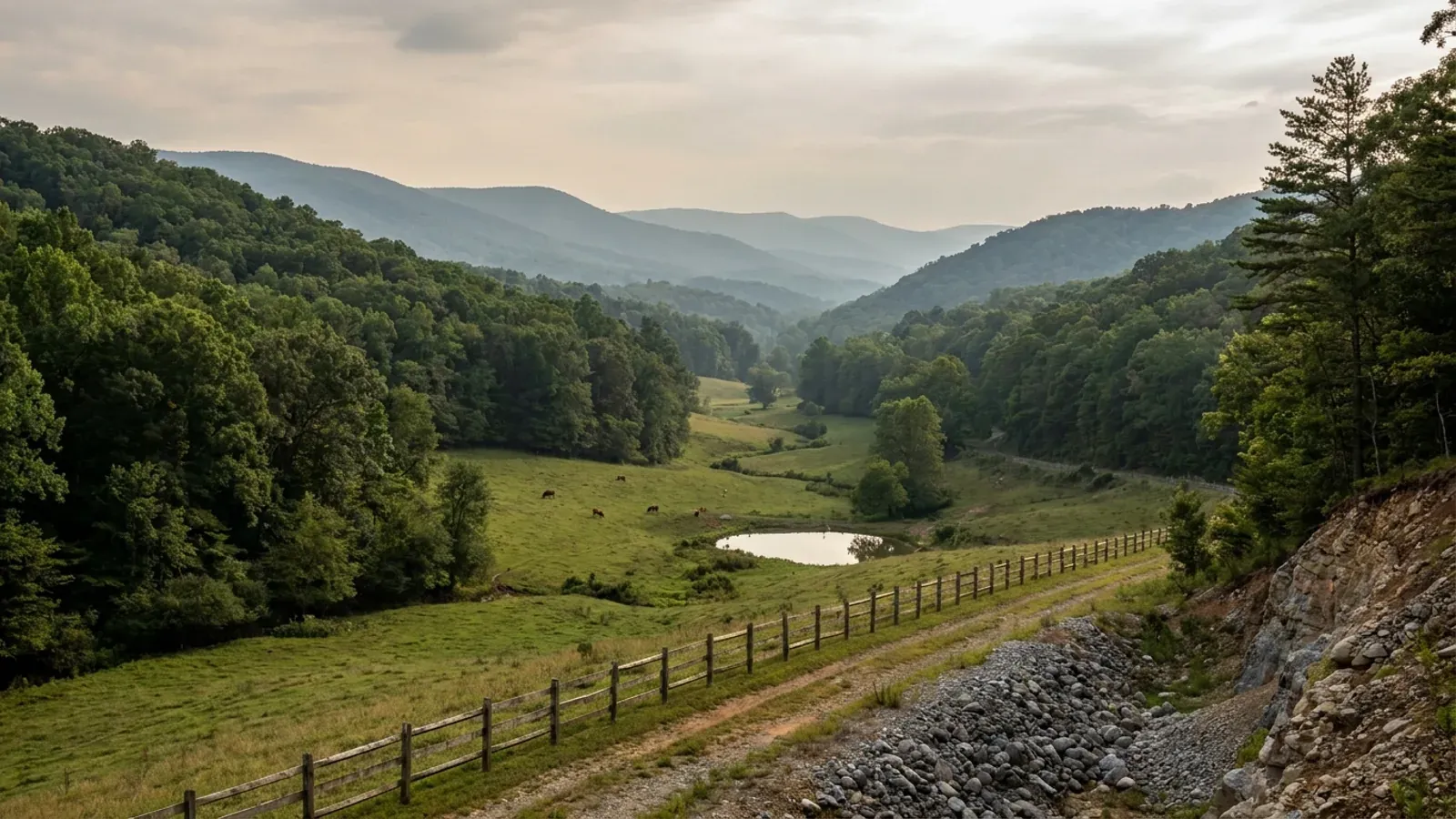
Barndominium Builders in Bedford County, VA
Bedford County is 760 square miles between Lynchburg and Roanoke, and 183,200 of its acres are in farms — the fifth-largest farm acreage of any locality in Virginia, with a 73-acre median farm and 422 farms under fifty acres. That combination is why both city pages point here: Lynchburg and Roanoke are independent cities in no county at all, and this is the land they buy. The county holds the northern shore of Smith Mountain Lake, and its ordinances are where the lake's numbers are actually written down — full pond is defined at 795 feet, and since January 2025 every dwelling on a private septic system within 500 feet of that elevation has to be pumped out on a five-year cycle. The design numbers are the county's own, and the interesting part is the two it declines to give: Bedford fills in twelve cells of Table R301.2 and leaves ground snow load and wind speed marked with an asterisk pointing at the ASCE 7-22 hazard tool, because a county that runs from the Roanoke River terraces to the Peaks of Otter has no single answer to either. What it does publish is an 18-inch frost line, seismic category B, climate zone 4A and 2,000 psf presumptive soil.
Bedford County at a glance
- County
- Bedford County
- Population
- 83,059
- ZIP codes
- 24523, 24551, 24121, 24104, 24526, 24556, 24174, 24122, 24095, 24101
Building conditions in Bedford County
The building code itself is the same in every Virginia locality, and no county, city or town may amend it. What changes from one to the next is who issues the permit and inspects the work, what that office charges, how the parcel is zoned, and the Table R301.2 design criteria the locality publishes — the 2021 Virginia Residential Code prints that table blank, with the instruction that additional criteria shall be established by the local jurisdiction. Those local numbers are what your drawings have to satisfy.
Bedford County Department of Community Development, Division of Building Inspection, 'Information for Designers 2021 Code Editions' / 'Local Design Criteria for Bedford County', county-published PDF on the Forms & Applications page, retrieved 2 September 2026
Bedford County Zoning Ordinance, Article II definitions ('Shoreline') and the R-4 multifamily additional standards; county-published PDF, retrieved 2 September 2026
Bedford County Code, Chapter 10 Lakes and Waterways, Sec. 10-3, Ord. No. O031124-09REV, 11 March 2024; county-published code PDF, and the county's Mandatory Sewage Disposal System Pump-Out page, both retrieved 2 September 2026
Bedford County Department of Community Development, Building Division Fee Schedule, amended 7 July 2009 and 22 May 2023, citing Va. Code 36-106; county-published PDF, retrieved 2 September 2026
Bedford County Zoning Ordinance, Article IV Use and Design Standards, Sec. 30-82-1 Accessory apartments, subsections (b) and (c); county-published PDF, retrieved 2 September 2026
2022 Census of Agriculture county series (acres operated, percent of total land, acres per operation median, woodland acres) and Census Bureau Vintage 2025 sub-county population estimates file sub-est2025_51.csv
Also worth knowing before you build in Bedford County
- The town of Bedford stopped being a city on 1 July 2013
- Bedford is one of only three Virginia localities ever to have reverted from independent city to town, with South Boston and Clifton Forge, and its date is fixed by its own charter rather than by recollection. The Charter of the Town of Bedford, enacted at 2013 chapters 565 and 628, states at section 1 that the inhabitants of the territory within the limits of the former City of Bedford shall continue as a body politic and corporate under the name of the Town of Bedford on and after July 1, 2013. Section 2 records the instrument behind it: an order of a voluntary settlement court entered on December 18, 2012 and recorded in the Bedford County clerk's office as instrument number 120013834, providing that the City of Bedford would become a town within the County of Bedford as of July 1, 2013 and that additional territory would be incorporated into the town on that date. The 1968 charter that had made Bedford a city of the second class was repealed by the same acts. Reference data has been slow to catch up — federal agricultural code lists were still carrying 51515 Bedford City years afterwards — so a source describing Bedford as a city is not describing the jurisdiction that exists now.
- Zoning permit for every accessory building; building permit above 256 square feet
- Two permits, two thresholds, and only one of them has a size trigger. Section 30-9 of the zoning ordinance requires a zoning permit for the erection, construction, reconstruction, moving, adding to or alteration of any structure, with exactly four exceptions: at-grade patios, driveways and sidewalks; conforming fences; satellite dishes; and roofing over an existing porch, stoop or deck without changing the square footage. A barn is not on that list. The building permit is the one with a number attached: the county's own guidance says a zoning permit is required for all accessory buildings but a building permit only for an accessory structure over 256 square feet, and its permit FAQ puts detached accessory structures under 256 square feet used for storage or utility purposes, not classified as group F1 or H occupancy, on the no-permit list. Retaining walls over three feet, masonry walls over six feet, decks, and any new electrical, plumbing, mechanical or gas system all need the building permit regardless of the shed threshold.
- The farm-building exemption is a sworn, revocable affidavit here
- The Uniform Statewide Building Code exempts farm buildings, and Va. Code 36-97 defines a farm building as one not used for residential purposes — which is where the barndominium version of the idea dies. Bedford County makes that concrete. Its Farm Building Exemption Affidavit is taken under oath before a notary and cites section 102.3 of the USBC, and the first of its seven acknowledgements is that the building will not be used for residential purposes in whole or in part. In whole or in part is broader than the statute's own words: a shop with a bunk room in the corner fails it. Item seven keeps the zoning permit alive regardless, requiring compliance with section 30-9 of the zoning ordinance while stating that this is in no way intended to hinder operations under the Right to Farm Act. And the county reserves the right to verify the information provided, with the exemption revocable if any of it is found to be false or invalid. A structure built exempt and then lived in is not a paperwork problem; it is a sworn statement that has stopped being true.
- Bedford County is not karst country, and the geology says why
- Karst follows Interstate 81 across twenty-seven Virginia counties, and buyers who have read that reasonably ask whether a county with the Blue Ridge running through it is one of them. The surface geology says no. The USGS state geologic compilation for Bedford County is dominated by Blue Ridge basement and Lynchburg Group metamorphics — layered biotite granulite and gneiss at 14 percent, Alligator Back metagraywacke at 11, augen gneiss at 11, Moneta Gneiss at 9, charnockite at 7. Every carbonate unit mapped in the county sits at the bottom of the list: the Elbrook Formation, the Conococheague Formation and the Alligator Back banded marble each cover less than a tenth of one percent of the surface. For scale, the lowest figure on the Virginia Speleological Survey's county table is twenty percent. The regional hazard mitigation plan covering Bedford agrees, placing the district's carbonate areas along the northern boundaries of Appomattox and Campbell counties and not here, and neither the county code nor the zoning ordinance carries a single karst provision of its own beyond the boilerplate the state stormwater regulation puts in every plan.
- No mountain-ridge ordinance, despite the Blue Ridge and the Peaks of Otter
- Va. Code 15.2-2295.1 lets a Virginia locality regulate tall buildings and structures on protected mountain ridges — defined as a ridge at or above 2,000 feet elevation and at least 500 feet above the adjacent valley floor. Bedford County has the terrain for it and has not adopted anything under it. A full-text search of the zoning ordinance and the county code turns up no ridge overlay, no elevation trigger and no ridgeline standard; every appearance of the phrase mountain ridge in the county code is a metes-and-bounds line in an electoral or school attendance boundary. The nearest thing to a viewshed rule is narrow and advisory, and it applies to small wind energy systems: if a proposal could affect the view shed of the Blue Ridge Parkway, parkway officials are notified for comment, and the comments are advisory only. What actually limits height here is the flat 45-foot district cap and, near the two airports, the airport safety overlay.
- An airport overlay reaches nearly a mile from two runways, one of them at the lake
- Section 30-72-2 of the zoning ordinance applies the county's airport safety provisions to all property within 5,100 feet of any runway of any licensed public use, government or military airport, naming New London and Smith Mountain Lake Airports. The substance lives in Appendix E, which section 30-72-3 states is the legal code for that section and not for informational purposes only, and the zones are overlay zones defined by approach, transitional, horizontal and conical surfaces above the underlying district. Smith Mountain Lake Airport sits in the middle of the lake market, and 5,100 feet is nearly a mile in every direction from the runway, so a height-limited envelope covers a meaningful share of exactly the ground with the most lake-lot demand. It is easy to miss because it does not appear in the district regulations at all.
- Grading permits start at 10,000 square feet — or 2,500 along the Roanoke River
- A land disturbing permit is required in Bedford County when land disturbance exceeds 10,000 square feet, and the county code's erosion and sediment control article exempts disturbed areas below that. Coverage under the state's construction general permit is a separate and higher trigger at one acre, or any disturbance inside a common plan of development or sale that cumulatively passes an acre — most commonly a subdivision platted or recorded after 1 July 2004. But the Roanoke River conservation overlay drops the local threshold hard: within 500 feet landward of the shoreline of the Roanoke River, and of the North Fork as far as Route 697, any land-disturbing activity exceeding 2,500 square feet has to meet the county's erosion and sediment control ordinance. A shop pad plus its driveway can pass 2,500 square feet on its own. The county runs its own erosion and stormwater management programme and collects the local portion of the construction general permit fee, with DEQ collecting its portion separately, and a single-family detached structure can use an agreement in lieu of a stormwater management plan.
- Radon zone 2, which puts the county outside the code's radon opt-in
- EPA places Bedford County in radon zone 2, the two-to-four picocuries-per-litre band, one of twenty-four Virginia counties there against forty-five in zone 1. That matters for one specific reason: the Uniform Statewide Building Code's radon-control provisions are a local opt-in available in areas of high radon potential as indicated by zone 1, so a zone 2 county is not in a position to adopt them. Radon testing on a slab-on-grade shop-house is still ordinary prudence in the Blue Ridge, and passive sub-slab depressurisation is cheap to rough in while the slab is open and expensive to retrofit. It is simply not a permit condition in this county. One footnote worth knowing: EPA's county table contains no rows for independent cities at all, and its map graphic shows a zone 1 enclave at Bedford drawn when Bedford was still a city — before 2013.
- Campers are not a place to live while you build, and neither is a trailer-built tiny house
- Two questions the county answers directly on its own residential guidance, and both catch people out on rural lots. Recreational vehicles and campers cannot be used for living or business purposes or connected to utility services except for maintenance purposes or as otherwise provided in the zoning ordinance, and can only be used for habitation in an approved campground, regardless of the length of time. So the common plan of parking a camper on the land and living in it through the build does not work here. And on tiny houses: one must meet all the building and zoning regulations that apply to any single-family dwelling, and the county does not permit the kind that are mobile or built on a trailer bed. A barndominium avoids both problems by being what the ordinance already recognises — a single-family detached dwelling, permitted by right in AP and AR — but the sequencing question of where you live during construction has to be solved somewhere other than on the lot.
- Flood status, and the dam question a lake buyer will ask
- Bedford County entered the National Flood Insurance Program on 29 September 1978, its Flood Insurance Study is dated 29 September 2010, and its community number is 510016 — all three published on the county's own design criteria sheet, which is where a lender or an insurer will want them from. Floodplain regulation is Chapter 9 of the county code. On the dam: Smith Mountain Dam is the obvious worry for anyone buying below it, and the honest answer has two halves that have to be said together. Virginia's dam-break inundation zone development requirements attach to development as Va. Code 15.2-2201 defines it, which takes three or more units or a business purpose — so a single dwelling on its own lot does not trigger them. Saying only the first half frightens buyers off good land; saying only the second half is incomplete for anyone planning more than one house.
Charter, Town of Bedford, 2013, cc. 565, 628, sections 1 and 2, on the Virginia State Law Portal at law.lis.virginia.gov/charters/bedford/, retrieved 2 September 2026
Bedford County Zoning Ordinance Sec. 30-9; Bedford County Building Inspections/Permits FAQ and Residential Projects FAQ, county pages retrieved 2 September 2026
Bedford County Department of Community Development, 'Farm Building Exemption Affidavit', county-published PDF on the Forms & Applications page; scanned document rendered and read 2 September 2026
USGS Mineral Resources Online Spatial Data, 'Geologic units in Bedford county, Virginia' (state geologic map compilation, unit surface percentages); Central Virginia Planning District Commission Hazard Mitigation Plan 2020, land subsidence / karst / sinkhole hazard profile; Bedford County Code and Zoning Ordinance, full-text search
Bedford County Zoning Ordinance and Bedford County Code, full-text search of the county-published PDFs, 2 September 2026; Va. Code 15.2-2295.1
Bedford County Zoning Ordinance, Sec. 30-72-2 Applicability and Sec. 30-72-3 Specific requirements, with Appendix E; county-published PDF, retrieved 2 September 2026
Bedford County Land Disturbance page and Residential Projects page; Bedford County Code Chapter 7 (erosion and stormwater management) and Zoning Ordinance Sec. 30-75-2 and 30-75-3; retrieved 2 September 2026
US EPA Map of Radon Zones, Virginia county table (45 zone 1, 24 zone 2, 26 zone 3 counties); Virginia Uniform Statewide Building Code radon provisions
Bedford County Residential Projects FAQ, Community Development, county page retrieved 2 September 2026
Bedford County 'Local Design Criteria' sheet (NFIP entry date, FIS date, community number); Bedford County Code Chapter 9 Floodplain; Va. Code 15.2-2201

The expensive surprises are in the ground, not the building
What moves a Virginia budget is usually below grade, and it is soil rather than rock. Five localities already treat a soil answer as a condition of the permit rather than a recommendation — Fauquier, Chesterfield, Isle of Wight, Madison and Culpeper each require a soil report, an engineered foundation design, or both before the footings are approved. Chesterfield asks for one on every new house with no opt-out, on its own published reasoning that small amounts of shrink-swell soil may turn up anywhere in the county. Virginia Energy puts the same point bluntly: standard homeowner's insurance does not cover damage from expansive or compressive soils. Along the Interstate 81 corridor the question changes shape entirely — Virginia Energy counts twenty-seven Virginia counties in the karst zone that follows that road, where what matters is what is under the slab rather than what the slab sits in, and karst does not stay west of the Blue Ridge: Loudoun County publishes karst terrain of its own, on the other side of it. The same ground then sizes the septic system, because 12VAC5-610 works from bedrooms and soil texture — 150 gallons a day per bedroom, with no row in the table for a shop, a garage or a barn at all, and clay assigned to the slowest texture group at 91 minutes per inch or worse, past the 45 minutes per inch that makes a reserve drainfield mandatory. The soil that needs a foundation engineer multiplies the drainfield. So the site work, the foundation and the drainfield get resolved together rather than one at a time. We price the dirt before we price the building.
What we build in Bedford County
All nine services are available in Bedford County. What a build costs depends far more on the parcel than on square footage, so we price against your land rather than publishing a rate card.
Custom Plans
Barndominium floor plans drawn to your parcel and to the design criteria your own Virginia locality publishes, not to a generic national spec.
Barndominium Kits
Engineered barndominium shell packages delivered to your Virginia land, drawn to the criteria your own building department fills in.
Turnkey Builds
Start to finish barndominium construction: permits, site work, shell and full interior finish, under one contract and one schedule.
What a build looks like
Three stages every Bedford County project passes through, from a raw parcel to a finished home. Site work first, because that is where the budget is decided.

The parcel
Zoning, setbacks, flood zone and utility access get checked before anything is drawn.
Pad and permit
Clearing, grading and a compacted pad, while the submittal works through whichever office issues the permit where you are building.

Frame to finish
Shell erected and dried in, then systems, insulation and interior finish through to CO.
Those are the rules where you are building in Bedford County. Tell us what you want to build and we will draw it to them.
Where we build around Bedford County
Bedford County and the rural land around it. The buildable acreage for a project this size usually sits outside the city limits, which is frequently what changes who issues your permit.
Keep reading
The questions that usually come next once you know what Bedford County allows.
Barndominium Cost Guide
Sourced per-square-foot ranges by tier and by size, with a calculator built on the same figures.
Read itIs It Legal in Virginia?
Classification, zoning, the HOA gate, and why "nonresidential farm building" does not cover a home.
Read itHow Long Does It Take?
Census build-duration data, and what actually sets the permit clock where you are building.
Read itNearby areas we build in
Others we cover nearby. One may be a county, another an independent city that belongs to no county at all, and another a town inside a county — so the office that issues the permit, the fees it charges, the zoning and the design criteria each locality publishes can all differ from one card to the next.
Building in Bedford County: common questions
8 questions we get asked most often about building in Bedford County. If yours is not on the list, ask it directly.
Who issues the building permit for a barndominium in Bedford County, VA?
What design wind speed and snow load does Bedford County use?
Can I put living quarters in a detached shop on my Bedford County land?
Can the shop be bigger than the house in Bedford County?
What does Smith Mountain Lake actually change if I build on the Bedford County shore?
Does the farm building exemption let me skip permits on a shop I plan to finish out later?
Why do the Lynchburg and Roanoke pages send me to Bedford County?
How long does a Bedford County permit take, and can I use my own inspector?
Building in Bedford County?
Start with the plan. Tell us what you want to build and we will draw it, then confirm which office issues the permit for your parcel, what it will let you put there, and what wind load it has to meet. That conversation costs nothing.