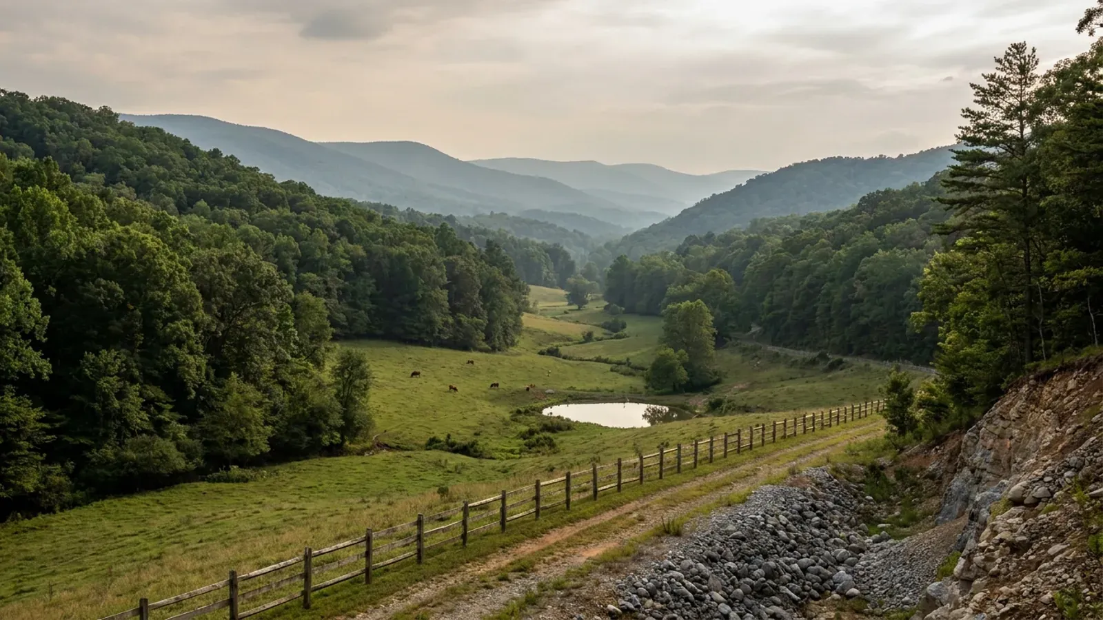
A narrow Roanoke Valley floor in pasture with steep wooded Blue Ridge foothills rising on both sides.
Lynchburg One statewide code, no local amendments

Barndominium Builders in Lynchburg, VA

Lynchburg is one of Virginia's 38 independent cities, which means it belongs to no county: Bedford, Campbell and Amherst all touch the city line and none of them has any authority inside it. The permit comes from the City's own division of inspections at 900 Church Street, and unlike most Virginia localities Lynchburg publishes its own filled-in design criteria — 25 psf ground snow, 18-inch frost line, seismic design category C, and a wind speed given as 90 mph residential and 115 mph commercial. It is also built on hills above the James, so the questions that are usually irrelevant on a city page are the ones that decide a site here: the zoning ordinance stops counting ground steeper than 25 percent toward your density, the sewer ordinance says outright that topography does not excuse you from connecting, and land disturbance is regulated from 1,000 square feet — a tenth of the state floor. There is a ten-acre conservation district inside the city limits, but its published purpose is to keep steep stream valleys open at 10 percent lot coverage. The acreage for a barndominium is across the line, in Bedford, Campbell, Amherst and Appomattox.

Lynchburg at a glance

Independent city
Lynchburg
Population
81,347
ZIP codes
24501, 24502, 24503, 24504

Building conditions in Lynchburg

The building code itself is the same in every Virginia locality, and no county, city or town may amend it. What changes from one to the next is who issues the permit and inspects the work, what that office charges, how the parcel is zoned, and the Table R301.2 design criteria the locality publishes — the 2021 Virginia Residential Code prints that table blank, with the instruction that additional criteria shall be established by the local jurisdiction. Those local numbers are what your drawings have to satisfy.

Build conditions for Lynchburg , Virginia : design wind speed 90 mph residential / 115 mph commercial (city's own sheet). BUILD CONDITIONS LYNCHBURG, VALynchburgONE STATEWIDE CODEDESIGN WIND SPEED90 mph residential…The 2021 Virginia Residential Code prints Table R301.2 blank, with the instruction that additionalcriteria shall be established by the local jurisdiction. Lynchburg fills part of it in. Its…ZONING · R-C, R-1, R-2, R-3, R-4 PLUS BUSINES…10 acres per dwelling in R-C; 15,000…Chapter 35.2, codified through Ord. No. O-25-021 adopted 11 March2025. Sec. 35.2-40.4 sets the R-C conservation district at 10 acres…PERMIT REVIEW CLOCK10 business daysPublished review target of the issuing authorityLAND DISTURBANCE PERMIT (RESIDENTIAL)$50 per acreFrom the Community Development Department Fee Schedule effective 1May 2018. A common plan of development under one acre adds $290…WHO ISSUES THE PERMITCity of Lynchburg Division of Inspec…900 Church Street, 1st Floor Permitting Center, Lynchburg VA 24504.Applications and inspection scheduling run through the eTRAKiT…
Build conditions for Lynchburg, drawn from the sourced facts on this page. Every figure above is cited in the quick-facts panel below, with its source and vintage.
It is in no county
Lynchburg is an independent city — a county equivalent belonging to no county at all. Bedford County, Campbell County and Amherst County all touch the city line, and not one of them has authority inside it. There is no county building department above the city and no county zoning reaching in. City Code Sec. 11-31 continues a division of inspections in the Department of Community Development and makes its executive the building commissioner, appointed by the city manager, serving as the city's building official. General advice that Virginia permits are handled at the county level is simply wrong for Lynchburg, as it is for all eight of Virginia's largest places.

Code of the City of Lynchburg Sec. 11-31 (Ord. O-03-177, eff. 10-1-03), Municode, codified through Ord. No. O-25-021 adopted 11 March 2025 (read 2 Sep 2026); City of Lynchburg Permitting & Inspections, https://www.lynchburgva.gov/329/Permitting-Inspections; Va. Code Sec. 36-105(A)

The city publishes its own design numbers
The 2021 Virginia Residential Code prints Table R301.2 blank and leaves the figures to the locality. Lynchburg publishes a sheet that fills part of it in: ground snow load 25 lbs, wind speed "90 mph RES/115 COM", seismic design C, weathering severe, frost line depth 18 inches, termite moderate/heavy, decay slight/moderate, winter design temperature 16 F. It prints no ice barrier row, no air freezing index and no wind-borne-debris or topographic-effect column at all. Note the wind entry: 90 mph is a nominal figure, not an ultimate 3-second gust, and the sheet does not say which basis it means — the City of Roanoke publishes the same 90 nominal while Roanoke County and Salem publish 115 ultimate on the identical shared sheet. Ask the plan reviewer rather than taking a number off a national map.

City of Lynchburg, Applicable Codes for the City of Lynchburg, General Design Requirements, https://www.lynchburgva.gov/DocumentCenter/View/262/Applicable-Codes-for-the-City-of-Lynchburg-PDF (read 2 Sep 2026); 2021 Virginia Residential Code Table R301.2

Ground disturbed at 1,000 square feet, not 10,000
City Code Sec. 16.1-4(a)(i), adopted by Ord. No. O-24-079 on 22 October 2024: "Land-disturbing activity that disturbs 1,000 square feet or more, is less than 5,000 square feet, and is not part of a common plan of development or sale, is subject to criteria defined in Article 2 (9VAC25-875-540 et seq.) of Part V of the Virginia Erosion and Stormwater Management Regulation." The state floor at 9VAC25-875-70 is 10,000 square feet, or 2,500 in a Chesapeake Bay Preservation Area — and Lynchburg is not a Bay Act locality. A 40 by 60 shop is 2,400 square feet of building before the driveway, so on any realistic site here the land-disturbance approval is not optional. It needs an erosion and stormwater plan or an executed agreement in lieu of one, the name of a certified responsible land disturber, and sign-off by the city's environmental planner before a shovel moves.

Code of the City of Lynchburg Secs. 16.1-4, 16.1-5 and 16.1-6 (Ord. No. O-24-079, Sec. 1, 10-22-24), Municode (read 2 Sep 2026); 9VAC25-875-70; Va. Code Sec. 62.1-44.15:30

The city draws its own slope line at 25 percent
Zoning Ordinance Sec. 35.2-61.4(f): density is calculated "excluding any portion of the lot or site within a 100-year floodplain or delineated wetland that exceeds ten percent of the total ... and excluding areas that have slopes in excess of 25 percent." Steep ground does not stop you building; it stops counting toward the number of dwelling units the lot is allowed. The subdivision ordinance goes further: Sec. 24.1-16 says land "deemed to be topographically unsuitable shall not be platted for residential occupancy," Sec. 24.1-30(b) requires that "in all hillside areas, streets running with contours shall be required to intersect at angles of not less than 60 degrees," and Sec. 24.1-25 lists "structures necessary to ensure stability of critical slopes" among the improvements a subdivider must bond. Very few Virginia localities publish any slope figure of their own.

Code of the City of Lynchburg, Ch. 35.2 Zoning Ordinance Sec. 35.2-61.4(f) and Ch. 24.1 Subdivision Ordinance Secs. 24.1-16, 24.1-25 and 24.1-30(b), Municode, codified through Ord. No. O-25-021 (11 Mar 2025) (read 2 Sep 2026)

Topography is not an excuse for a septic system
City Code Sec. 34-3(c)(2): "Any new construction on unimproved property requiring sewage disposal shall connect to the city sewer system where available ... It shall be unlawful for any owner or tenant to use a septic system or any other alternative sewage disposal system when city sewer lines are available for connection." Sec. 34-3(c)(3) defines available as anywhere on the property, in an immediately adjacent right-of-way, in a public right-of-way within 50 feet of the property, or in an abutting public easement — and then says the part that only a hill city needs to say: "Sewer service availability shall not be influenced by the ground topography either on a property or in relationship to adjacent right-of-way or adjacent parcels. Sewer service is considered to be available whether the service is by gravity flow or pumping." The main being uphill of you is not an answer. Violation is a class 1 misdemeanour, each day a separate offence.

Code of the City of Lynchburg Sec. 34-3 (Code 1959 Sec. 29-6.2; Ord. No. O-12-012, 1-24-12), Municode (read 2 Sep 2026); Va. Code Sec. 15.2-5137

Where the land actually is
Four counties touch Lynchburg and every one of them has real acreage. Bedford, west toward Smith Mountain Lake, is the deepest supply in the region: 183,200 acres in farms, 37.7 percent of the county, a median farm of 73 acres and 422 farms under 50 acres — the largest small-tract pool of the four — and it grew 4.4 percent since 2020. Campbell, south and east around Rustburg and Altavista, is the shortest drive and the biggest median parcel at 99 acres across 117,078 farm acres. Amherst, north across the James toward the Blue Ridge, has 74,554 farm acres but the smallest farm share of the four at 24.6 percent, because so much of it is mountain and national forest. Appomattox, east on Route 460, is the smallest and the fastest growing at 6.3 percent, with 74,535 farm acres on just 334 square miles. All four sit in the same planning district and the same health district as the city — but each is its own building and zoning authority, and nothing in Lynchburg's ordinances follows you across the line.

2022 Census of Agriculture, USDA NASS, acres in farms, median farm size and farms by size class by county; U.S. Census Bureau Vintage 2025 population estimates, 2020-2025 change

Also worth knowing before you build in Lynchburg

The shop cannot come first, and it cannot be a workshop
Zoning Ordinance Sec. 35.2-71.10: "No accessory building shall be constructed upon a lot until the construction of the main building has actually commenced and no accessory building shall be used unless the main building on a lot is completed and used." Sec. 35.2-71.1 keeps accessory buildings in the rear or side yard, at no more than 30 percent of the required rear yard, behind the front building line and at least five feet from any property line, and Sec. 35.2-71.2 requires an accessory structure in a side yard to be built "of materials substantially similar to those of the principal structure." Sec. 35.2-71.9 bars any industrial, manufacturing, trade or commercial use in R-1, R-2 and R-3 except a home occupation. So the build-the-shop-first sequence a lot of buyers plan is not available inside the city, and neither is a metal building that looks nothing like the house beside it.

Code of the City of Lynchburg, Ch. 35.2 Zoning Ordinance Secs. 35.2-71.1, 35.2-71.2, 35.2-71.9 and 35.2-71.10 (Ord. No. O-17-013, Sec. 1, 2-14-17), Municode (read 2 Sep 2026)

The workspace is measured against the house, not the shop
The sharpest provision in the ordinance for anyone planning to work out of the building. Sec. 35.2-71.4(b)(7): a home occupation may "not use more than 20 percent of the principal dwelling's gross floor area for the home occupation, regardless of whether the home occupation is conducted in the principal dwelling or an accessory building." A 2,000 square foot house with a 3,000 square foot shop gets 400 square feet of lawful working space, and the shop being a separate building changes nothing. The permitted occupations at Sec. 35.2-71.4(a) are professional offices, state-licensed personal or medical services, and "artists, craftsmen and teachers" — a contracting or fabrication business is not on the list. Equipment is limited to what is "customary for purely domestic or household purposes," outside storage to one business vehicle and one trailer, and clients to one at a time by appointment.

Code of the City of Lynchburg, Ch. 35.2 Zoning Ordinance Sec. 35.2-71.4 (Ord. No. O-17-013, Sec. 1, 2-14-17), Municode (read 2 Sep 2026)

There is a ten-acre district, and it exists to stay empty
Sec. 35.2-40.1: "The R-C district is intended to provide for very low intensity development in areas not served by City sewer and water supply systems ... This district encompasses sensitive land in stream valleys and areas of steep slope, which should be retained as open spaces." A single-household detached or modular home is permitted by right in it. The standards at Sec. 35.2-40.4 are 10 acres per dwelling, 50-foot setbacks on all four sides, 150 feet of lot width, 10 percent maximum lot coverage, and a height rule that reads like nothing else in the state: "no portion of a building shall exceed one foot of height above average grade at the foundation of the building for each two feet of distance from the property line or street right-of-way line." On a 10 percent coverage cap a ten-acre R-C parcel could hold a very large building — but the district is drawn over the steep stream valleys precisely so it will not.

Code of the City of Lynchburg, Ch. 35.2 Zoning Ordinance Secs. 35.2-40.1, 35.2-40.2 and 35.2-40.4 (Ord. No. O-17-013, Sec. 1, 2-14-17), Municode (read 2 Sep 2026)

The permit is priced on valuation, not on your kit
On the fee schedule effective 1 May 2018 a building permit runs $40 for the first $1,000 of total valuation, then $5 per additional $1,000 to $50,000; $285 for the first $50,000 plus $4 per $1,000 to $100,000; $460 for the first $100,000 plus $3 per $1,000 to $500,000; and $1,660 for the first $500,000 plus $2 per $1,000 above that. A plan checking fee of 10 percent of the permit fee is added wherever construction exceeds $1,000, and a 2.00 percent state levy funding the Virginia Code Academy is added to every permit — the only permit-fee number that is identical in every Virginia locality. Working without a permit is $100, a new-construction reinspection $50, a code appeal $200. The figure that drives all of it is the total valuation of construction and materials, so a kit's invoice price is an input to the fee, not the answer to it, and site work, foundation, slab, utilities and labour all sit inside the same number.

City of Lynchburg, Community Development Department Fee Schedule, effective 5/1/2018, https://www.lynchburgva.gov/DocumentCenter/View/459/Fee-Schedule-PDF (read 2 Sep 2026); 13VAC5-63-70 Section 107.2

Ten working days, and a soil test you can decline
The city's published Building Plans Submittal Procedure sets residential plan review at ten working days and commercial at fifteen, on one complete digital set, and refuses anything marked "Preliminary" or "Not for Construction." On soils it offers a choice most localities do not: "The applicant may choose to have a soil test performed and submit the results or sign a release affidavit releasing all liability to the applicant in the event of poor soil conditions." If a test is done and moderate to high shrink-swell soil is found, engineered foundation plans are required and a third-party inspection may replace the footing or foundation inspection. Two other lines matter on a hillside lot: residential plans do not normally need a registered design professional, but Va. Code Sec. 54.1-402 lets the building official require one; and "retaining walls over four feet in height, measured from the bottom of the footing will require plans prepared and sealed by an RDP."

City of Lynchburg, Building Plans Submittal Procedure, https://www.lynchburgva.gov/258/Building-Plans-Submittal-Procedure (read 2 Sep 2026); Va. Code Sec. 54.1-402

Not a Chesapeake Bay Act locality, and neither are the four counties
The Bay Act does not follow the coastline. It applies to a closed statutory list at Va. Code Sec. 62.1-44.15:68 naming 29 counties and 17 cities, and it reaches a long way inland up the tidal rivers — Richmond city and Henrico County are both on it, on the same James River that runs through Lynchburg. Lynchburg is not on that list. Neither are Bedford, Campbell, Amherst or Appomattox. So the 100-foot Resource Protection Area buffer, the bar on siting a new dwelling in an RPA and the 100 percent unbuildable reserve drainfield are not constraints here, and crossing into any of the four adjacent counties does not change that. What does bite instead is local: the 1,000 square foot land-disturbance trigger, the R-C district over the stream valleys, and the special flood hazard districts at Zoning Ordinance Sec. 35.2-59.7.

Va. Code Sec. 62.1-44.15:68 (Tidewater Virginia definition, 29 counties and 17 cities); Code of the City of Lynchburg Secs. 16.1-4 and 35.2-59.7, Municode (read 2 Sep 2026)

Shallow rock, not swelling clay
NRCS maps this ground in soil survey area VA631, Campbell County and the City of Lynchburg. The dominant series are Cecil, Tatum, Cullen, Appling, Georgeville, Nason, Manteo and Wilkes — Piedmont and Slate Belt soils weathered from granite, gneiss and metamorphosed volcanics. Cecil, Appling and Cullen classify as fine or very-fine kaolinitic Hapludults and Kanhapludults, with representative linear extensibility of 1.5 to 4.5 percent. None of the dominant series is smectitic or vertic, which is what separates this ground from the Culpeper Basin's Jackland, Waxpool and Haymarket, and Virginia Energy's own list of likely expansive-soil areas — the Coastal Plain, the Shenandoah Valley, and the Mesozoic basins around Culpeper, Farmville, Danville and Richmond — does not include here. What does limit a foundation is depth and slope: Manteo hits lithic bedrock at about 38 centimetres and is mapped on 25 to 60 percent slopes, Wilkes is a shallow series on 15 to 60 percent slopes, and across the survey area roughly 27 percent of mapped acreage sits in units reaching 25 percent slope or steeper. On the flats, poorly drained Worsham soils are the drainfield problem rather than the footing one.

USDA NRCS Soil Data Access, SSURGO survey area VA631 "Campbell County and the City of Lynchburg, Virginia", legend/mapunit/component/chorizon/corestrictions tables, https://sdmdataaccess.sc.egov.usda.gov/Tabular/post.rest (queried 2 Sep 2026); Virginia Energy, Division of Geology and Mineral Resources, Expansive Soils

The city says it is running out of room, in its own words
Lynchburg is 81,347 people on 48.9 square miles, about 1,663 to the square mile, and the USDA does not report it as a farm locality at all. Its adopted Comprehensive Plan is blunter than most: "As the City approaches build-out, pressure to develop adjacent to and within sensitive areas will increase," and "The City of Lynchburg has a limited number of large areas remaining for new development." The plan counted "nearly 5,000 acres of vacant land within the City located outside of resource conservation areas," of which 2,954 acres were designated for residential use — a figure from a plan adopted in January 2014, and designated for subdivision housing rather than for acreage. The same chapter on natural systems explains why the rest is hard: "Those areas of the City that feature a highly dissected landscape of narrow ridges and steep-sided valleys present a challenge to developers," and "Some areas of the City are so steep that they remain wooded and relatively natural today."

Lynchburg 2030 Comprehensive Plan, Ch. 6 Land Use Development & Community Design and Ch. 10 Natural Systems, adopted by City Council 14 January 2014, https://www.lynchburgva.gov/DocumentCenter/View/297/ and /282/ (read 2 Sep 2026); U.S. Census Bureau Vintage 2025 population estimates; 2022 Census of Agriculture, USDA NASS

A city bond on top of the state licence
Virginia licences contractors through DPOR in classes A, B and C by contract value, and Lynchburg adds one of its own on top. City Code Sec. 11-74: "It shall be the further duty of every such person holding a Class 'C' or Class 'B' contractors license to give good and sufficient bond in the sum of $5,000.00 to be approved by the city attorney ... Class 'A' contractors are exempt from the requirements of this section." Sec. 11-75 makes a lapsed bond count as no bond at all. Sec. 11-73 requires a city business licence as well. Sec. 11-78 requires a master tradesman in control of electrical, plumbing, mechanical or gas work at all times. Sec. 11-71 keeps the owner-builder route open for work on your own home or an immediate family member's, on an owner-builder affidavit and with no relief from permits, inspections or fees.

Code of the City of Lynchburg Secs. 11-71 through 11-78 (Ord. O-03-177, eff. 10-1-03), Municode (read 2 Sep 2026); Va. Code Secs. 54.1-1100 and 54.1-1101

An excavator grading a compacted building pad on a cleared lot, with survey stakes and a drainage swale visible.
Below the slab

The expensive surprises are in the ground, not the building

What moves a Virginia budget is usually below grade, and it is soil rather than rock. Five localities already treat a soil answer as a condition of the permit rather than a recommendation — Fauquier, Chesterfield, Isle of Wight, Madison and Culpeper each require a soil report, an engineered foundation design, or both before the footings are approved. Chesterfield asks for one on every new house with no opt-out, on its own published reasoning that small amounts of shrink-swell soil may turn up anywhere in the county. Virginia Energy puts the same point bluntly: standard homeowner's insurance does not cover damage from expansive or compressive soils. Along the Interstate 81 corridor the question changes shape entirely — Virginia Energy counts twenty-seven Virginia counties in the karst zone that follows that road, where what matters is what is under the slab rather than what the slab sits in, and karst does not stay west of the Blue Ridge: Loudoun County publishes karst terrain of its own, on the other side of it. The same ground then sizes the septic system, because 12VAC5-610 works from bedrooms and soil texture — 150 gallons a day per bedroom, with no row in the table for a shop, a garage or a barn at all, and clay assigned to the slowest texture group at 91 minutes per inch or worse, past the 45 minutes per inch that makes a reserve drainfield mandatory. The soil that needs a foundation engineer multiplies the drainfield. So the site work, the foundation and the drainfield get resolved together rather than one at a time. We price the dirt before we price the building.

What a build looks like

Three stages every Lynchburg project passes through, from a raw parcel to a finished home. Site work first, because that is where the budget is decided.

Aerial view of an undeveloped rural lot with cleared grass, a oak and hickory treeline with a few loblolly pines, and a pale gravel access track.
Stage one

The parcel

Zoning, setbacks, flood zone and utility access get checked before anything is drawn.

An excavator grading a compacted building pad on a cleared lot, with survey stakes and a drainage swale visible.
Stage two

Pad and permit

Clearing, grading and a compacted pad, while the submittal works through whichever office issues the permit where you are building.

A finished barndominium at dusk with warm interior lighting glowing through its large windows.
Stage three

Frame to finish

Shell erected and dried in, then systems, insulation and interior finish through to CO.

Those are the rules where you are building in Lynchburg. Tell us what you want to build and we will draw it to them.

Where we build around Lynchburg

Lynchburg and the rural land around it. The buildable acreage for a project this size usually sits outside the city limits, which is frequently what changes who issues your permit.

The Lynchburg service area, including the rural acreage outside the built-up edge, which is where the parcels big enough for a build like this usually sit. The map marks the territory we build in. It is not a branch location, and there is no office at this pin.

Nearby areas we build in

Others we cover nearby. One may be a county, another an independent city that belongs to no county at all, and another a town inside a county — so the office that issues the permit, the fees it charges, the zoning and the design criteria each locality publishes can all differ from one card to the next.

Building in Lynchburg: common questions

8 questions we get asked most often about building in Lynchburg. If yours is not on the list, ask it directly.

I am pricing a barndominium kit for the Lynchburg area. What does the kit price not cover?
More than most kit pages admit, and the Lynchburg-specific parts are easy to check. First, the permit fee is calculated on total valuation of construction and materials, not on the kit invoice — the city's schedule runs $460 for the first $100,000 plus $3 for each additional $1,000 in the $100,001 to $500,000 band, with a plan checking fee of 10 percent of the permit fee on top wherever construction exceeds $1,000, plus the 2.00 percent state levy that every Virginia locality collects for the Virginia Code Academy. So foundation, slab, site work, utilities and labour all sit inside the number the fee is computed from. Second, land disturbance. City Code Sec. 16.1-4 regulates any land-disturbing activity from 1,000 square feet, which is a tenth of the 10,000 square foot state floor at 9VAC25-875-70, and a 40 by 60 building is 2,400 square feet before you cut a driveway. That means an erosion and stormwater plan or an agreement in lieu of one, a certified responsible land disturber named on the application, a residential land disturbance permit at $50 per acre and, for a common plan under an acre, $290 issuance on the stormwater side. Third, plans. A kit vendor's stock drawings still have to satisfy the city's Building Plans Submittal Procedure, which wants a floor plan, elevations of all sides, foundation and wall section details including separation walls, and the sizes, types and spans of structural members, with the locations of engineered components identified. Anything marked "Preliminary" or "Not for Construction" is refused outright.
Who issues the building permit in Lynchburg, and does Bedford or Campbell County have any say?
The City does, and no they do not. Lynchburg is one of Virginia's 38 independent cities, which means it is a county equivalent belonging to no county at all. Bedford County lies west, Campbell County south and east, Amherst County north across the James, and none of the three has any authority inside the city line: no county building department above the city, no county zoning reaching in, and no county tier for you to appeal to. The permit comes from the division of inspections in the Department of Community Development at 900 Church Street, and City Code Sec. 11-31 titles the person in charge the building commissioner, appointed by the city manager and serving as the city's building official. Applications and inspection scheduling run through the eTRAKiT portal after contractor or public registration. A lot of general advice about Virginia says permits are handled at the county level; for Lynchburg, and for every one of Virginia's eight largest places, that is the wrong model. The code itself is not local: the Uniform Statewide Building Code supersedes local building codes under Va. Code Sec. 36-98 and no locality may amend it, which is why the useful local questions here are the design table, the zoning, the fees and the erosion ordinance rather than the code edition.
Lynchburg is built on hills. Does the slope actually stop me building?
It rarely stops you outright, but it is the thing that decides a site here, and unusually for a city the ordinances say so in their own words. Zoning Ordinance Sec. 35.2-61.4(f) calculates density "excluding areas that have slopes in excess of 25 percent," so ground steeper than a quarter stops counting toward the dwelling units the lot is allowed — it does not forbid building on it, it shrinks what the parcel is worth in units. The subdivision ordinance is harder: Sec. 24.1-16 says land "deemed to be topographically unsuitable shall not be platted for residential occupancy," Sec. 24.1-30(b) requires that "in all hillside areas, streets running with contours shall be required to intersect at angles of not less than 60 degrees," and Sec. 24.1-25 puts "structures necessary to ensure stability of critical slopes" among the improvements a subdivider has to bond. The erosion chapter requires the stormwater pollution prevention plan to "minimize the disturbance of steep slopes" and requires a site map showing the topography. And the Comprehensive Plan is candid: "Those areas of the City that feature a highly dissected landscape of narrow ridges and steep-sided valleys present a challenge to developers ... to accomplish much additional development in Lynchburg, some steep areas will likely need to be graded." Two practical consequences for a wide, low, slab-on-grade building. One, retaining walls over four feet measured from the bottom of the footing need plans sealed by a registered design professional, and hillside sites generate those quickly. Two, in the R-C district height is measured as one foot above average grade at the foundation for every two feet of distance from the property line, and elsewhere height is measured from the crown of the street unless the building is set back 35 feet or more — on a lot that falls away from the road those rules give very different answers. Roanoke County publishes guidance describing a 33.3 percent trigger in the state code it enforces; Lynchburg publishes no equivalent building-department handout, and its own published slope figure is the 25 percent line in the zoning ordinance.
Can I put a septic system in rather than connect to city sewer?
Almost certainly not, and Lynchburg has written the hill-country loophole shut. City Code Sec. 34-3(c)(2): "Any new construction on unimproved property requiring sewage disposal shall connect to the city sewer system where available ... It shall be unlawful for any owner or tenant to use a septic system or any other alternative sewage disposal system when city sewer lines are available for connection." Available is defined at Sec. 34-3(c)(3) as sewer anywhere on the property, in an immediately adjacent segment of public right-of-way, in a public right-of-way within 50 feet of the property, or in a public easement abutting on an adjoining parcel. Then comes the sentence that only a city on hills needs: "Sewer service availability shall not be influenced by the ground topography either on a property or in relationship to adjacent right-of-way or adjacent parcels. Sewer service is considered to be available whether the service is by gravity flow or pumping." So the main being fifty feet away and eighty feet below you is not an argument. The director of utilities may allow an exception on a demonstration of extreme hardship; a violation is a class 1 misdemeanour with each day a separate offence. Where sewer genuinely is not available — which in practice means the R-C conservation district, whose own purpose clause describes it as covering "areas not served by City sewer and water supply systems" — you are into the state onsite system. There the Health Department issues the permit, not the private evaluator, with 15 working days on a single-lot permit before it is deemed approved under Va. Code Sec. 32.1-163.5, and sizing is 150 gallons per day per bedroom under 12VAC5-610-670 Table 5.1, which has no living-area band and no row for a shop, garage or barn at all. Lynchburg and all four adjacent counties are served by the same VDH Central Virginia Health District, whose district office is at 307 Alleghany Avenue in the city.
Is the clay here going to crack my slab?
The evidence says this is not a shrink-swell market, and that is worth stating plainly because so much barndominium advice assumes it is. NRCS maps this ground in survey area VA631, Campbell County and the City of Lynchburg. The dominant series are Cecil, Tatum, Cullen, Appling, Georgeville, Nason, Manteo and Wilkes — residual Piedmont and Slate Belt soils off granite, gneiss and metamorphosed volcanics. Cecil, Appling and Cullen classify as fine or very-fine kaolinitic Hapludults and Kanhapludults with representative linear extensibility of 1.5 to 4.5 percent, and not one dominant series here is smectitic or vertic, which is exactly what the genuinely expansive Virginia soils are: the Culpeper Basin's Jackland, Waxpool and Haymarket, all fine and smectitic on diabase residuum. Virginia Energy's own statement names the Coastal Plain, the Shenandoah Valley and the Mesozoic basins around Culpeper, Farmville, Danville and Richmond as the likely expansive areas — Lynchburg is in none of them. What the soils here do throw at a foundation is different: Manteo hits lithic bedrock at around 38 centimetres and is mapped on 25 to 60 percent slopes, Wilkes is a shallow series on 15 to 60 percent slopes, and roughly 27 percent of the mapped acreage in the survey area sits in units reaching 25 percent slope or steeper. Shallow rock under part of a wide slab and honest soil under the rest is a differential-settlement problem in the same way clay is, and it is dealt with the same way — by finding out first. The city gives you a choice on that: its Building Plans Submittal Procedure says an applicant "may choose to have a soil test performed and submit the results or sign a release affidavit releasing all liability to the applicant in the event of poor soil conditions," and only requires engineered foundation plans where moderate to high shrink-swell soil is actually found. Signing the affidavit is cheaper on the day and moves every consequence onto you.
Can I build the shop first and live in it while the house goes up?
No. Zoning Ordinance Sec. 35.2-71.10 is unambiguous: "No accessory building shall be constructed upon a lot until the construction of the main building has actually commenced and no accessory building shall be used unless the main building on a lot is completed and used." Sec. 35.2-71.1 keeps accessory buildings in the rear or side yard, at no more than 30 percent of the required rear yard, behind the front building line and at least five feet from any property line, and Sec. 35.2-71.2 requires one in a side yard to be built of materials substantially similar to the principal structure. The one lawful route to living space in a detached outbuilding is an accessory dwelling unit under Sec. 35.2-71.3, capped at 900 square feet and one bedroom, in the rear yard and outside the principal-structure setback lines — and on a lot in R-C, R-1, R-2 or R-3 that does not meet the district minimum lot area, no detached accessory dwelling unit may be established at all. If the plan is to work out of the shop as well, read Sec. 35.2-71.4(b)(7) before anything else: a home occupation may "not use more than 20 percent of the principal dwelling's gross floor area ... regardless of whether the home occupation is conducted in the principal dwelling or an accessory building." The allowance is 20 percent of the house, not of the shop, and the permitted occupations are professional offices, state-licensed personal or medical services, and artists, craftsmen and teachers. What works inside the city is a single dwelling with the shop volume built into it, not a shop that later grows a kitchen.
So where near Lynchburg can I actually buy the acreage?
Four counties, all touching the city, and they are genuinely different from one another. Bedford, west along Route 460 and 122 toward Smith Mountain Lake, is the deepest supply in the region and the fifth largest farm county in Virginia: 183,200 acres in farms, 37.7 percent of the county, a median farm of 73 acres and 422 farms under 50 acres, growing 4.4 percent since 2020. It is also the most competitive, because it serves the Roanoke market as well as this one, and the lake end prices like recreation land rather than farm land. Campbell, south and east around Rustburg and Altavista, is the shortest drive from the city and the biggest median parcel of the four at 99 acres across 117,078 farm acres, with a flat population — the least contested of the group. It also publishes its own design criteria, at 110 mph and seismic category B on the same 25 psf snow load and 18-inch frost line the city publishes, so it is the closest published table to a Lynchburg-area site. Amherst, north across the James toward the Blue Ridge Parkway, has 74,554 farm acres but the smallest farm share of the four at 24.6 percent because so much of the county is mountain and national forest; the land there is scenic and the buildable share of a given tract is smaller than the deed acreage suggests. Appomattox, east on Route 460, is the smallest by population and the fastest growing at 6.3 percent, with 74,535 farm acres on only 334 square miles. All four are in the same planning district as the city and the same VDH health district, so the septic desk is the same one. Everything else changes at the line: each county runs its own building department, its own zoning ordinance, its own fee schedule and its own Table R301.2 fill-in, and none of Lynchburg's rules travel with you.
Is Lynchburg covered by the Chesapeake Bay Preservation Act? We are on the James.
No, and the question is a fair one because the Act genuinely does reach a long way up the James. It does not follow the coastline: it applies to a closed statutory list of jurisdictions at Va. Code Sec. 62.1-44.15:68, naming 29 counties and 17 cities, and the City of Richmond and Henrico County are both on it, roughly a hundred and fifty river miles downstream of here. Lynchburg is not on that list, and neither are Bedford, Campbell, Amherst or Appomattox. That means the things that dominate a Richmond-area conversation are not in play here: no 100-foot Resource Protection Area buffer, no bar on siting a new dwelling in an RPA, no requirement for a 100 percent reserve drainfield you may not build on, and no water quality impact assessment for encroaching on a buffer. It also means the regime does not change when you cross into any of the four counties this page points you to, which is unusually simple for Virginia. What you should not conclude is that there is no water rule at all. Inland Virginia localities write their own stream and land-disturbance rules under the ordinary zoning power, and Lynchburg's are tighter than the state floor: land disturbance is regulated from 1,000 square feet under City Code Sec. 16.1-4 where the state regulation starts at 10,000, the R-C conservation district is drawn over the stream valleys, and Zoning Ordinance Sec. 35.2-59.7 establishes the special flood hazard districts against the FEMA maps.

Building in Lynchburg?

Start with the plan. Tell us what you want to build and we will draw it, then confirm which office issues the permit for your parcel, what it will let you put there, and what wind load it has to meet. That conversation costs nothing.