Barndominium Builders in Augusta County, VA
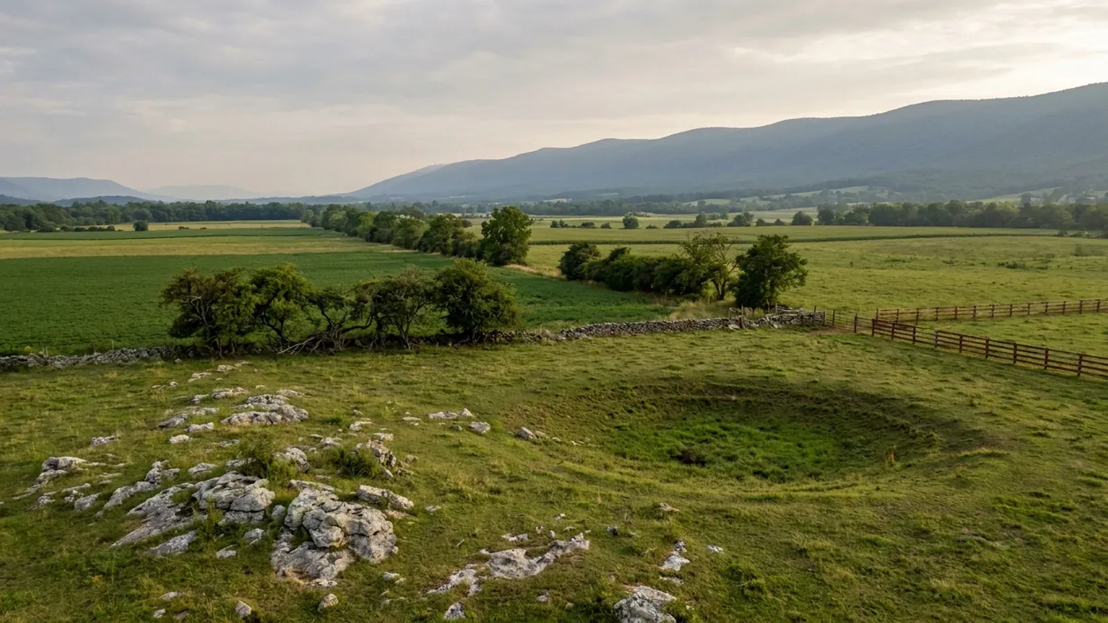
Augusta County is the second-largest county in Virginia by land area — 967.07 square miles, less than two square miles behind Pittsylvania — and it carries 243,974 acres in farms, the largest agricultural land base in the Shenandoah Valley. The county's own arithmetic puts roughly 623,000 acres inside its lines, about 220,000 of them in federal or state hands, leaving around 403,000 acres privately owned; the farm acreage is about three-fifths of that private land. Two independent cities sit inside the ring and are not part of it: Staunton and Waynesboro each run their own building department, and Augusta County has no authority inside either city line, just as neither city has any authority outside its own. What the county asks in return for its land is design — 43 pounds per square foot of ground snow, the heaviest figure any Virginia locality publishes, a 24-inch frost line, and roughly 40 percent of the county underlain by karst on the last published survey, in the county that closed nine miles of I-81 when three sinkholes opened under it.
Augusta County at a glance
- County
- Augusta County
- Population
- 78,940
- ZIP codes
- 22939, 22980, 24401, 24421, 24430, 24431, 24437, 24440, 24441, 24459, 24467, 24469, 24472, 24477, 24479, 24482, 24486
- Site visits
- Site visits anywhere between the Blue Ridge and the Alleghenies, usually within the week
Building conditions in Augusta County
The building code itself is the same in every Virginia locality, and no county, city or town may amend it. What changes from one to the next is who issues the permit and inspects the work, what that office charges, how the parcel is zoned, and the Table R301.2 design criteria the locality publishes — the 2021 Virginia Residential Code prints that table blank, with the instruction that additional criteria shall be established by the local jurisdiction. Those local numbers are what your drawings have to satisfy.
2022 Census of Agriculture, county series (acres operated; percent of land in farms; median acres per operation; area-operated categories 1.0–9.9 and 10.0–49.9 acres); U.S. Census Bureau 2025 Gazetteer, counties file, ALAND_SQMI for GEOID 51015
City of Staunton, Departments index (Community Development: Building Services Division, Planning & Zoning Division), ci.staunton.va.us/departments; City of Waynesboro site map and Building Division page, waynesboro.va.us/1140 and /1146; Augusta County, Building Inspection, co.augusta.va.us/government/departments-and-offices/building-inspection; Town of Craigsville staff list, craigsville.us/staff
Augusta County, Residential Permit Process, Design Criteria block, co.augusta.va.us/residents/home-and-property/home-building-permit-process; comparison figures from each named jurisdiction's own published design criteria
Augusta County Code, Chapter 25 Zoning, Division B, Article VII, §§ 25-77.2, 25-77.3 and 25-78, published as a PDF on the county's own County Code page, co.augusta.va.us/government/county-code
Virginia Energy, Division of Geology and Mineral Resources, "Sinkholes and Karst", energy.virginia.gov/geology/Sinkholes.shtml; Belo, Bradley Paul, "Natural Hazard Mitigation Planning For Karst Terrains in Virginia", Virginia Tech, 2003, Table 3.1, attributed to the Virginia Speleological Survey (2003); Virginia DCR Natural Heritage Karst Program, "Karst Landscapes" and "Karst Home", dcr.virginia.gov/natural-heritage/karsthome
Augusta County, Residential Permit Process, "Storage Buildings/Garages" checklist, co.augusta.va.us/residents/home-and-property/home-building-permit-process
Also worth knowing before you build in Augusta County
- The county seat left Staunton in June 2026, after 288 years
- Augusta County's government has sat at the Government Center in Verona for years, but its courts stayed in downtown Staunton — a city the county does not govern — until the new Augusta County Courthouse opened at 100 Dick Huff Lane in Verona. The ribbon cutting was 3 June 2026 and the courts began operating there on 15 June 2026. In the county's own account of the ceremony, Circuit Court Judge Shannon T. Sherrill said: "Consider that for the first time in nearly 300 years, the seat of Augusta County will stand outside its historic location in downtown Staunton." The county notes that when it was formed in 1738, its government and court functions were located in what is now the City of Staunton.
- Augusta County's own code defines karst — for groundwater, not foundations
- The Source Water Protection Overlay article of the county zoning ordinance carries a definition at § 25-513: "Karst. Geologic setting where dissolution of bedrock (primarily carbonate bedrock such as limestone or dolomite) forms subsurface voids capable of rapid transmission of water. The subsurface features can be unseen or evident as sinkholes, caves, sinking streams, and springs that make the underlying aquifer particularly susceptible to contamination from activities at the land surface." It sits inside a groundwater-protection article, so what it governs is contamination risk, not foundations. Nothing in the county's published residential permit process requires a geotechnical or geophysical study for a house.
- The two cities' wells reach into county land
- Under § 25-514 of the county zoning ordinance, an Area 1 Source Water Protection Overlay district is a 1,000-foot fixed radius measured in a flat horizontal plane, without regard to changes in ground elevation, around a public groundwater supply source, and the ordinance expressly contemplates future public water sources developed by the Augusta County Service Authority, Craigsville, Staunton or Waynesboro. Area 2 districts are the mapped recharge areas that feed those sources. So a parcel in the county can pick up an overlay from a well owned by a city that has no other authority over it.
- A $10 farm building and a $0.18 dwelling are not the same permit
- Augusta County's published fee schedule charges $10 for a farm building permit, with multiple structures allowed on one permit for the same property, against $0.18 per square foot of heated living space for a new residence and $0.18 per square foot with a $75 minimum for a residential accessory structure. The gap is the whole reason the farm-building route tempts people — and it closes the moment anyone lives there, because Va. Code § 36-97 defines a farm building as one not used for residential purposes. A 2,400-square-foot shop permitted as a farm building costs $10; the same shell with living quarters is a dwelling, and it is inspected as one.
- Two towns, and 98.8% of the county lives outside both
- Augusta County contains exactly two incorporated towns. Craigsville had an estimated 923 residents in 2025. Grottoes straddles the Augusta–Rockingham line, and the Census records its Augusta-side population as zero — all 3,099 residents live on the Rockingham side. The balance of Augusta County, outside any town, is 78,017 of the county's 78,940 people. For practical purposes the whole county is unincorporated land under county zoning.
- VDOT has to sign off before the county will
- Augusta County requires a highway entrance permit for a new dwelling unit and states that some form of written approval from VDOT is needed even where the driveway already exists or sits on a private drive. A Responsible Land Disturber with proper certification is required for new dwelling units unless the owner is acting as general contractor, and a landowner may sign as the responsible party on only one agreement in lieu of a plan per year — which matters if you are building more than one structure in a season. The erosion agreement itself carries a $250 fee.
- Radon is a real number here, and the county does not regulate it
- Augusta County is EPA Radon Zone 1, the band predicted to average above 4 pCi/L indoors, and Virginia's own measured data backs that up: VDH's published testing results show 836 tests in Augusta County averaging 5.6 pCi/L, well above the 4.0 action level. Neither the county's residential permit process nor its published design criteria list carries a radon-resistant construction requirement, so unlike Shenandoah County or Rockbridge County next door, radon-resistant detailing in Augusta is a choice the owner makes rather than something the permit forces. A passive sub-slab system is cheap while the slab is still an idea and expensive afterwards.
- Septic sizes on bedrooms, and the shop does not count
- Virginia sizes a drainfield at 150 gallons per day per bedroom under 12VAC5-610-670 Table 5.1 — there is no living-area band and no row for a shop, a garage or a barn at all, so a 3,000-square-foot workshop adds nothing to the design flow and a fourth bedroom adds 150 gpd. VDH issues the permit, not the private evaluator, and § 32.1-163.5 gives it 15 working days on a single-lot application before the permit is deemed approved. Augusta County adds its own rule on top: all foundation walls, including decks, must be 10 feet from the septic tank. The health department serving the county is at 1426 North Augusta Street in Staunton.
- Both mountain flanks are in this county, and one slope rule is unambiguous state law
- Augusta County runs from the Blue Ridge to the Allegheny Front, so it holds ridgeline ground on both sides of the Valley. Va. Code § 15.2-2295.1 lets a locality regulate development on a protected mountain ridge, defined as a ridge at or above 2,000 feet in elevation and at least 500 feet above the elevation of the valley floor — that is state law and it is unambiguous. Separately, Roanoke County's Office of Building Safety publishes that the 2021 VUSBC regulates construction on slopes steeper than 1 to 3, or 33.3%, through VCC § 1808 and VRC § R403.1.7, requiring an engineered site study and foundation plan before a permit. That is Roanoke County's published statement about the code it enforces, and worth raising with Augusta County plan review on any steep site.
- The Shenandoah Valley is on the state's expansive-soil list
- Virginia Energy's Expansive Soils page names the Coastal Plain, the Shenandoah Valley and the Mesozoic basins around Culpeper, Farmville, Danville and Richmond as the most likely areas to have expansive or frost-heave-susceptible soils, while saying the exact distribution can only be approximated from current soil maps and that field visits to specific areas are necessary. It also states that standard homeowner's insurance does not cover damage from expansive or compressive soils or frost heave. That naming is regional rather than a parcel finding for Augusta County, which is exactly why the state points readers at the NRCS Web Soil Survey and a site visit before a foundation is designed.
- What the county says about how much land is actually available
- Augusta County's own frequently asked questions state that it is the second largest county in Virginia in terms of land area, that there are 970 square miles of land in the county which translates to approximately 623,000 acres, that approximately 220,000 acres are owned by the federal or state government, and that this leaves approximately 403,000 acres in the hands of private owners. Set the 243,974 acres the 2022 Census of Agriculture counts in farms against that 403,000, and roughly three out of every five privately held acres in Augusta County are farmland.
- Timing, and the things that stall an Augusta County build
- Inspections must be requested no later than 4:00 PM the working day before, and the county does not set time blocks. A Certificate of Occupancy takes two working days to process once every final inspection is approved and the health department has issued an operation permit for sewage and water. Work must start within six months of permit issue and continue over each six-month period to keep the permit alive. The county keeps building permit records for three years after project completion under USBC § 105.4 and advises owners to keep their own copies of permits, plans and inspection reports.
Augusta County, "Augusta County Celebrates Opening of New Courthouse", county news release posted 5 June 2026; Supreme Court of Virginia, Augusta County Circuit Court court information page, vacourts.gov/courts/circuit/augusta
Augusta County Code, Chapter 25 Zoning, Division H Overlay Districts, Article LI Source Water Protection Overlay (SWPO) Districts, § 25-513 Definitions, PDF linked from co.augusta.va.us/government/county-code
Augusta County Code, Chapter 25 Zoning, Division H, Article LI, § 25-514 Boundaries of SWPO Areas
Augusta County, Permit Costs, co.augusta.va.us/government/departments-and-offices/building-inspection/permit-costs; Va. Code § 36-97, definition of "farm building or structure"
U.S. Census Bureau, Vintage 2025 subcounty population estimates, sub-est2025_51.csv, SUMLEV 157 records for county FIPS 015 and 165 and SUMLEV 050 for Augusta County
Augusta County, Residential Permit Process, new single family checklist, and Permit Costs, co.augusta.va.us
EPA county radon zones table, radon_zones-spreadsheet.xls; Virginia Department of Health, Radon Testing Results, vdh.virginia.gov, last updated 23 September 2025; Augusta County, Residential Permit Process, co.augusta.va.us
12VAC5-610-670 Table 5.1; Va. Code § 32.1-163.5; Augusta County, Residential Permit Process, required inspections note, and Building Inspection page, Other Agency Contacts
Va. Code § 15.2-2295.1; Roanoke County Development Services, Office of Building Safety, "Development On or Near Steep Slopes", roanokecountyva.gov
Virginia Energy, Division of Geology and Mineral Resources, "Expansive Soils", energy.virginia.gov/geology/ExpansiveSoils.shtml; USDA NRCS Web Soil Survey, websoilsurvey.nrcs.usda.gov
Augusta County, Community Development, Frequently Asked Questions, "How big is Augusta County?", co.augusta.va.us/government/departments-and-offices/community-development/frequently-asked-questions; 2022 Census of Agriculture, county series
Augusta County, Residential Permit Process and Building Inspection pages, co.augusta.va.us

The expensive surprises are in the ground, not the building
What moves a Virginia budget is usually below grade, and it is soil rather than rock. Five localities already treat a soil answer as a condition of the permit rather than a recommendation — Fauquier, Chesterfield, Isle of Wight, Madison and Culpeper each require a soil report, an engineered foundation design, or both before the footings are approved. Chesterfield asks for one on every new house with no opt-out, on its own published reasoning that small amounts of shrink-swell soil may turn up anywhere in the county. Virginia Energy puts the same point bluntly: standard homeowner's insurance does not cover damage from expansive or compressive soils. Along the Interstate 81 corridor the question changes shape entirely — Virginia Energy counts twenty-seven Virginia counties in the karst zone that follows that road, where what matters is what is under the slab rather than what the slab sits in, and karst does not stay west of the Blue Ridge: Loudoun County publishes karst terrain of its own, on the other side of it. The same ground then sizes the septic system, because 12VAC5-610 works from bedrooms and soil texture — 150 gallons a day per bedroom, with no row in the table for a shop, a garage or a barn at all, and clay assigned to the slowest texture group at 91 minutes per inch or worse, past the 45 minutes per inch that makes a reserve drainfield mandatory. The soil that needs a foundation engineer multiplies the drainfield. So the site work, the foundation and the drainfield get resolved together rather than one at a time. We price the dirt before we price the building.
What we build in Augusta County
All nine services are available in Augusta County. What a build costs depends far more on the parcel than on square footage, so we price against your land rather than publishing a rate card.
Custom Plans
Barndominium floor plans drawn to your parcel and to the design criteria your own Virginia locality publishes, not to a generic national spec.
Barndominium Kits
Engineered barndominium shell packages delivered to your Virginia land, drawn to the criteria your own building department fills in.
Turnkey Builds
Start to finish barndominium construction: permits, site work, shell and full interior finish, under one contract and one schedule.
What a build looks like
Three stages every Augusta County project passes through, from a raw parcel to a finished home. Site work first, because that is where the budget is decided.

The parcel
Zoning, setbacks, flood zone and utility access get checked before anything is drawn.
Pad and permit
Clearing, grading and a compacted pad, while the submittal works through whichever office issues the permit where you are building.

Frame to finish
Shell erected and dried in, then systems, insulation and interior finish through to CO.
Those are the rules where you are building in Augusta County. Tell us what you want to build and we will draw it to them.
Where we build around Augusta County
Augusta County and the rural land around it. The buildable acreage for a project this size usually sits outside the city limits, which is frequently what changes who issues your permit.
Keep reading
The questions that usually come next once you know what Augusta County allows.
Barndominium Cost Guide
Sourced per-square-foot ranges by tier and by size, with a calculator built on the same figures.
Read itIs It Legal in Virginia?
Classification, zoning, the HOA gate, and why "nonresidential farm building" does not cover a home.
Read itHow Long Does It Take?
Census build-duration data, and what actually sets the permit clock where you are building.
Read itNearby areas we build in
Others we cover nearby. One may be a county, another an independent city that belongs to no county at all, and another a town inside a county — so the office that issues the permit, the fees it charges, the zoning and the design criteria each locality publishes can all differ from one card to the next.
Building in Augusta County: common questions
9 questions we get asked most often about building in Augusta County. If yours is not on the list, ask it directly.
My land is near Staunton or Waynesboro. Who issues my building permit?
Isn't the Augusta County courthouse in Staunton?
Can I permit my barndominium as a farm building for $10?
How much land do I need, and how far from the road does the building have to sit?
Does the size of my shop change the setbacks?
My kit supplier says the plans come with the building. Is that enough for Augusta County?
The county is 40% karst. Does that mean I need a geotechnical study?
What about Craigsville and Grottoes — do the towns permit their own building?
What snow load and frost depth should my engineer design to in Augusta County?
Building in Augusta County?
Start with the plan. Tell us what you want to build and we will draw it, then confirm which office issues the permit for your parcel, what it will let you put there, and what wind load it has to meet. That conversation costs nothing.