Barndominium Builders in Staunton & Waynesboro, VA
Staunton and Waynesboro are two of Virginia's 38 independent cities, sitting twelve miles apart with Augusta County wrapped around both and governing neither. Each runs its own building department, its own zoning ordinance and its own fee schedule, and the two agree on almost nothing: Staunton's largest residential lot is 15,000 square feet and caps an accessory building at 15 feet, Waynesboro's is 12,000 square feet and caps one at 22 feet and half the floor area of the house. Where they do agree is the number that matters most to a clear-span building — both publish 43 pounds per square foot of ground snow, the heaviest figure any Virginia locality publishes, matching Augusta County exactly. The land is the other half of the story. Waynesboro has no agricultural district at all, and the roughly 2,600 acres inside Staunton's city limits sit in four agricultural-forestal overlay districts where a dwelling is permitted only for someone earning a substantial part of their livelihood from farming or forestry on that same property. The acreage a barndominium needs is in the county, and since June 2026 even the county courthouse has moved out of downtown Staunton to Verona.
Staunton & Waynesboro at a glance
- Independent city
- Staunton
- Cities & counties covered
- Staunton 26,801 · Waynesboro 23,951
- Site visits
- Site visits in both cities and across Augusta County, usually within the week
Building conditions in Staunton & Waynesboro
The building code itself is the same in every Virginia locality, and no county, city or town may amend it. What changes from one to the next is who issues the permit and inspects the work, what that office charges, how the parcel is zoned, and the Table R301.2 design criteria the locality publishes — the 2021 Virginia Residential Code prints that table blank, with the instruction that additional criteria shall be established by the local jurisdiction. Those local numbers are what your drawings have to satisfy.
Staunton City Code §§ 15.05.020 and 15.10.050, and Waynesboro City Code §§ 18-27 and 18-29 (Ord. No. 2020-49, 24 August 2020), read on ecode360.com (ST4660) and api.municode.com (client 4849, product 11686, job 494325) on 2 September 2026
Augusta County, "Augusta County Celebrates Opening of New Courthouse", county news release posted 5 June 2026, co.augusta.va.us; Supreme Court of Virginia, Augusta County Circuit Court information page, vacourts.gov/courts/circuit/augusta, which prints the Verona address as current
City of Staunton, Current Building Codes and Design Criteria, ci.staunton.va.us/home/showpublisheddocument/12463/638549281038230000; City of Waynesboro, Design Standards, waynesboro.va.us/152/Design-Standards; comparison figures from each named locality's own published criteria via research/statewide/design-criteria-and-climate.md § 4b
City of Waynesboro, Design Standards, waynesboro.va.us/152/Design-Standards, fetched 2 September 2026; City of Staunton, Current Building Codes and Design Criteria sheet; 2021 Virginia Residential Code Table R301.2, printed blank with "additional criteria shall be established by the local jurisdiction"
Staunton City Code §§ 18.95.020, 18.95.030, 18.95.040, 18.95.050, 18.95.060 and 18.95.070 (Ord. 2004-38; Ord. 2010-29; Ord. 2018-26; Ord. 2020-01; Ord. 2020-16), read on ecode360.com (ST4660) 2 September 2026; Va. Code §§ 15.2-4300 to 15.2-4314
Staunton City Code §§ 18.20.050, 18.110.020 and 18.110.030; Waynesboro City Code § 98-4.6.2 (Ord. No. 2024-12, § 1, 22 April 2024)
Also worth knowing before you build in Staunton & Waynesboro
- Three fee schedules, three different measuring sticks
- Staunton charges $0.18 per square foot with a $75 minimum for a new residential building, a flat $75 for a residential accessory building, $100 for a pool, $90 for each residential trade permit and $150 where gas is combined with plumbing or mechanical, $200 for plan review before application, $100 for a revision, $50 for a reinspection and $25 to renew a permit. Its schedule then says how it measures: outside dimensions of the structure, including all heated and unheated space, excluding crawl spaces and unfinishable attics. Waynesboro charges $0.15 per square foot with a $50 minimum for new construction and additions, $0.05 for alterations, $0.10 per square foot for accessory structures, $25 for fences and pre-built storage buildings, $75 for a manufactured home placement and $50 for each trade permit — calculated on gross floor area. Augusta County charges $0.18 per square foot of heated living space. Same headline rate as Staunton, entirely different bill on a building that is mostly unheated shop.
- A $10 farm building and a dwelling are not the same permit, and neither city has the $10 line
- Augusta County publishes a $10 flat fee for a farm building permit, against $0.18 per square foot of heated living space for a dwelling. It is the cheapest permit in the Valley and it is a trap for anyone planning to live in the building, because Va. Code § 36-97 defines a farm building as one not used for residential purposes. The moment residential use begins, the structure is not a farm building, and the Uniform Statewide Building Code applies to all of it. Inside Staunton or Waynesboro the question never arises: neither city's published fee schedule carries a farm-building line at all. Staunton's agricultural-forestal chapter makes the same point from the other direction — land in an A-1 district must be used solely for agricultural and forestal production, and the permission to put a dwelling on it is a separate, narrow subsection with its own occupancy test.
- Karst is real here and neither city regulates it as a foundation problem
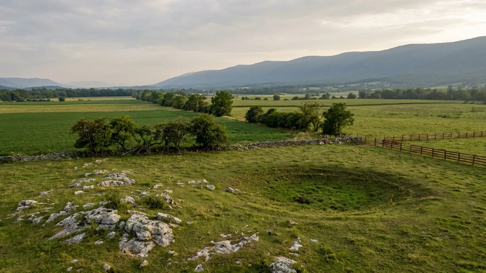
- A 2003 Virginia Tech study by Bradley Paul Belo, drawing on Virginia Speleological Survey data, puts Augusta County at about 40 percent karst. Virginia Energy records that in March 2001 a nine-mile stretch of Interstate 81 in Augusta County closed after three sinkholes appeared, the largest 20 feet by 11 feet and 22 feet deep, and that VDOT has logged roughly 500 road-damaging sinkholes in thirty years. Both cities do define karst in their own codes — Staunton at section 13.01.015, Waynesboro in Chapter 30 Article II — as any land predominantly underlain by limestone, dolomite or other soluble bedrock, with karst features meaning sinkholes, sinking and losing streams, caves and large flow springs. Both require a stormwater management plan to map karst features and to show soil types and geologic formations where karst features are present. That is the whole of it: state model stormwater language in the erosion chapter, and no karst-specific foundation, geotechnical or setback requirement in either city. A single-family lot in Staunton files an agreement in lieu of a plan rather than a stormwater plan, so the mapping duty does not even engage.
- Waynesboro can stop you drilling a well
- Waynesboro's Groundwater Management Overlay, zoning section 98-3.3.4, is laid over parts of the city where the aquifers are known to contain contaminants above the maximum levels set by state or federal law, plus a buffer. Inside it, connection to the city water system is required for all development wherever service is available on-site, by easement or in an adjacent right-of-way; after connection, use of any other source of water supply for domestic use must cease; and no owner may place a new well or operate an existing one for domestic use unless public water is not available. An existing well may still be used to irrigate lawn or ornamental plants. Check the zoning map before assuming a well is an option on a Waynesboro parcel. Staunton's zoning ordinance carries no equivalent overlay.
- One flood map date across all three jurisdictions
- Waynesboro's floodplain overlay records the effective date of the Flood Insurance Rate Map and Flood Insurance Study as 28 September 2007. Staunton's design criteria sheet prints Flood Hazards 9/28/2007, and Augusta County publishes the same date. It is the one design row on which all three jurisdictions in this valley agree without qualification. Both cities require new construction to have its lowest floor elevated to or above the base flood elevation and both only recommend, rather than require, more than a foot of freeboard — so the extra foot is a decision you make with your lender and insurer, not one the ordinance makes for you.
- Waynesboro will let a third party do the inspection, on its terms
- Waynesboro publishes a written Third Party Inspection Policy under section 113.7.1 of the building code. The inspector must hold the appropriate Virginia DHCD certification for the inspection being performed, or be a design professional licensed in the Commonwealth. They may have no direct financial or familial interest in the project, which the policy spells out to include family members, employees, owners and contractors. They must be preapproved by the Building and Zoning office before the inspection date, must use a city form obtained beforehand with a separate form for each inspection, must complete and date it the day of the inspection, and must submit the report within two business days. Failure to obtain preapproval or the form automatically disqualifies the inspector, and preapproval can be revoked at any time.
- What actually stalls a Staunton permit
- Staunton publishes an estimated processing time of ten business days and a submittal route through an online permitting portal opened on 5 May 2026, with paper still accepted. Four other approvals sit around it. A water and sewer connection and facility fees application goes to the City Engineer's Office to determine availability, and must be completed before any building permit issues. For a single-family home or a site disturbing under 10,000 square feet, an agreement in lieu of a plan must be signed by the owner, a pre-construction meeting held and the city's erosion and stormwater inspector must approve the initial controls — the agreement fee is $250 and the surety $2,500, against $3,000 for a full city land-disturbance permit. All real estate taxes must be paid before a permit is issued. And if the property is in a historic district, a certificate of appropriateness may be needed first. Electrical, plumbing, mechanical and gas are separate permits.
- The nearest usable acreage, named
- Augusta County is 967 square miles, the second-largest county in Virginia by land area, and holds 243,974 acres in farms — 38.1 percent of its land, across 1,460 farms with a median size of 47 acres and 741 operations under 50 acres. The county's own arithmetic puts roughly 623,000 acres inside its lines with about 220,000 in federal or state hands, leaving around 403,000 privately owned. Its General Agriculture district starts at one acre with 150 feet of lot width. North of it, Rockingham County has 191,588 acres in farms across 1,722 farms — more than any other county in Virginia — a median of 46 acres and 886 operations under 50 acres, and publishes 42.5 psf of ground snow. East over the Blue Ridge, Nelson County is 471 square miles with 68,566 acres in farms, 22.8 percent of its land, 399 farms, a median of 72 acres and 138 operations under 50 acres. All three are governed by county zoning and a county building official, and none of them is Staunton or Waynesboro.
- Septic sizes on bedrooms, and the shop counts for nothing
- Both cities sit in the Central Shenandoah Health District, which VDH's own page defines as the counties of Augusta, Bath, Highland, Rockbridge and Rockingham and the cities of Buena Vista, Harrisonburg, Lexington, Staunton and Waynesboro. VDH issues the septic permit, not the private evaluator, and on a single-lot permit it is deemed approved if the department does not act within 15 working days. Sizing comes from 12VAC5-610-670 Table 5.1 at 150 gallons per day per bedroom, with no living-area band and no row for a shop, garage or barn at all — so a 4,000 square foot barndominium with three bedrooms sizes exactly as a 1,400 square foot three-bedroom ranch. The design percolation rate is normally assigned from soil texture under 12VAC5-610-490 rather than measured in a pit, though the regulation expressly contemplates a measured rate and requires shrink-swell soils to be thoroughly wetted before a percolation test. Staunton requires the health department's construction permits to be uploaded with the building permit application wherever the lot is served by well or septic.
Staunton City Code § 15.10.120 (Ord. 2005-10; Ord. 2007-11; Ord. 2018-23; Ord. 2024-31); City of Waynesboro Residential Permit Fee Schedule, waynesboro.va.us/DocumentCenter/View/58; Augusta County Permit Costs, co.augusta.va.us, per research/entries/augusta-county-va.json
Augusta County Permit Costs, co.augusta.va.us/government/departments-and-offices/building-inspection/permit-costs; Va. Code § 36-97, definition of "farm building or structure"; Staunton City Code §§ 15.10.120 and 18.95.030; City of Waynesboro Residential Permit Fee Schedule
Belo, Bradley Paul, "Natural Hazard Mitigation Planning For Karst Terrains in Virginia", Virginia Tech, May 2003, Table 3.1, attributed to the Virginia Speleological Survey (2003); Virginia Energy, "Sinkholes and Karst", energy.virginia.gov/geology/Sinkholes.shtml; Staunton City Code §§ 13.01.015(48), 13.01.015(49) and 13.01.070; Waynesboro City Code ch. 30 art. II
Waynesboro City Code § 98-3.3.4, Groundwater management overlay (-GMO), read via api.municode.com (client 4849, product 11686, job 494325, codified through Ordinance No. 2026-13 enacted 8 June 2026)
Waynesboro City Code § 98-3.3.5, Floodplain overlay (-FO); City of Staunton, Current Building Codes and Design Criteria sheet; Staunton City Code ch. 18.170; Augusta County design criteria per research/statewide/design-criteria-and-climate.md § 1b
City of Waynesboro Building & Zoning Department, Third Party Inspection Policy, waynesboro.va.us/DocumentCenter/View/11483/Third-party-inpection-written-policy
City of Staunton Building Services Division, Residential Permit Application Process, ci.staunton.va.us/departments/building-services-divison; Staunton City Code §§ 13.01.100 and 13.01.170 (performance security and fees) and § 15.10.120
2022 Census of Agriculture, county series, via research/statewide/geography-and-population.md § 4.2; Augusta County Zoning Ordinance § 25-77.2 and Community Development FAQ, per research/entries/augusta-county-va.json; Rockingham County Climate and Geographic Design Criteria 2023
VDH Central Shenandoah Health District, vdh.virginia.gov/central-shenandoah; Va. Code § 32.1-163.5; 12VAC5-610-670 Table 5.1, 12VAC5-610-490 and 12VAC5-610-950 D 1; City of Staunton Building Services Division, Residential Permit Application Process

The expensive surprises are in the ground, not the building
What moves a Virginia budget is usually below grade, and it is soil rather than rock. Five localities already treat a soil answer as a condition of the permit rather than a recommendation — Fauquier, Chesterfield, Isle of Wight, Madison and Culpeper each require a soil report, an engineered foundation design, or both before the footings are approved. Chesterfield asks for one on every new house with no opt-out, on its own published reasoning that small amounts of shrink-swell soil may turn up anywhere in the county. Virginia Energy puts the same point bluntly: standard homeowner's insurance does not cover damage from expansive or compressive soils. Along the Interstate 81 corridor the question changes shape entirely — Virginia Energy counts twenty-seven Virginia counties in the karst zone that follows that road, where what matters is what is under the slab rather than what the slab sits in, and karst does not stay west of the Blue Ridge: Loudoun County publishes karst terrain of its own, on the other side of it. The same ground then sizes the septic system, because 12VAC5-610 works from bedrooms and soil texture — 150 gallons a day per bedroom, with no row in the table for a shop, a garage or a barn at all, and clay assigned to the slowest texture group at 91 minutes per inch or worse, past the 45 minutes per inch that makes a reserve drainfield mandatory. The soil that needs a foundation engineer multiplies the drainfield. So the site work, the foundation and the drainfield get resolved together rather than one at a time. We price the dirt before we price the building.
What we build in Staunton & Waynesboro
All nine services are available in Staunton & Waynesboro. What a build costs depends far more on the parcel than on square footage, so we price against your land rather than publishing a rate card.
Custom Plans
Barndominium floor plans drawn to your parcel and to the design criteria your own Virginia locality publishes, not to a generic national spec.
Barndominium Kits
Engineered barndominium shell packages delivered to your Virginia land, drawn to the criteria your own building department fills in.
Turnkey Builds
Start to finish barndominium construction: permits, site work, shell and full interior finish, under one contract and one schedule.
What a build looks like
Three stages every Staunton & Waynesboro project passes through, from a raw parcel to a finished home. Site work first, because that is where the budget is decided.

The parcel
Zoning, setbacks, flood zone and utility access get checked before anything is drawn.
Pad and permit
Clearing, grading and a compacted pad, while the submittal works through whichever office issues the permit where you are building.

Frame to finish
Shell erected and dried in, then systems, insulation and interior finish through to CO.
Those are the rules where you are building in Staunton & Waynesboro. Tell us what you want to build and we will draw it to them.
Where we build around Staunton & Waynesboro
Staunton and the rural land around it. The buildable acreage for a project this size usually sits outside the city limits, which is frequently what changes who issues your permit.
Keep reading
The questions that usually come next once you know what Staunton & Waynesboro allows.
Barndominium Cost Guide
Sourced per-square-foot ranges by tier and by size, with a calculator built on the same figures.
Read itIs It Legal in Virginia?
Classification, zoning, the HOA gate, and why "nonresidential farm building" does not cover a home.
Read itHow Long Does It Take?
Census build-duration data, and what actually sets the permit clock where you are building.
Read itNearby areas we build in
Others we cover nearby. One may be a county, another an independent city that belongs to no county at all, and another a town inside a county — so the office that issues the permit, the fees it charges, the zoning and the design criteria each locality publishes can all differ from one card to the next.
Building in Staunton & Waynesboro: common questions
8 questions we get asked most often about building in Staunton & Waynesboro. If yours is not on the list, ask it directly.
Does Augusta County issue my permit if I build in Staunton or Waynesboro?
What wind speed and snow load do I design to in each city?
Can I build a shop with living quarters in either city?
Staunton has farmland inside the city limits. Can I buy some and build?
This is karst country. Will anyone make me investigate the ground before I build?
What will the permit cost, and why do the two cities quote it so differently?
How long does a permit take, and what else has to be approved first?
There is nowhere in either city to put a real barndominium. Where should I be looking?
Building in Staunton & Waynesboro?
Start with the plan. Tell us what you want to build and we will draw it, then confirm which office issues the permit for your parcel, what it will let you put there, and what wind load it has to meet. That conversation costs nothing.