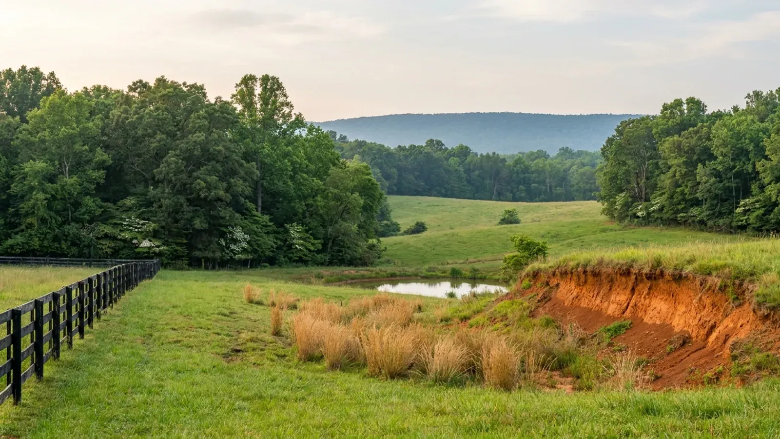
Rolling Virginia Piedmont farmland with black board fencing, oak and hickory woodland, and exposed red clay soil at a field edge.
Louisa County One statewide code, no local amendments

Barndominium Builders in Louisa County, VA

Louisa County is the epicentre county of the 23 August 2011 magnitude 5.8 earthquake, and its own Community Development department publishes seismic design category B — two categories below the point at which the residential code's seismic provisions reach a detached one- or two-family dwelling. What does change a build here is the county's published Shrink/Swell Soil Policy, which names dozens of tax map numbers where a soil test is required before a permit issues and sends the footing design to an engineer if the result comes back moderate to high. It is a 495 square mile county that grew 13.6 percent between 2020 and 2025, sits between Richmond and Charlottesville with the largest median farm size of any county in the Richmond ring at 75 acres, and holds most of Lake Anna's shoreline, where Dominion Energy's easement and a five-foot lakefront yard rule change how a house is sited at the water's edge.

Louisa County at a glance

County
Louisa County
Population
42,924
ZIP codes
23093, 23117, 23024, 22942, 23065, 22974, 23102, 23192

Building conditions in Louisa County

The building code itself is the same in every Virginia locality, and no county, city or town may amend it. What changes from one to the next is who issues the permit and inspects the work, what that office charges, how the parcel is zoned, and the Table R301.2 design criteria the locality publishes — the 2021 Virginia Residential Code prints that table blank, with the instruction that additional criteria shall be established by the local jurisdiction. Those local numbers are what your drawings have to satisfy.

Build conditions for Louisa County , Virginia : design wind speed 115 mph ultimate. BUILD CONDITIONS LOUISA COUNTY, VALouisa CountyONE STATEWIDE CODEDESIGN WIND SPEED115 mph ultimateFrom the county's own Design Criteria Chart, which reproduces Table R301.2(1) on Louisa CountyCommunity Development letterhead: 115 mph, with topographic effects, special wind region and…ZONING · A-1 AND A-2 AGRICULTURAL, R-1 AND R…1.5 acres in A-1, A-2 and R-1, or la…County Code sections 86-137, 86-155 and 86-172. Height is generous:sections 86-141 and 86-158 allow 50 feet for a residence and uses…LAKE ANNA WATERFRONT EROSION FEE$200Charged in addition to the $100 erosion and sediment control fee onthe county's published New Single Family Dwelling schedule. It…WHO ISSUES THE PERMITLouisa County Department of Communit…1 Woolfolk Avenue, Louisa, VA 23093, (540) 967-3430,buildingpermits@louisacounty.gov. Applications go by post, drop-off…
Build conditions for Louisa County, drawn from the sourced facts on this page. Every figure above is cited in the quick-facts panel below, with its source and vintage.
The epicentre county publishes seismic design category B
Louisa County Community Development's own Design Criteria Chart reproduces Table R301.2(1) and enters "B" in the Seismic Design Category column. Its older County Design Requirements sheet says the same thing in older words: "SEISMIC CONDITION BY ZONE — B". That matters because the 2021 Virginia Residential Code applies its seismic provisions to townhouses in categories C, D0, D1 and D2, and to detached one- and two-family dwellings only in D0, D1 and D2. A detached house in category B is two steps below the trigger. Across the whole Central Virginia seismic zone only Powhatan, Cumberland and southern Fauquier publish a C at all, and even a C does not reach a detached dwelling. The most famous earthquake in modern Virginia history did not change how a detached home is engineered here, and the county's own published category is the evidence.

Louisa County Community Development, Design Criteria Chart, https://www.louisacounty.gov/DocumentCenter/View/7236/Louisa-County-Design-Criteria-Chart, and County Design Requirements, https://www.louisacounty.gov/DocumentCenter/View/152/County-Design-Requirements-PDF (both fetched and read 2 Sep 2026); 2021 Virginia Residential Code R301.2.2

What the 2011 earthquake actually damaged
The USGS records the magnitude 5.8 event of 23 August 2011 as beginning near Mineral at a depth of about 6 to 8 kilometres, roughly 65 kilometres north-west of Richmond. It was felt over an area holding a third of the United States population, drew more than 148,000 Did You Feel It reports, caused $200 to $300 million in total losses including damage to the Washington Monument, the National Cathedral and the Armed Forces Retirement Home, and produced minor to major damage to almost 600 residential properties. It also caused the first ever shutdown of a US commercial nuclear plant, at North Anna about 23 kilometres away. No surface rupture was ever found. And the sentence that matters most for anyone planning a build: "Much of the structural damage was confined to brick buildings and unreinforced masonry structures." The county's own record of the event is chimney damage on houses. A steel-frame or post-frame building with a light roof is close to the opposite of that construction class.

U.S. Geological Survey, M5.8 August 23, 2011 Mineral, Virginia, https://www.usgs.gov/programs/earthquake-hazards/science/m58-august-23-2011-mineral-virginia (rendered and read 2 Sep 2026); Virginia Department of Energy, Division of Geology and Mineral Resources, Earthquakes

A published shrink-swell soil policy, and a detached garage stops being exempt the moment you live in it
Louisa publishes a Shrink/Swell Soil Policy. A soil test is required before permit for all new one- and two-family dwellings and townhouses, and for all new structures under the construction code unless exempted. The exemption list includes "Detached Garages without habitable space above" — so a shop stays outside the requirement until it holds living quarters, and then it is back inside it. The test is a minimum of two borings at opposite outside corners, driven two feet below the recommended footing depth or five feet, whichever is greater, or to auger refusal. It must be performed by a Virginia licensed professional engineer or a Virginia certified soil scientist who is pre-approved under the county's third-party inspection policy. If the result is moderate to high, the footing and foundation must be designed by a Virginia licensed professional engineer or architect and that design is submitted with the permit application. The county grounds the policy in its own Soil Survey of Louisa County issued in March 1976.

County of Louisa, VA, Shrink / Swell Soil Policy, https://www.louisacounty.gov/DocumentCenter/View/7245/Shrink-Swell-Policy, linked from the county's Virginia Building Code page (PDF read page by page, 2 Sep 2026)

The towns zone; the county issues the building permit
Louisa County has two incorporated towns, Louisa and Mineral, and neither runs a building department. The proof is in the county's own paperwork: its New Single Family Dwelling permit packet lists "Town of Louisa or Town of Mineral Zoning Approval - if building within town limits" among the submittals required to obtain the county building permit, and its non-residential packet repeats the line. The Town of Mineral's website carries a planning commission, a town code, a zoning map and a published zoning rate card at $150 for a new zoning permit and $250 for a rezoning, variance or special use permit, but no building department, no building permit page and no inspections page anywhere in its sitemap. The Town of Louisa publishes a building and zoning permit application among its town forms. Inside either town you deal with the town on zoning and the county on the building permit.

Louisa County New Single Family Dwelling Application Packet, https://www.louisacounty.gov/DocumentCenter/View/5464 (updated 05.21.26) and New Non-Residential Building Application Packet, View/5463 (updated 10.09.24); Town of Mineral Local Services and Forms pages, townofmineral.com; Town of Louisa Forms page, louisava.gov (all read 2 Sep 2026)

On Lake Anna, Dominion Energy's easement is part of the approval
Virginia Electric and Power Company, now Dominion Energy, bought roughly 18,000 acres in 1968 to build North Anna and its cooling lake, and it still holds the shoreland easement. County Code section 86-655 requires a Lake Anna site plan to carry "an approval statement by Dominion Energy for proposed development on Dominion Energy's shoreland or shoreline". Section 86-656 caps structures on land inside that easement at 20 feet for a flat roof and 28 feet for a pitched one, measured from lowest finished grade — away from the easement the ordinary 50-foot residential height limit applies. Section 86-117(a) then does something unusual in the other direction: a parcel fronting Lake Anna may keep a yard of only five feet from the water-fronting property line where a larger side or rear yard would normally be required, so long as no structure encroaches on any designated lake, pool, flood or erosion control elevation set by the owner of the water body. Land disturbance over 10,000 square feet on the waterfront brings a Lake Anna shoreline agreement in lieu, and slopes over 15 percent add a 25-foot undisturbed vegetated strip along the shore.

Louisa County Code Chapter 86 sections 86-117, 86-655 and 86-656 (Ord. of 5-6-24 (2024-4); Ord. of 6-16-2025 (2025-9)), read via api.municode.com, client 12047, product 12480, job 496269, codified through Ordinance No. 2026-12 enacted 4 May 2026; Louisa County Lake Anna page, louisacounty.gov/868

The largest parcels in the Richmond ring, and the fastest growth in its own region
Louisa grew from 37,785 to 42,924 people between 2020 and 2025, up 13.6 percent — the third-fastest growth of any locality in Virginia, behind only New Kent and Goochland, and far ahead of everywhere else in its own planning district, where Greene managed 6.6 percent and Albemarle 5.1. It is 495 square miles at 87 people to the square mile, with 86,660 acres in farms across 452 farms and a median farm of 75 acres, the largest median of any county in the Richmond ring: Goochland's is 40 acres, Hanover's 38. There are still 181 farms under 50 acres for buyers who want a smaller tract. It sits administratively with Charlottesville, in the Thomas Jefferson planning district and the Blue Ridge health district, while I-64 runs the other way to Richmond, which is why both cities' land buyers end up looking here.

U.S. Census Bureau Vintage 2025 population estimates (sub-est2025_51.csv) and 2025 Gazetteer county file; 2022 Census of Agriculture, USDA NASS, county-level acres in farms and median farm size

Also worth knowing before you build in Louisa County

The county's whole published design table
Louisa's Design Criteria Chart fills in every cell of Table R301.2(1): ground snow load 30 psf, wind speed 115 mph, topographic effects none, special wind region none, wind-borne debris zone none, seismic design category B, weathering severe, frost line depth 18 inches, termite moderate to heavy, winter design temperature 17 degrees, ice barrier underlayment required yes, air freezing index 250, mean annual temperature 58. The 2021 Virginia Residential Code prints that table blank with the instruction that additional criteria are established by the local jurisdiction, so these are Louisa's own figures and no one else's. Climate zone is the exception the code does set: the code's own county table assigns 4A everywhere except five localities at 5A and nineteen at 3A, and Louisa is in neither list.

Louisa County Community Development, Design Criteria Chart, louisacounty.gov/DocumentCenter/View/7236 (read 2 Sep 2026); 2021 Virginia Residential Code Table R301.2 and Table N1101.7

Louisa does not participate in the National Flood Insurance Program
The county says so on its own floodplain page: "Louisa does not participate in the National Flood Insurance Program (NFIP)." Its explanation is that FEMA required localities to adopt updated floodplain ordinances, that the updated ordinance "would have placed significant additional restrictions in effect", that the Board of Supervisors considered it across four public meetings in 2016 and worked with FEMA to reduce the restrictions, and that after citizens raised errors in the federal maps the Board did not adopt it. The county still overlays the FEMA maps on its GIS and still points owners to a Letter of Map Revision where the mapping is wrong, and its zoning approval sheet still records a flood zone yes or no. Private flood insurance is available. Anyone financing creek-bottom or lakeside land here needs to know this before they make an offer.

Louisa County, Floodplains and Flood Maps, https://www.louisacounty.gov/1260/Floodplains-and-Flood-Maps (read 2 Sep 2026)

A dam upstream does not reach a single house
Lake Anna is a reservoir, and buyers reasonably ask about the inundation zone below it. Va. Code section 10.1-606.3 hangs both its engineering study and its prohibition on "development" as that term is defined at section 15.2-2201, and that definition requires a tract used for a business or industrial purpose or containing three or more residential dwelling units, and expressly excludes land principally devoted to agricultural production. A single dwelling on an existing recorded lot is therefore not development, and it triggers neither the study nor the payment toward upgrading the dam. Two things do change the answer: splitting a parcel into three or more residential lots puts you squarely inside the regime, and section 15.2-2295.2 separately allows a locality to require modification of a conditional use permit or special exception application inside a mapped zone.

Va. Code § 10.1-606.3, § 15.2-2201 and § 15.2-2295.2, read from the served statute text; summarised in research/statewide/land-water-and-septic.md § 9

Septic is priced by bedrooms, and the shop counts for nothing
Virginia sizes a dwelling's septic design at 150 gallons per day per bedroom — 75 gallons per person, two persons per bedroom — and Table 5.1 has no living-area band and no row at all for a garage, shop or barn. A four-bedroom barndominium is a 600 gallon per day design whether the shop bay is 1,200 square feet or 4,000. What the soil does to that number is another matter: 12VAC5-610-490 assigns the design percolation rate from soil texture, and clay lands in Texture Group IV at 91 minutes per inch or more, past the 45 minute trigger for a mandatory 50 percent reserve area and within sight of the 120 minute ceiling above which no conventional trench may be placed at all. The same soil report that decides your foundation decides your drainfield. The health department, not the private evaluator, issues the permit; the Blue Ridge Health District covers Louisa from an office on Industrial Drive in Louisa, and the county's own guidance warns that "Health Department permits can take 60 days or more".

12VAC5-610-670 Table 5.1 and footnote 1; 12VAC5-610-490; 12VAC5-610-710; 12VAC5-610-950; Va. Code § 32.1-163.5; VDH Blue Ridge Health District, vdh.virginia.gov/blue-ridge (read 2 Sep 2026); Louisa County Community Development FAQs, louisacounty.gov/3066

You may build the shop before the house
County Code sections 86-135(b) and 86-153(b), for the A-1 and A-2 agricultural districts, say that structures customarily accessory and subordinate to the intended principal use "may be constructed prior to the principal or main structure", with the condition that the first structure built on the site takes the main-structure setbacks permanently. The definition of accessory structure at section 86-13 repeats it. That is the opposite of the rule in the City of Richmond, where an accessory building may not even be erected until the house is under construction. Two limits travel with it: section 86-110 allows only one main building per lot, and section 86-111 bars travel trailers, campers and motor homes as permanent dwellings in any district, defining permanent as available for occupancy for 30 consecutive days, so there is no lawful live-in-the-camper stage.

Louisa County Code §§ 86-13, 86-110, 86-111, 86-135 and 86-153, read via api.municode.com, job 496269 (codified through Ordinance No. 2026-12, 4 May 2026)

Living quarters in a detached shop are capped by the size of the house
If the living space and the shop are one building, it is a detached single-family dwelling, a by-right permitted use in A-1 with no ratio between the two halves. If the living space sits in a separate detached shop, it is an accessory dwelling unit, also by right in A-1 — but the definition at section 86-13 limits it to under 1,500 square feet of finished floor space inside a detached accessory structure "no more than one-half the size of the finished square footage of the primary dwelling unit". So a 2,400 square foot house cannot carry a 3,000 square foot detached shop with an apartment in it. One unit per lot, occupancy limited to one family or three unrelated people, no letting in increments under six months, and the main house must be lived in by the owner or an immediate family member.

Louisa County Code § 86-13 (definition of accessory dwelling unit) and § 86-134 (permitted uses, A-1), read via api.municode.com, job 496269

What the county charges, and how the shop is priced differently
From the county's published New Single Family Dwelling schedule, updated 21 May 2026: zoning review $125, erosion and sediment control $100, a further $200 Lake Anna waterfront erosion fee on the shoreline, $75 for a new 911 address, then building fees at a $1,500 minimum for a new dwelling with $1.00 per finished square foot and $0.50 per unfinished square foot. Decks and porches are $0.20 to $0.25 per square foot with a $250 minimum. The non-residential schedule prices an accessory structure at $0.20 per square foot with a $75 minimum. The same 2,000 square foot steel building is therefore a few hundred dollars as a shop or several thousand as a dwelling, which is the clearest illustration of why the classification question matters. Permit renewal is $75, working without a permit costs 50 percent of the permit fee with a $250 minimum, a first failed inspection $30, and $250 if the inspector arrives and the work is not ready. Every building fee carries the 2 percent state levy that applies in every Virginia locality.

Louisa County New Single Family Dwelling Application Packet, Schedule of Fees, DocumentCenter/View/5464 (updated 05.21.26); New Non-Residential Building Application Packet, Schedule of Fees, DocumentCenter/View/5463 (updated 10.09.24)

Generic plans are rejected at the counter
The county's permit packet is explicit: "Plans shall be house-specific and only contain details, specs, etc. for that specific site; no generic, non-specific plans will be accepted." It also insists on a plat obtained from the Clerk of the Circuit Court and states that a GIS image, a Google map image or a well and drainfield provider's drawing will not do. A Responsible Land Disturber's certificate is required even where the property owner is the builder, a state contractor's licence or a contractor licence exemption form must be submitted, and if the proposed structure lands within 20 feet of a minimum setback a foundation survey or setback certification is added. Seventeen inspections run from footing to final, same-day inspections are not available, and third-party inspectors must be on the county's approved list and report within 72 hours.

Louisa County New Single Family Dwelling Application Packet, Submittal Requirements and Permit Review Process, DocumentCenter/View/5464 (updated 05.21.26)

The farm building exemption fails twice here
Louisa's Agricultural Structures page states the exemption and then closes both doors on it for a home. First the state definition: a farm building is "a building or structure not used for residential purposes, located on property where farming operations take place", used primarily for storage, animals, farm office use, machinery, supplies or best management practices. A building somebody lives in is out by definition. Then the county adds a zoning point that no statewide source carries: "Farming operations are not a permitted use in R1, R2 and the RD zoning districts", so on a residentially zoned parcel the exemption is unavailable regardless. The county requires an Agricultural Structure Worksheet and affidavit to claim it, and notes that exempt farm structures are still not exempt from zoning.

Louisa County, Agricultural Structures, https://www.louisacounty.gov/3177/Agricultural-Structures and Agricultural Structure Worksheet, DocumentCenter/View/5498 (read 2 Sep 2026); Va. Code § 36-97

Not a Chesapeake Bay Act locality, though two neighbours are
The Chesapeake Bay Preservation Act reaches a closed statutory list of 29 counties and 17 cities at Va. Code § 62.1-44.15:68, and Louisa is not on it — while Hanover and Spotsylvania, on two of its borders, are. That means no 100-foot Resource Protection Area buffer here, no unconditional 100 percent reserve drainfield that cannot be built on, and no 2,500 square foot land disturbance trigger. The land disturbance threshold in Louisa is 10,000 square feet, above which erosion and sediment control plans go to the Thomas Jefferson Soil and Water Conservation District. It is one of the few places in the Richmond and Fredericksburg ring where the Bay Act does not apply, and it is worth checking rather than assuming, because the Act's reach follows a list and not the coastline.

Va. Code § 62.1-44.15:68 (statutory Tidewater Virginia list); Louisa County Community Development FAQs on land disturbing permits, louisacounty.gov/3066 (read 2 Sep 2026)

An excavator grading a compacted building pad on a cleared lot, with survey stakes and a drainage swale visible.
Below the slab

The expensive surprises are in the ground, not the building

What moves a Virginia budget is usually below grade, and it is soil rather than rock. Five localities already treat a soil answer as a condition of the permit rather than a recommendation — Fauquier, Chesterfield, Isle of Wight, Madison and Culpeper each require a soil report, an engineered foundation design, or both before the footings are approved. Chesterfield asks for one on every new house with no opt-out, on its own published reasoning that small amounts of shrink-swell soil may turn up anywhere in the county. Virginia Energy puts the same point bluntly: standard homeowner's insurance does not cover damage from expansive or compressive soils. Along the Interstate 81 corridor the question changes shape entirely — Virginia Energy counts twenty-seven Virginia counties in the karst zone that follows that road, where what matters is what is under the slab rather than what the slab sits in, and karst does not stay west of the Blue Ridge: Loudoun County publishes karst terrain of its own, on the other side of it. The same ground then sizes the septic system, because 12VAC5-610 works from bedrooms and soil texture — 150 gallons a day per bedroom, with no row in the table for a shop, a garage or a barn at all, and clay assigned to the slowest texture group at 91 minutes per inch or worse, past the 45 minutes per inch that makes a reserve drainfield mandatory. The soil that needs a foundation engineer multiplies the drainfield. So the site work, the foundation and the drainfield get resolved together rather than one at a time. We price the dirt before we price the building.

What a build looks like

Three stages every Louisa County project passes through, from a raw parcel to a finished home. Site work first, because that is where the budget is decided.

Aerial view of an undeveloped rural lot with cleared grass, a oak and hickory treeline with a few loblolly pines, and a pale gravel access track.
Stage one

The parcel

Zoning, setbacks, flood zone and utility access get checked before anything is drawn.

An excavator grading a compacted building pad on a cleared lot, with survey stakes and a drainage swale visible.
Stage two

Pad and permit

Clearing, grading and a compacted pad, while the submittal works through whichever office issues the permit where you are building.

A finished barndominium at dusk with warm interior lighting glowing through its large windows.
Stage three

Frame to finish

Shell erected and dried in, then systems, insulation and interior finish through to CO.

Those are the rules where you are building in Louisa County. Tell us what you want to build and we will draw it to them.

Where we build around Louisa County

Louisa County and the rural land around it. The buildable acreage for a project this size usually sits outside the city limits, which is frequently what changes who issues your permit.

The Louisa County service area, including the rural acreage outside the built-up edge, which is where the parcels big enough for a build like this usually sit. The map marks the territory we build in. It is not a branch location, and there is no office at this pin.

Nearby areas we build in

Others we cover nearby. One may be a county, another an independent city that belongs to no county at all, and another a town inside a county — so the office that issues the permit, the fees it charges, the zoning and the design criteria each locality publishes can all differ from one card to the next.

Building in Louisa County: common questions

9 questions we get asked most often about building in Louisa County. If yours is not on the list, ask it directly.

Louisa was the epicentre of the 2011 earthquake. Does my house need special seismic engineering?
No, and the county's own published figure is the reason. Louisa County Community Development publishes a Design Criteria Chart filling in Table R301.2(1), and its Seismic Design Category cell says B. The older County Design Requirements sheet says the same thing in older words. The 2021 Virginia Residential Code applies its seismic provisions to townhouses in categories C, D0, D1 and D2, and to detached one- and two-family dwellings only in D0, D1 and D2. A detached house in category B is two steps below the trigger, and even the handful of Virginia jurisdictions that publish a C — Powhatan, part of Cumberland, southern Fauquier — do not reach a detached dwelling with it. That is worth stating plainly because the instinct runs the other way and competitor pages are silent on it entirely. What it does not mean is that nothing happened. The USGS records the 2011 event as magnitude 5.8, beginning near Mineral at a depth of 6 to 8 kilometres, felt across an area holding a third of the country's population, with $200 to $300 million in losses including damage to the Washington Monument, and minor to major damage to almost 600 homes. Its own summary is precise about what broke: "Much of the structural damage was confined to brick buildings and unreinforced masonry structures." The photograph it publishes from this county is of a damaged chimney. That is a masonry failure mode, and a steel-frame or post-frame building with a light roof is close to the opposite of that construction. If your design includes a masonry chimney or a brick veneer wall, that is the detail worth talking about — not the frame.
Who issues the permit — the county, or the Town of Louisa or Town of Mineral?
The county, everywhere, including inside both town limits. The Louisa County Department of Community Development on Woolfolk Avenue issues the building permit and runs the inspections. The two towns run zoning and only zoning. The clearest evidence is the county's own single-family permit packet, which lists "Town of Louisa or Town of Mineral Zoning Approval - if building within town limits" as a submittal you bring to the county — a town zoning approval feeding a county building permit. The Town of Mineral's site carries a planning commission, a town code, a zoning map and a published rate card at $150 for a new zoning permit, $100 for an existing one and $250 each for a rezoning, variance or special use permit, and it offers a zoning permit application. It has no building department page and no inspections page anywhere. The Town of Louisa publishes a building and zoning permit application among its town forms. So on a parcel inside either town you do two things: the town's zoning sign-off, then the county permit. On the roughly 495 square miles outside the towns, which is where nearly all the buildable land is, it is the county alone. This is worth saying because general advice about Virginia permitting assumes a single answer for the whole state, and Virginia has 133 separate jurisdictions with no single answer at all.
Will I need a soil test, and what happens if the soil comes back bad?
Probably yes, and Louisa is unusually explicit about it. The county publishes a Shrink/Swell Soil Policy which requires a soil test before permit for all new one- and two-family dwellings and townhouses, and for all new structures under the construction code unless exempted. The exemption list is where a barndominium buyer should look closely: "Detached Garages without habitable space above" are exempt, so a plain shop escapes the requirement and a shop with living quarters does not. The permit packets also name the trigger by parcel, listing dozens of tax map numbers where the report is required, and both say the list is not all-inclusive and to ring the office to confirm your parcel. The test is a minimum of two borings at opposite outside corners of the proposed structure, driven two feet below the recommended footing depth or five feet, whichever is greater, or until auger refusal, with the poorest sample from each boring going to a laboratory. It must be performed by a Virginia licensed professional engineer or a Virginia certified soil scientist who has been pre-approved under the county's third-party inspection policy. If the result is zero or low, the footing and foundation may follow the ordinary code minimums. If it is moderate to high, the footing and foundation must be designed by a Virginia licensed professional engineer or architect, and that design is submitted with the permit application and can affect whether the permit issues. If the building is later moved so it no longer sits over the boring locations, the report is void and a new one is required. For a wide, light, slab-heavy building this is the single most consequential local rule on the page, and it is worth budgeting for before you buy.
What design numbers does Louisa actually publish?
All of them, in one chart, which is more than most Virginia localities manage. The county's Design Criteria Chart fills in Table R301.2(1): ground snow load 30 psf, wind speed 115 mph, topographic effects none, special wind region none, wind-borne debris zone none, seismic design category B, weathering severe, frost line depth 18 inches, termite moderate to heavy, winter design temperature 17 degrees, ice barrier underlayment required yes, air freezing index 250, mean annual temperature 58. That matters because the 2021 Virginia Residential Code prints Table R301.2 blank, with em-dashes in every cell and the instruction that additional criteria are established by the local jurisdiction. So these are Louisa's own numbers, not the state's, and nobody should be handing you a figure off a national map. One trap to know about: the county's older design sheet prints "WIND PRESSURE (lbs. p.s.f.) 90", and a 90 there is not a lower wind than 115. It is the old allowable-stress expression of the same wind, and the two figures describe the same condition — the current chart's 115 mph ultimate is the one a 2021-code design works from. The only design figure the state genuinely sets is the climate zone: the code's own county table puts five localities in 5A and nineteen in 3A and everywhere else in 4A, which includes Louisa. Statewide and safe alongside it: a 5 air changes per hour blower door result and R-15, or R-13 plus R-1 continuous, in the walls.
I want to build on Lake Anna. What is different at the water's edge?
Three things, and only one of them is a restriction people expect. First, Dominion Energy is in the approval chain. Virginia Electric and Power Company bought about 18,000 acres in 1968 to build North Anna and its cooling lake, and it still holds the shoreland easement, so County Code section 86-655 requires the site plan to carry an approval statement from Dominion Energy for anything proposed on its shoreland or shoreline. Section 86-656 caps structures on land inside that easement at 20 feet for a flat roof and 28 feet for a pitched roof, measured from lowest finished grade. Away from the easement the ordinary agricultural-district limit of 50 feet for a residence applies, so that low cap is a shoreline rule, not a whole-parcel rule. Second, the setback runs the other way from what you would guess: section 86-117(a) lets a parcel fronting Lake Anna keep a yard of only five feet from the water-fronting property line where a larger side or rear yard would normally be required, provided nothing encroaches on the lake, pool, flood or erosion control elevation set by the owner of the water body. Normal pool is 250 feet above sea level on the lake and 251 on the waste heat treatment side. Third, erosion control is real work here. Land disturbance over 10,000 square feet on the waterfront requires a Lake Anna shoreline agreement in lieu of an erosion and sediment control plan; measures are keyed to the average slope inside the Dominion boundary, with a vegetated diversion at 3 to 15 percent and that diversion plus a 25-foot undisturbed vegetated strip along the shore above 15 percent, or a 100-foot forested buffer as an alternative. There is a $200 Lake Anna waterfront erosion fee on top of the $100 erosion and sediment control fee. Plan for a shoreline review step in the permit sequence, and talk to Dominion before you submit rather than after.
Is a dam upstream, or the floodplain, going to be a problem?
Two separate answers and both are worth having straight. On dams: Va. Code section 10.1-606.3, the dam break inundation zone statute, hangs both its engineering study and its prohibition on "development" as that term is defined at section 15.2-2201 — a tract used for a business or industrial purpose, or containing three or more residential dwelling units, and expressly not land principally devoted to agricultural production. One house on an existing recorded lot is not development. It does not trigger the engineering study and it does not trigger the payment toward upgrading the dam. Two things change that: subdividing into three or more residential lots puts you inside the regime, and section 15.2-2295.2 lets a locality require modification of a conditional use permit or special exception application within a mapped zone if you need one anyway. So being downstream of a reservoir is not by itself a reason to walk away from good land. On floodplain, the surprise runs the other way: Louisa County does not participate in the National Flood Insurance Program. The county's own page says so, and explains that FEMA required localities to adopt updated floodplain ordinances, that the Board of Supervisors considered it across four public meetings in 2016 and worked with FEMA to reduce the restrictions, and that after citizens raised errors in the federal maps the Board did not adopt it. The county still overlays FEMA's maps on its GIS, still records a flood zone on the zoning approval sheet, and still recommends a Letter of Map Revision where the mapping is wrong. Private flood insurance is available. If you are financing the purchase, raise this with your lender early rather than late.
If I build a big shop and live in part of it, how does Louisa classify that?
It depends on whether the living space is the main dwelling or an add-on, and the difference is worth thousands of square feet. If the living area and the shop bay are one structure, that is a detached single-family dwelling, a by-right permitted use in the A-1 agricultural district, and there is no ratio between the two halves — the shop can be as large as the site and the budget allow. If instead you want the living space inside a separate detached shop while a house stands on the same lot, it becomes an accessory dwelling unit. That is still permitted by right in A-1, but the definition at section 86-13 limits it to under 1,500 square feet of finished floor space inside a detached accessory structure no more than half the size of the finished square footage of the main house. So a 2,400 square foot house cannot carry a 3,000 square foot detached shop with an apartment in it. One unit per lot, occupancy limited to one family or up to three unrelated people, nothing let in increments shorter than six months, and the main house must be occupied by the owner or an immediate family member. The fee schedules make the classification concrete: a dwelling is $1.00 per finished square foot with a $1,500 minimum, and an accessory structure is $0.20 per square foot with a $75 minimum. One more useful rule most counties do not have: sections 86-135 and 86-153 expressly allow the accessory structure to be built before the main structure, provided the first building on the site meets the main-structure setbacks — so the shop-first sequence is available here, which it is not in the City of Richmond.
How big a lot do I need, and how far back does the building have to sit?
The minimum lot is 1.5 acres in A-1, A-2 and R-1 alike, and the ordinance adds "or larger as required by the health department for the provision of adequate on-site water and septic systems" — so on slow soil the septic design, not the zoning, sets your real minimum. Road setbacks come from section 86-115 and they are generous: 60 feet from the edge of right-of-way on I-64, 100 feet on US Route 15 and the primary highways the section names, including Routes 22, 208, 250, 33 and 522, 60 feet on secondary roads, and 40 feet on agricultural or residential subdivision streets, with every road deemed to have at least a 50-foot right-of-way. Side and rear yards differ between the two agricultural districts in a way that matters for an outbuilding: A-1 holds a detached accessory structure to the same 25-foot side and 40-foot rear yard as the house, while A-2 lets it sit 10 feet from a side or rear line. Height is not a constraint — 50 feet for a residence and uses accessory to it, and 65 feet in A-1 for other permitted buildings. In A-1 the minimum lot width is 200 feet at the building setback line, and frontage on an existing state road or federal highway is 300 feet unless you are one of the two lots per parent parcel allowed at 200. One further check before you plan the layout: if the structure lands within 20 feet of any minimum setback, the county adds a foundation survey and setback certification to the permit.
How long does a permit take here, and what does it cost?
The county publishes both. On timing, its own guidance says a building permit for a home will typically take a few weeks for the county to process, and then adds the honest part: "Due to the growth in the region, Health Department permits can take 60 days or more." Approved health department construction permits must be in hand before the building permit can be picked up, so well and septic approval, not plan review, is the critical path. The packet advises allowing two to three days after submittal, then collecting your zoning approval so you can apply to the health department with it. Conditional use permits and rezonings run 90 to 120 days on average. On cost, from the schedule updated 21 May 2026: a $125 zoning review fee, $100 erosion and sediment control, a further $200 if the parcel is Lake Anna waterfront, $75 for a new 911 address, and building fees at a $1,500 minimum for a new dwelling with $1.00 per finished square foot and $0.50 per unfinished square foot. Open decks and porches are $0.20 per square foot with a $250 minimum, covered ones $0.25. A detached accessory structure with no living space is $0.20 per square foot with a $75 minimum. Every building fee carries a 2 percent state levy, which is the one permit-fee number identical in every Virginia locality. Renewal is $75, a first failed inspection is $30, and $250 if the inspector arrives and the work is not ready. Starting without a permit costs 50 percent of the permit fee with a $250 minimum. Budget the shrink-swell soil report separately: it is a third-party cost, not a county fee.

Building in Louisa County?

Start with the plan. Tell us what you want to build and we will draw it, then confirm which office issues the permit for your parcel, what it will let you put there, and what wind load it has to meet. That conversation costs nothing.