Barndominium Builders in Nelson & Amherst Counties, VA
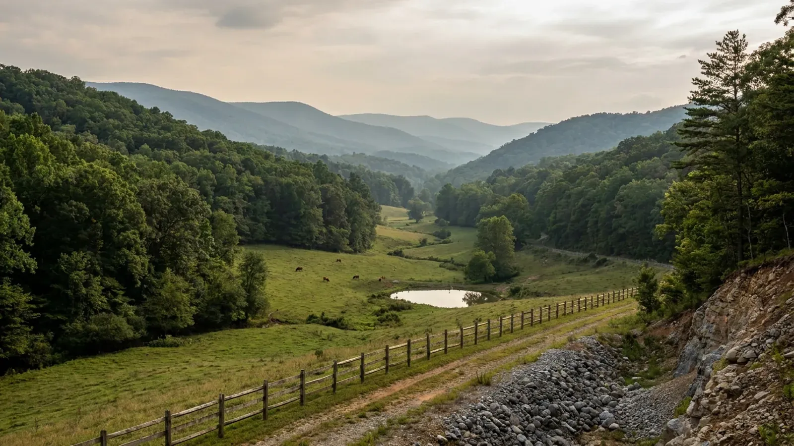
Nelson and Amherst adjoin along the Blue Ridge and share almost nothing that decides a build. Amherst County publishes a complete Design Criteria sheet — 30 psf ground snow, 115 mph wind, seismic design category B, 18-inch frost line — and Nelson County publishes no such sheet at all, but its Mandatory Inspections form does something no other locality on this site does: it splits the county's minimum footing depth on a road, 18 inches east of Route 151 and 24 inches west of it, because west of that line the ground climbs into the mountains. Amherst asks one acre for a house in its Agricultural Residential district; Nelson asks two in A-1 and twenty per dwelling in its Conservation district, and caps how many lots a parcel may ever be divided into on a sliding table. Roughly forty percent of the mapped acreage in each county sits at a representative slope of 25 percent or steeper, which is why this is the land answer for Lynchburg and also why the ground has to be chosen before the building is. Two building departments, two zoning ordinances, two fee schedules built on different arithmetic, and two different health districts issuing the septic permit.
Nelson & Amherst Counties at a glance
- County
- Nelson County
- Cities & counties covered
- Nelson County 14,766 · Amherst County 31,650
Building conditions in Nelson & Amherst Counties
The building code itself is the same in every Virginia locality, and no county, city or town may amend it. What changes from one to the next is who issues the permit and inspects the work, what that office charges, how the parcel is zoned, and the Table R301.2 design criteria the locality publishes — the 2021 Virginia Residential Code prints that table blank, with the instruction that additional criteria shall be established by the local jurisdiction. Those local numbers are what your drawings have to satisfy.
Nelson County Department of Building Inspections, Nelson County Mandatory Inspections, last modified 6/21/2022, https://www.nelsoncounty-va.gov/wp-content/uploads/2023/05/Mandatory-Inspections-6-21-2022.pdf (PDF read 2 Sep 2026)
Amherst County Building Safety and Inspections, Design Criteria, county document centre item 7036 "Design Criteria 2026", https://www.countyofamherst.com/egov/apps/document/center.egov?view=item&id=7036 (PDF read 2 Sep 2026); Nelson County Building Inspections, Forms & Publications, https://www.nelsoncounty-va.gov/departments-offices/building-inspections/forms-publications/ (read 2 Sep 2026)
USDA NRCS Soil Data Access, SSURGO survey areas VA125 "Nelson County, Virginia" and VA009 "Amherst County, Virginia", legend/mapunit/component tables, https://sdmdataaccess.sc.egov.usda.gov/Tabular/post.rest (queried 2 Sep 2026)
Amherst County Code Appendix A, Zoning and Subdivisions, § 710.06 and the Article III definition of "Developable area, net", via api.municode.com job 485442 product 10359 (read 2 Sep 2026); Nelson County Code Appendix A, Article 3, via api.municode.com job 494006 product 12109 (read 2 Sep 2026); Albemarle County Code § 18-4.2.1; City of Lynchburg Zoning Ordinance § 35.2-61.4(f); Isle of Wight, Frederick County and Roanoke County published guidance as recorded in research/statewide/soils-karst-and-slopes.md
Virginia Energy, Division of Geology and Mineral Resources, Landslide Hazard Mapping, https://energy.virginia.gov/geology/FEMA_landslide.shtml, and Landslides, https://energy.virginia.gov/geology/Landslides.shtml (both read 2 Sep 2026); DGMR/Landslides MapServer feature counts and OrgGrndSlp statistics, https://www.energy.virginia.gov/gis/rest/services/DGMR/Landslides/MapServer (queried 2 Sep 2026, field units confirmed as degrees from the layer metadata)
Nelson County Code §§ 4-55 and 4-56 (Res. of 8-22-73), via api.municode.com job 494006 product 12109 (read 2 Sep 2026); Nelson County Department of Building Inspections, Farm Structure Exemption application, https://www.nelsoncounty-va.gov/wp-content/uploads/2024/10/Farm-Structure-Exemption-Application.pdf (PDF read 2 Sep 2026)
Also worth knowing before you build in Nelson & Amherst Counties
- A shop with living quarters is a dwelling in Nelson and a narrow exception in Amherst
- Nelson County's zoning ordinance settles it in one clause. An accessory building is a subordinate building, customarily incidental to and located upon the same lot occupied by the main building, and no such accessory building shall be used for housekeeping purposes. Put living quarters in it and it stops being accessory: a dwelling is any building designed for residential purposes, and a dwelling unit is one providing complete independent living facilities, including permanent provisions for living, sleeping, eating, cooking and sanitation. So in Nelson the shop with an apartment in it is the house, and it carries the A-1 two-acre minimum, a lot from the parcel's division allowance, and dwelling setbacks. Amherst County's definition of an accessory building, use or structure runs the other way but only slightly: it lists, in the A-1 zoning district only, living quarters of persons employed on the premises. That is a farm-labour provision rather than a barndominium provision. What Amherst offers instead is § 408 — two additional single-family dwellings may be permitted on the same lot as the main dwelling, on application to and approval by the zoning administrator, in A-1, R-2 or Public Lands, provided each meets the district's lot area, width, coverage and yard requirements and has a fifteen-foot passageway to a public street.
- Whether the shop can be bigger than the house is answered by feel in one county and by numbers in the other
- Nelson County's adopted ordinance sets no size relationship at all — an accessory building must be subordinate and customarily incidental, which is a judgment the zoning administrator makes, and the only hard figures are a fifteen-foot setback from the property line and no accessory building inside the required front yard. The county's public review draft ordinance, released August 2026 and not law, would replace that with a number: accessory structures shall not exceed 40 percent of the gross floor area of the main structure, except in rural districts, with the rural exception doing the real work for anyone building on acreage. Amherst County already has numbers, and they are about the yard rather than the house: a detached accessory building may be not more than two stories in height and may be constructed on not more than 30 percent of the rear yard, must sit at least fifteen feet from the rear lot line and no closer to a side line than the district setback, and may not be located in the front yard. Amherst's stated intent is to ensure accessory structures remain secondary in function to the main building — function, not floor area. Within Amherst's 25 percent A-1 lot coverage cap there is real room for a shop larger than the dwelling.
- Thirty-five feet needs a special use permit in Nelson and is free to 65 feet in Amherst
- Nelson County A-1 § 4-6: any structure erected to a height greater than 35 feet from grade requires a special use permit, and the exceptions are a short list — single-family dwellings, two-family dwellings, boardinghouses, tourist homes, utility poles, public and semipublic uses, agriculture, fire and rescue facilities, and water storage tanks. A tall shop bay is not on that list, so in Nelson the dwelling may go over 35 feet and the workshop beside it needs a $200 special use permit to do the same. Amherst County's table at § 803.01 gives A-1 a 35-foot limit for a single-family dwelling and 65 feet for other uses, so the same tall bay is permitted outright. That inversion — the house free and the shop gated in one county, both free in the other — is the most barndominium-specific difference between the two ordinances.
- Neither county regulates what the outside of the building is made of
- Worth stating plainly, because some Virginia localities do: the City of Petersburg's zoning prohibits corrugated sheet metal panels as a finish material across the city and treats architectural metal panels as discretionary. Nothing of that kind exists here. The word "corrugated" appears nowhere in Nelson County's zoning or subdivision appendices, in Amherst County's zoning and subdivisions appendix, in the Town of Amherst's zoning chapter, or in either county's building chapter, and neither ordinance carries an exterior-materials, facade or cladding standard of any kind. The only architectural provisions in either county are Amherst's requirement that a site plan in the V-1 Village District include architectural elevations of each side, and both counties' communication-tower concealment rules. Nelson's public review draft would prohibit sheet metal in walls and fences — not in buildings — and an editor's note in its proposed Route 29 Corridor Overlay says the county may wish to consider regulating building materials, colors or facades, which is an acknowledgement that it does not.
- This is not a shrink-swell market, and the measurement says so
- Virginia Energy names the Mesozoic basins around Culpeper, Farmville, Danville and Richmond, plus the Coastal Plain and the Shenandoah Valley, as the places likely to carry expansive soils — with its own caveat that the distribution can only be approximated and that field visits to specific areas are necessary. Neither of these counties is in that sentence, and the soil survey agrees. Of Nelson County's 303,700 mapped acres, components with any horizon at a linear extensibility of 6 percent or more total 1,838 acres — 0.6 percent — and the only genuinely high series present is Jackland, the smectitic gabbro soil, at about 919 acres. In Amherst County the figure is 624 acres of 306,300, about 0.2 percent, topping out at a linear extensibility of 7.5 percent in the Haymarket and Mirerock series. The dominant series are Hayesville, Edneytown, Peaks, Elioak and Occoquan in Nelson and Clifford, Edneytown, Peaks, Stott Knob and Wintergreen in Amherst — kaolinitic and mixed Hapludults and Dystrudepts weathered from granite, gneiss, granodiorite, mica schist, phyllite and greenstone. Not one dominant series in either county is smectitic or vertic. What does limit a foundation here is rock and slope: 75,199 acres in Nelson and 74,124 in Amherst carry a lithic or paralithic restriction shallower than one metre, and the shallow Lithic Dystrudepts Bugley and Sylvatus sit on the steepest ground.
- Not one acre in either county rates "not limited" for a drainfield
- The soil survey's septic tank absorption field interpretation returns three classes. In Nelson County, 226,237 of 303,700 acres rate "very limited", 38,479 acres "somewhat limited", and zero acres "not limited". In Amherst County it is 184,153 acres "very limited", 84,066 "somewhat limited", and again zero "not limited". The limiting features are not the same in the two counties: Nelson's largest are seepage in the bottom layer at 170,781 acres, then slope at 163,625 and depth to bedrock at 104,182; Amherst leads with slope at 158,194 acres, then seepage at 119,894 and bedrock at 75,312. That ordering is the practical difference — in Amherst the drainfield problem is most often the fall of the ground, in Nelson it is as often the soil letting effluent through too fast. Virginia sizes the system at 150 gallons per day per bedroom under 12VAC5-610-670 Table 5.1, with no living-area band and no row for a shop, garage or barn at all, and the design rate is normally assigned from soil texture group under 12VAC5-610-490. Nelson County Code § 4-28 goes further than most: it authorises the health department to require percolation tests or other methods of soil evaluation, at the applicant's expense, in subdivision and commercial land development cases.
- Two adjoining counties, two health districts, two metropolitan areas
- The septic approval is the one sign-off that gates the building permit, and it comes from a different office on each side of the county line. Nelson County is in VDH's Blue Ridge Health District, which serves Charlottesville and Albemarle, Fluvanna, Greene, Louisa and Nelson; the Nelson County Health Department is at 1653 Thomas Nelson Highway, Arrington, on 434-263-8315. Amherst County is in the Central Virginia Health District, whose environmental health office for the county is at 224 2nd Street, Amherst, on 434-946-9408, with the district office in Lynchburg. The split runs deeper than health: Nelson sits in the Thomas Jefferson Planning District and the Charlottesville metropolitan area, Amherst in the Central Virginia Planning District and the Lynchburg metropolitan area, while both fall in VDOT's Lynchburg district. Amherst County Code § 4-3 gives the health department fifteen days after receiving the application to notify the building inspector of approval or disapproval; statewide, Va. Code § 32.1-163.5 deems a single-lot septic permit approved if VDH has not acted within fifteen working days.
- Neither county has adopted a protected mountain ridge ordinance
- Va. Code § 15.2-2295.1 lets any locality containing a protected mountain ridge regulate the height and location of tall buildings and structures on it, as an overlay zone superimposed on the base zoning. A protected mountain ridge is defined at 2,000 feet or more in elevation and 500 feet or more above the elevation of an adjacent valley floor, and a tall building or structure is one over 40 feet. The Blue Ridge runs the length of both counties and neither has used the power: searching both zoning ordinances and both county codes for "mountain ridge", "ridgeline", "crest" and "2,000 feet" produces no such overlay. Nelson County does define a mountain ridge, and its definition is stricter than the statute's — a ridge with an elevation of one thousand feet or higher above mean sea level and an elevation three hundred feet or more above the elevation of an adjacent valley floor — but it lives in Article 20, the communication towers ordinance, alongside rules keeping towers 1,320 feet from the Blue Ridge Parkway and the Appalachian National Scenic Trail and 120 feet from a Virginia Scenic Byway. It reaches towers, not houses or shops. Amherst County's zoning appendix contains no occurrence of the word "mountain" at all.
- Steep ground can force an engineered erosion plan in Amherst, and it is a $500 difference
- Both counties will take an agreement in lieu of an erosion and sediment control plan for a single-family house, which is the cheap route, but Amherst attaches a condition worth knowing before buying on a hillside. Amherst County Code § 11-52(b) lets the director accept the agreement and then adds that the director may require a plan for such individual lots if the director determines that severe topography, erodible soils, resource protection areas or other environmentally sensitive features are present on the lot. If that happens, the plan review fee under § 11-53(c) is $500 for a noncommercial site plus $10 per acre, or part thereof, above one acre. Nelson County runs the agreement in lieu route for new single-family homes on a fee of $35 to $450 and requires the name and certification number of the Responsible Land Disturber at the time of application, with erosion measures installed and verified in writing before any inspection, and final grading, seeding and stabilisation before occupancy. Both counties apply the 10,000 square foot land-disturbance threshold, and both remove the exemption for smaller disturbances on individual lots in a recorded subdivision where the development as a whole exceeds it.
- Nelson has no towns at all; Amherst has one, and it does zoning but not permits
- Established from the Census sub-county population file rather than assumed. In the 2024 vintage sub-county estimates Nelson County appears as a single record with no incorporated place parts beneath it — 14,766 people and no towns — so the county is the only local authority anywhere inside it, Lovingston, Nellysford and Wintergreen included, none of which is incorporated. Amherst County, at 31,650, splits into exactly two rows: Amherst town at 2,128 and the balance of the county at 29,522. The town's own Building Inspection/Permits page states that the Amherst County Building Official on 434-946-9302 administers the Uniform Statewide Building Code, and that this includes issuing building and other permits and performing inspections as needed. The town does run its own zoning: a full zoning chapter with A-1 through M-1 districts, its own planning commission, board of zoning appeals and zoning certificate, and its own zoning fee schedule. So inside the town limits the zoning approval is the town's and the building permit is the county's — and Amherst County's own building permit process page says exactly that, sending applicants to the town zoning department on 434-946-7885 if the site is in town and to county planning and zoning on 434-946-9303 if it is not.
- Nelson County publishes the engineer-seal threshold and a third-party inspection policy
- Two published local documents that are unusually specific for a county this size. Nelson's Residential Plan Checklist states the design-professional exemption as its office applies it: plans for residential work may be exempt from the services and seal of an architect or engineer where the project is a single-family or two-family home, townhouse or multifamily dwelling and the structure does not exceed 5,000 square feet in total net floor area or three stories in height; that exempt construction documents must bear the author's name, signature, address and occupation; that under Va. Code § 54.1-410(A) the local building official may require design-professional plans anyway; and that under § 54.1-402(B)(1) construction documents for any unique design of structural elements for floors, walls, roofs or foundations require them regardless. That last clause is the one a long clear-span shop meets. Nelson's Third Party Policy, written under USBC section 113.7.1, requires written notification before any inspection, the report back within 72 hours, ICC certification for the inspection type, no financial interest in the project, and a professional insurance policy of one million dollars naming the jurisdiction as additional insured. Amherst County publishes its own third-party inspection policy alongside a cross-sections handout and an owner-builder statement.
- The land Lynchburg does not have, and what it costs in acres
- Lynchburg is an independent city of 81,347 people on 48.9 square miles of hills above the James, and it belongs to no county at all. The 2022 Census of Agriculture puts 74,554 acres in farms in Amherst County — 24.6 percent of the county, across 385 farms averaging 194 acres with a median of 76, and 138 of them under 50 acres — and 68,566 acres in Nelson, 22.8 percent, across 399 farms averaging 172 acres with a median of 72, again 138 under 50 acres. Amherst is the county directly over the city line to the north; Nelson is the next one up, and it is among the least densely settled counties in Virginia at 31.7 people per square mile against Amherst's 67.4. Neither county appears on the Chesapeake Bay Preservation Act's statutory Tidewater list at Va. Code § 62.1-44.15:68, so the Resource Protection Area buffer regime that governs building in Richmond, Henrico, Hanover and the whole of Northern Virginia does not reach here at all. Both counties fall in EPA radon Zone 2, which puts them outside the radon opt-in, since VRC R331.1 requires Zone 1 plus local action under the zoning article.
- Nelson County is rewriting the ordinance this page describes
- The two-acre A-1 minimum, the lot-count table and the 20-acre Conservation district are the adopted law today, and they are also under review. Nelson County has a Public Review Draft Zoning and Subdivision Ordinance out, with a summary of changes memo dated 19 August 2026, an open house held that month, and planning commission and board of supervisors hearings still to be scheduled. The draft merges the zoning and subdivision ordinances into one instrument, adds three overlay districts — a Village Overlay, a Route 29 Corridor Overlay and a Route 151 Corridor Overlay — and adds a new community design standards article covering lighting, landscaping, walls and fences, parking and signage, with dark-sky lighting standards that exempt agricultural and single-family residential lighting. Nothing in it is law until adopted, and anyone buying in Nelson on the strength of a dimensional standard should ask the planning department at 434-263-7090 which version will govern their application.
- Amherst County has adopted the maintenance code; Nelson has not
- Enforcement of Part I of the Uniform Statewide Building Code is mandatory for new construction in every Virginia locality. Part III, the Virginia Maintenance Code, is the part a locality chooses. Amherst County adopted it: the board of supervisors took Part III in November 2015, and county code § 4-147 adopts Parts I, II and III together by reference, so existing structures in Amherst are held to a minimum maintenance standard the county will enforce, with a fourteen-day repair request complaint route published for it. Nelson County Code § 4-26 adopts the building code by reference without a corresponding maintenance adoption, and its building inspections department publishes no property maintenance programme. For a barndominium owner the difference shows up after completion rather than at permit time, in what the county can require of a building once it is finished.
Nelson County Code Appendix A, Article 2, definitions of "Building, accessory", "Dwelling" and "Dwelling unit"; Amherst County Code Appendix A, Article III definition of "Accessory building, use or structure" and § 408 (Ord. No. 2013-0016, 1-27-14); both via api.municode.com (read 2 Sep 2026)
Nelson County Code Appendix A, Article 2 and § 4-3-4 (Ord. No. O2007-003, 5-21-07); Nelson County Public Review Draft Zoning & Subdivision Ordinance § 7-8-1(B), https://www.nelsoncounty-va.gov/wp-content/uploads/2026/08/2.-DRAFT-ZOSO.pdf (PDF read 2 Sep 2026; a draft in public review, not adopted); Amherst County Code Appendix A §§ 901.01, 901.02 and 802.01 (Ord. No. 2019-0009, 8-20-19) via api.municode.com (read 2 Sep 2026)
Nelson County Code Appendix A § 4-6 (Ord. of 12-14-93; Ord. of 6-8-99; Ord. No. O2011-04, 8-9-11) and Nelson County Planning & Zoning, Schedule & Fees, https://www.nelsoncounty-va.gov/departments-offices/planning-zoning/schedule-fees/ (read 2 Sep 2026); Amherst County Code Appendix A § 803.01 (Ord. No. 2020-0002, 7-21-20) via api.municode.com (read 2 Sep 2026)
Searched in full for "corrugated", "sheet metal", "metal panel", "exterior material", "facade" and "architectural": Nelson County Code Appendices A and B and Chapter 4; Amherst County Code Appendix A and Chapters 4 and 11; Town of Amherst Code Chapter 24 — all via api.municode.com (read 2 Sep 2026). Nelson County Public Review Draft Zoning & Subdivision Ordinance §§ 5 and 8-4-5 (August 2026 draft, not adopted). Petersburg comparison from the Petersburg zoning ordinance Art. 25 § 4.4(2) (18 June 2024) as recorded in this project's research corpus
USDA NRCS Soil Data Access, SSURGO survey areas VA125 and VA009, legend/mapunit/component/chorizon/corestrictions/copmgrp tables, https://sdmdataaccess.sc.egov.usda.gov/Tabular/post.rest (queried 2 Sep 2026); Virginia Energy, Division of Geology and Mineral Resources, Expansive Soils
USDA NRCS Soil Data Access, cointerp rule "ENG - Septic Tank Absorption Fields" for survey areas VA125 and VA009 (queried 2 Sep 2026); Nelson County Code § 4-28 (Ord. of 4-9-69; Ord. of 12-14-99) via api.municode.com; 12VAC5-610-670 Table 5.1 and 12VAC5-610-490
VDH Blue Ridge Health District, https://www.vdh.virginia.gov/blue-ridge/, and VDH Central Virginia Health District environmental health contacts, https://www.vdh.virginia.gov/central-virginia/environmental-health/ (both read 2 Sep 2026); Nelson County Health Department listing, https://www.nelsoncounty-va.gov/departments-offices/health-department/ (read 2 Sep 2026); Amherst County Code § 4-3(c) via api.municode.com; Va. Code § 32.1-163.5
Va. Code § 15.2-2295.1; Nelson County Code Appendix A, Article 20 §§ 20-2, 20-6 and 20-9 (Ord. No. O2014-01, 3-11-14); Amherst County Code Appendix A, searched in full; both via api.municode.com (read 2 Sep 2026)
Amherst County Code §§ 11-52 and 11-53 (Ord. No. 2015-0005, 8-18-15) via api.municode.com, and Amherst County Erosion & Sediment Control division page, https://www.countyofamherst.com/department/division.php?structureid=107; Nelson County Erosion and Sediment Control Ordinance, https://www.nelsoncounty-va.gov/wp-content/uploads/2023/05/NELSON-COUNTY-EROSION-AND-SEDIMENT-CONTROL-ORDINANCE.pdf, and Nelson County Building Inspections, Permitting Process and Building Permit Fees, https://www.nelsoncounty-va.gov/departments-offices/building-inspections/ (all read 2 Sep 2026)
U.S. Census Bureau, Sub-County Resident Population Estimates SUB-EST2024, https://www2.census.gov/programs-surveys/popest/datasets/2020-2024/cities/totals/sub-est2024.csv, records for state 51, counties 009 and 125 (read 2 Sep 2026); Town of Amherst, Building Inspection/Permits, https://amherstva.gov/community/building-inspectionpermits/; Amherst County, Building Permit Process, county document centre item 17 (both read 2 Sep 2026)
Nelson County Department of Building Inspections, Residential Plan Checklist, https://www.nelsoncounty-va.gov/wp-content/uploads/2024/10/Residential-Plan-Checklist.pdf, and Nelson County 3rd Party Policy, https://www.nelsoncounty-va.gov/wp-content/uploads/2024/10/3rd-Party-Inspections.pdf (PDFs read 2 Sep 2026); Amherst County Building Safety & Inspections department page, https://www.countyofamherst.com/department/index.php?structureid=14 (read 2 Sep 2026)
2022 Census of Agriculture county tables as compiled in research/statewide/geography-and-population.md; U.S. Census Bureau population estimates; Va. Code § 62.1-44.15:68 Tidewater Virginia list; EPA radon zone table and VRC R331.1 as recorded in research/statewide/design-criteria-and-climate.md
Nelson County Planning & Zoning, Zoning & Subdivision Ordinance Update, https://www.nelsoncounty-va.gov/departments-offices/planning-zoning/, and Summary of Changes Memo dated 19 August 2026, https://www.nelsoncounty-va.gov/wp-content/uploads/2026/08/3.-Summary-of-Changes-Memo.pdf (both read 2 Sep 2026)
Amherst County, Property Maintenance, https://www.countyofamherst.com/department/division.php?structureid=108 (read 2 Sep 2026), and Amherst County Code § 4-147; Nelson County Code § 4-26 (Res. of 9-12-73; Ord. of 12-9-03); both codes via api.municode.com (read 2 Sep 2026)

The expensive surprises are in the ground, not the building
What moves a Virginia budget is usually below grade, and it is soil rather than rock. Five localities already treat a soil answer as a condition of the permit rather than a recommendation — Fauquier, Chesterfield, Isle of Wight, Madison and Culpeper each require a soil report, an engineered foundation design, or both before the footings are approved. Chesterfield asks for one on every new house with no opt-out, on its own published reasoning that small amounts of shrink-swell soil may turn up anywhere in the county. Virginia Energy puts the same point bluntly: standard homeowner's insurance does not cover damage from expansive or compressive soils. Along the Interstate 81 corridor the question changes shape entirely — Virginia Energy counts twenty-seven Virginia counties in the karst zone that follows that road, where what matters is what is under the slab rather than what the slab sits in, and karst does not stay west of the Blue Ridge: Loudoun County publishes karst terrain of its own, on the other side of it. The same ground then sizes the septic system, because 12VAC5-610 works from bedrooms and soil texture — 150 gallons a day per bedroom, with no row in the table for a shop, a garage or a barn at all, and clay assigned to the slowest texture group at 91 minutes per inch or worse, past the 45 minutes per inch that makes a reserve drainfield mandatory. The soil that needs a foundation engineer multiplies the drainfield. So the site work, the foundation and the drainfield get resolved together rather than one at a time. We price the dirt before we price the building.
What we build in Nelson & Amherst Counties
All nine services are available in Nelson & Amherst Counties. What a build costs depends far more on the parcel than on square footage, so we price against your land rather than publishing a rate card.
Custom Plans
Barndominium floor plans drawn to your parcel and to the design criteria your own Virginia locality publishes, not to a generic national spec.
Barndominium Kits
Engineered barndominium shell packages delivered to your Virginia land, drawn to the criteria your own building department fills in.
Turnkey Builds
Start to finish barndominium construction: permits, site work, shell and full interior finish, under one contract and one schedule.
What a build looks like
Three stages every Nelson & Amherst Counties project passes through, from a raw parcel to a finished home. Site work first, because that is where the budget is decided.

The parcel
Zoning, setbacks, flood zone and utility access get checked before anything is drawn.
Pad and permit
Clearing, grading and a compacted pad, while the submittal works through whichever office issues the permit where you are building.

Frame to finish
Shell erected and dried in, then systems, insulation and interior finish through to CO.
Those are the rules where you are building in Nelson & Amherst Counties. Tell us what you want to build and we will draw it to them.
Where we build around Nelson & Amherst Counties
Nelson County and the rural land around it. The buildable acreage for a project this size usually sits outside the city limits, which is frequently what changes who issues your permit.
Keep reading
The questions that usually come next once you know what Nelson & Amherst Counties allows.
Barndominium Cost Guide
Sourced per-square-foot ranges by tier and by size, with a calculator built on the same figures.
Read itIs It Legal in Virginia?
Classification, zoning, the HOA gate, and why "nonresidential farm building" does not cover a home.
Read itHow Long Does It Take?
Census build-duration data, and what actually sets the permit clock where you are building.
Read itNearby areas we build in
Others we cover nearby. One may be a county, another an independent city that belongs to no county at all, and another a town inside a county — so the office that issues the permit, the fees it charges, the zoning and the design criteria each locality publishes can all differ from one card to the next.
Building in Nelson & Amherst Counties: common questions
9 questions we get asked most often about building in Nelson & Amherst Counties. If yours is not on the list, ask it directly.
I am in Lynchburg and there is nowhere to build. Where do I go?
How deep do the footings have to go?
Can I put living quarters in the shop?
Can the shop be bigger than the house?
Will anyone tell me I cannot use metal siding?
Is the steep ground going to stop me building?
Nelson County is where Hurricane Camille happened. Should that change how I build?
Is the clay going to crack my slab?
Who issues my permit, and what will it cost?
Building in Nelson & Amherst Counties?
Start with the plan. Tell us what you want to build and we will draw it, then confirm which office issues the permit for your parcel, what it will let you put there, and what wind load it has to meet. That conversation costs nothing.