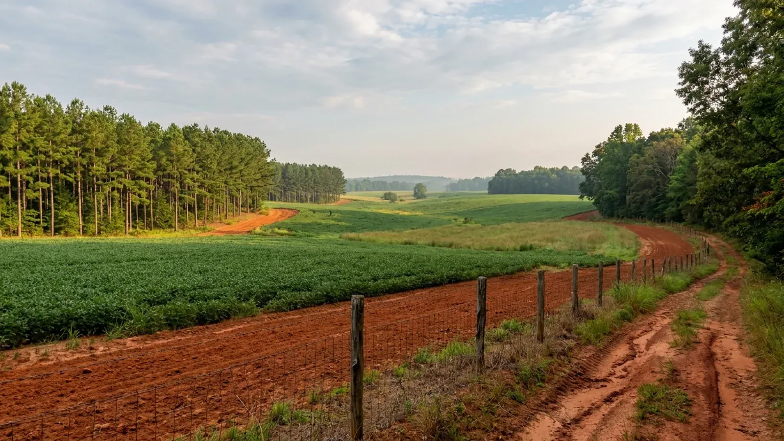
Rolling Southside Virginia farmland with red-orange clay, a loblolly pine plantation and mixed oak woodland.
Pittsylvania County One statewide code, no local amendments

Barndominium Builders in Pittsylvania County, VA

Pittsylvania is the largest locality in Virginia at 969.003 square miles, and it holds more land in farms than any other county in the state at 244,183 acres — beating Augusta by under two square miles on one measure and by 209 acres on the other. It is also one of the very few Virginia localities that fills in Table R301.2 completely and publishes it, and the numbers are unusual: a ground snow load that changes inside the county at Chatham, seismic design category A, and a 12-inch frost line matching what the tidewater localities publish rather than the 18 to 24 inches published across the rest of the Piedmont. The Agricultural district here has a 20,000 square foot minimum lot and no regulated lot coverage, and the zoning ordinance's own definition of an accessory building is what decides whether a shop with living quarters is treated as a dwelling. Danville, next door, is an independent city in no county at all; the county line is where its authority stops and the land begins.

Pittsylvania County at a glance

County
Pittsylvania County
Population
59,490
ZIP codes
24531, 24557, 24563, 24549, 24586, 24566, 24527, 24530, 24565, 24161, 24069

Building conditions in Pittsylvania County

The building code itself is the same in every Virginia locality, and no county, city or town may amend it. What changes from one to the next is who issues the permit and inspects the work, what that office charges, how the parcel is zoned, and the Table R301.2 design criteria the locality publishes — the 2021 Virginia Residential Code prints that table blank, with the instruction that additional criteria shall be established by the local jurisdiction. Those local numbers are what your drawings have to satisfy.

Build conditions for Pittsylvania County , Virginia : design wind speed 110 mph. BUILD CONDITIONS PITTSYLVANIA COUN…Pittsylvania CountyONE STATEWIDE CODEDESIGN WIND SPEED110 mphPublished by Pittsylvania County on its Building Codes page as "Design Wind Speed: 110 miles perhour". The county does not state the basis, so the figure is quoted as it is printed rather than…ZONING · A-1 AGRICULTURAL, ONE OF TWELVE DIST…20,000 sq ft, with lot coverage not…Sec. 35-180 sets the A-1 minimum lot at 20,000 square feet andleaves maximum lot coverage unregulated; Sec. 35-187 allows one…WHO ISSUES THE PERMITPittsylvania County Community Develo…53 N. Main Street (P.O. Drawer D), Chatham, VA 24531, with OtisVaughan as Chief Building Official. Applications go in by hand, fax…
Build conditions for Pittsylvania County, drawn from the sourced facts on this page. Every figure above is cited in the quick-facts panel below, with its source and vintage.
The biggest county in Virginia, and the biggest farm county, by a hair
At 969.003 square miles of land Pittsylvania is the largest of Virginia's 133 localities — ahead of Augusta County by 1.93 square miles. It also holds 244,183 acres in farms, more than any other Virginia county, ahead of Augusta again by 209 acres. That is 1,053 farms across 37.7 percent of the county, a median farm of 100 acres, 77,627 acres of woodland inside those farms, and 283 operations under 50 acres. And the population is 59,490 and falling. Every market ranking keyed to metro population misses this county completely.

2025 Census Gazetteer, counties file for Virginia, https://www2.census.gov/geo/docs/maps-data/data/gazetteer/2025_Gazetteer/2025_gaz_counties_51.txt (ALAND_SQMI across all 133 rows, read 2 Sep 2026); 2022 Census of Agriculture, USDA NASS, county file; U.S. Census Bureau Vintage 2025 population estimates

The snow load changes inside the county, at Chatham
The 2021 Virginia Residential Code prints Table R301.2 blank and leaves the numbers to the locality. Pittsylvania fills it in and publishes the whole thing — and its ground snow load is "25 lbs. per square foot above Chatham, 20 lbs. per square foot for Chatham and below." A design figure that changes at a town in the middle of the county means the parcel address settles the roof load, not the county name. The rest of the published table: design wind speed 110 mph, seismic design category A, weathering moderate, frost line depth 12 inches, termite moderate to heavy, air freezing index 248, mean annual temperature 56, ice shield not required.

Pittsylvania County Building Codes page, Design Criteria block, https://www.pittsylvaniacountyva.gov/243/Building-Codes (rendered and read 2 Sep 2026); 2021 Virginia Residential Code Table R301.2

The Dan River basin clay is real here, and it is 3.7 percent of the county
Virginia Energy names "the Mesozoic basins around Culpeper, Farmville, Danville, and Richmond" as the state's most likely expansive-soil areas — and the Dan River basin is this county's. But that sentence is about a basin around a city, so the question is what is mapped on this ground. USDA-NRCS soil data for survey area VA143 gives the answer: of 654,200 acres, soils carrying a horizon at linear extensibility of 6 percent or more total 24,099 acres — about one acre in twenty-seven. They are Lackstown at 10,473 acres, Enott at 7,772, Leaksville at 3,157, Halifax at 1,719 and Orange at 979. The four soils that actually cover the county — Clifford, Poplar Forest, Fairview and Nathalie — are kaolinitic, and kaolinite does not shrink and swell: their maximum linear extensibility runs 1.5 to 2.2 percent. The county's own building department publishes the same conclusion in one line of its design criteria: "Shrink/Swell Percentage: less than 20%."

USDA-NRCS Soil Data Access, https://SDMDataAccess.sc.egov.usda.gov/Tabular/post.rest, survey area VA143, tables legend/mapunit/component/chorizon (queried 2 Sep 2026); Virginia Energy, Division of Geology and Mineral Resources, Expansive Soils, https://energy.virginia.gov/geology/ExpansiveSoils.shtml; Pittsylvania County Building Codes page

Not one acre of the county is unrestricted for a drainfield
NRCS rates 427,913 of the county's 654,200 acres "Very limited" for septic tank absorption fields and the remaining 130,338 "Somewhat limited", with 10,227 not rated. There is no "Not limited" acreage at all. And the reasons are not what the clay story predicts: the two limitations that fire hardest are seepage in the bottom layer, on 267,412 acres, and slope of 8 to over 15 percent, on 149,154. Depth to a water table accounts for 49,836 acres and slow percolation for far less. In this county the drainfield fight is about slope and about a substratum that drains too fast, not about tight clay. For foundations the same data set is much kinder: 129,837 acres are rated not limited for dwellings without basements.

USDA-NRCS Soil Data Access, cointerp table, rules "ENG - Septic Tank Absorption Fields" and "ENG - Dwellings W/O Basements", survey area VA143 (queried 2 Sep 2026)

The zoning definition is what makes a barndominium work here
Sec. 35-35 of the county zoning ordinance says an accessory building "shall not dominate a principal building in area, extent or purpose" — which is exactly what a 3,000 square foot detached shop does beside a 1,500 square foot house. The same definition continues: "An accessory building that is attached to and is an integrated part of a principal building (by location, materials and architectural design) shall be governed by the regulations for principal buildings in this Ordinance." A barndominium is one building, one structural system, one set of materials. So it reads as a principal building — a single-family dwelling, which is a permitted use by right in A-1 — and it gets the 40-foot height limit and the ordinary yard requirements rather than the accessory-building cap. It is the two-building plan that runs into the definition, not the one-building plan.

Pittsylvania County Code Chapter 35, Zoning, Sec. 35-35 (definitions of Accessory Building, Dwelling and Dwelling, Single-Family), Secs. 35-178, 35-180, 35-181, https://www.pittsylvaniacountyva.gov/DocumentCenter/View/251 (downloaded and read 2 Sep 2026; ordinance adopted 1991, latest amendment shown 19 April 2022)

Your side setback is a percentage of your road frontage
Sec. 35-182 B: the minimum side setback in the Agricultural district "shall be ten (10) percent of the road frontage distance with a minimum of ten (10) feet." That is not a fixed number, and on farm frontage it grows fast — 400 feet of road frontage gives a 40-foot side yard on each side, 600 feet gives 60. For a building whose whole point is width, it is the most consequential figure in the ordinance and it is the one nobody checks. The rear setback is 40 feet, except that accessory structures up to 800 square feet may sit 12 feet off the rear line — so an accessory building over 800 square feet, which every real shop is, takes the full 40. Front is 60 feet from the right-of-way centerline or 35 feet from its edge, whichever is greater.

Pittsylvania County Code Chapter 35, Zoning, Sec. 35-182 A–E, https://www.pittsylvaniacountyva.gov/DocumentCenter/View/251 (read 2 Sep 2026)

Also worth knowing before you build in Pittsylvania County

The three towns, and why the county still permits
Pittsylvania contains exactly three incorporated towns: Chatham at 1,191 people, Gretna at 1,280 and Hurt at 1,234, with 55,785 in the balance of the county. Va. Code § 36-105(A) is explicit that "towns with a population of less than 3,500 may elect to administer and enforce the Building Code; however, where the town does not elect to administer and enforce the Building Code, the county in which the town is situated shall administer and enforce the Building Code for the town." All three are far under that line. Chatham publishes a zoning and land use map and sends in-town zoning questions to the Town Manager; Gretna runs a Planning Department, a Board of Zoning Appeals and its own zoning ordinance at Town Code Title 6, Chapter 3. Neither publishes a building department. Inside a town line, expect county building inspections and town zoning, and confirm the zoning with the town.

Va. Code § 36-105(A), https://law.lis.virginia.gov/vacode/title36/chapter6/section36-105/ (read 2 Sep 2026); U.S. Census Bureau Vintage 2025 sub-county estimates, SUMLEV 157, county 51143; Town of Chatham, Zoning & Land Use Map, https://www.chatham-va.gov/administration/page/zoning-land-use-map; Town of Gretna, Planning and Zoning pages, https://www.townofgretna.org/departments/planning/zoning

The farm-building affidavit, and the felony printed next to it
The county's own agricultural buildings page reproduces the § 36-97 definition of a farm building — one "not used for residential purposes" — and then adds a local step: the owner must come into the Community Development office and sign an affidavit "that the structure will only be used for agricultural purposes for its entire lifespan." Underneath, in the county's own words: "Knowingly providing false information to obtain a building permit or lying on an affidavit constitutes a Class 4 felony, which is punishable by up to ten years in prison and a fine of up to $100,000." Convert it later and the county requires all relevant sections of the code to be met and the inspections completed, with the same felony attached to failing to do so. The county then prints the advice itself: for anyone who might want other uses later, "it makes more sense to follow the Virginia Building Code by obtaining a building permit and requesting building inspections during the original construction."

Pittsylvania County, Agricultural Buildings, https://www.pittsylvaniacountyva.gov/249/Agricultural-Buildings (rendered and read 2 Sep 2026); Va. Code §§ 36-97 and 36-99

Buying part of a farm in land use? The roll-back tax follows
Pittsylvania runs a land-use taxation programme under County Code Sec. 6-12 and Title 58.1 Chapter 32 Article 4. Qualifying land is assessed at use value instead of market value: the 2024 rates are $600 an acre for cropland, forest, horticulture and pasture, and $1,300 for open space, against a real estate rate of $0.62 per $100. The county's own worked example is a 71-acre parcel worth $4,000 an acre — $1,760.80 in tax at market value, $264.12 in land use. The minimums are five acres for crop or pasture, twenty for forest, and $1,000 of documented income for the year. The catch is Sec. 6-12.6 and 6-12.7: when the use changes to a non-qualifying one, a roll-back tax and interest are imposed under § 58.1-3237, the owner must report the change within sixty days, and failing to do so adds a penalty of fifty percent of the roll-back plus half a percent a month. Taking five acres out of a working farm for a house and a shop is a change of use.

Pittsylvania County, Land Use Program, https://www.pittsylvaniacountyva.gov/381/Land-Use-Program and Real Estate Tax, /377/Real-Estate-Tax (read 2 Sep 2026); Pittsylvania County Code Chapter 6, Secs. 6-12 to 6-12.7.1, https://www.pittsylvaniacountyva.gov/DocumentCenter/View/1299; Va. Code §§ 58.1-3229 to 58.1-3244

What the county charges, and the three separate permits
On the Community Development fee schedule effective 1 July 2026, a new single-family dwelling permit has a minimum of $180.00 and is rated at $0.18 per square foot; a garage or accessory building has a $60.00 minimum; plan review for a new dwelling is $50.00. Every permit carries the 2.0 percent state levy, which is the same in every Virginia locality, plus a $5.00 county blight eradication fee. A certificate of occupancy is $100.00, a reinspection $50 to $100, and starting work without a permit $100.00. Zoning is billed separately at $25.00 for a zoning permit, $400.00 for a rezoning, variance or special use permit. Land disturbance is a third permit, required above 10,000 square feet of disturbance, at a flat $150.00 for a single-family dwelling — and the county states that building inspections and the certificate of occupancy can be withheld until the construction entrance and silt fence are in.

Pittsylvania County Community Development Fee Schedule, 2027 Rates, effective 07/01/2026, https://www.pittsylvaniacountyva.gov/DocumentCenter/View/1738; Pittsylvania County Land Disturbance page, /235/Land-Disturbance; Certificate of Occupancy page, /241/Certificate-of-Occupancy (all read 2 Sep 2026)

Metal buildings get named in the county's own guidance
The county's accessory structures page says it directly: "Plans for prefabricated metal carports, metal garages, and similar structures that are not designed prescriptively in accordance with the USBC, may be required to be sealed by a registered design professional and may require additional engineered details." It also says the code "makes no distinction between a prefabricated structure that is delivered on-site completely assembled and a structure that is erected on-site." New residential construction takes one digital PDF plus one paper copy of sealed plans. The permit itself carries a clock: an application lapses six months after filing, a permit can be revoked if work does not start within six months, an inspection is required within the first six months and at six-month intervals after, and the Building Official may impose a three-year limit to finish a new detached dwelling or a residential accessory structure.

Pittsylvania County, Accessory Structures, https://www.pittsylvaniacountyva.gov/256/Accessory-Structures; Residential Structures, /252/Residential-Structures; Application for Permit, page 4 of 9, https://www.pittsylvaniacountyva.gov/DocumentCenter/View/151 (all read 2 Sep 2026)

One health district covers both the county and Danville
The building permit stops dead at the Danville city line in both directions — Danville is an independent city belonging to no county, so the county has no authority inside it and it has none outside. Septic and wells are the exception. VDH runs the Pittsylvania-Danville Health District, headquartered in Danville, and it handles "permitting and inspecting of food establishments, tourist establishments, onsite sewage systems, and private wells" for the county and the city alike. That is not the West Piedmont Health District, which serves Martinsville, Henry, Franklin and Patrick and does not include this county even though the West Piedmont planning district does. And the county closes the loop at the end: a copy of the health department's operational permit must reach Building Inspections before a certificate of occupancy can be issued.

Virginia Department of Health, Pittsylvania-Danville Health District, Environmental Health Services, https://www.vdh.virginia.gov/pittsylvania-danville/environmental-health/ and https://www.vdh.virginia.gov/west-piedmont/ (both read 2 Sep 2026); Pittsylvania County, Certificate of Occupancy, https://www.pittsylvaniacountyva.gov/241/Certificate-of-Occupancy

An excavator grading a compacted building pad on a cleared lot, with survey stakes and a drainage swale visible.
Below the slab

The expensive surprises are in the ground, not the building

What moves a Virginia budget is usually below grade, and it is soil rather than rock. Five localities already treat a soil answer as a condition of the permit rather than a recommendation — Fauquier, Chesterfield, Isle of Wight, Madison and Culpeper each require a soil report, an engineered foundation design, or both before the footings are approved. Chesterfield asks for one on every new house with no opt-out, on its own published reasoning that small amounts of shrink-swell soil may turn up anywhere in the county. Virginia Energy puts the same point bluntly: standard homeowner's insurance does not cover damage from expansive or compressive soils. Along the Interstate 81 corridor the question changes shape entirely — Virginia Energy counts twenty-seven Virginia counties in the karst zone that follows that road, where what matters is what is under the slab rather than what the slab sits in, and karst does not stay west of the Blue Ridge: Loudoun County publishes karst terrain of its own, on the other side of it. The same ground then sizes the septic system, because 12VAC5-610 works from bedrooms and soil texture — 150 gallons a day per bedroom, with no row in the table for a shop, a garage or a barn at all, and clay assigned to the slowest texture group at 91 minutes per inch or worse, past the 45 minutes per inch that makes a reserve drainfield mandatory. The soil that needs a foundation engineer multiplies the drainfield. So the site work, the foundation and the drainfield get resolved together rather than one at a time. We price the dirt before we price the building.

What a build looks like

Three stages every Pittsylvania County project passes through, from a raw parcel to a finished home. Site work first, because that is where the budget is decided.

Aerial view of an undeveloped rural lot with cleared grass, a oak and hickory treeline with a few loblolly pines, and a pale gravel access track.
Stage one

The parcel

Zoning, setbacks, flood zone and utility access get checked before anything is drawn.

An excavator grading a compacted building pad on a cleared lot, with survey stakes and a drainage swale visible.
Stage two

Pad and permit

Clearing, grading and a compacted pad, while the submittal works through whichever office issues the permit where you are building.

A finished barndominium at dusk with warm interior lighting glowing through its large windows.
Stage three

Frame to finish

Shell erected and dried in, then systems, insulation and interior finish through to CO.

Those are the rules where you are building in Pittsylvania County. Tell us what you want to build and we will draw it to them.

Where we build around Pittsylvania County

Pittsylvania County and the rural land around it. The buildable acreage for a project this size usually sits outside the city limits, which is frequently what changes who issues your permit.

The Pittsylvania County service area, including the rural acreage outside the built-up edge, which is where the parcels big enough for a build like this usually sit. The map marks the territory we build in. It is not a branch location, and there is no office at this pin.

Nearby areas we build in

Others we cover nearby. One may be a county, another an independent city that belongs to no county at all, and another a town inside a county — so the office that issues the permit, the fees it charges, the zoning and the design criteria each locality publishes can all differ from one card to the next.

Building in Pittsylvania County: common questions

9 questions we get asked most often about building in Pittsylvania County. If yours is not on the list, ask it directly.

Who issues the building permit in Pittsylvania County, and what about Chatham, Gretna and Hurt?
The county does. Pittsylvania County Community Development, Building Inspections, at 53 N. Main Street in Chatham, issues the permit and runs the inspections, with Otis Vaughan as Chief Building Official. The county has exactly three incorporated towns — Chatham at 1,191 people, Gretna at 1,280 and Hurt at 1,234 — and all three sit far below the threshold in Va. Code § 36-105(A), which says towns under 3,500 population may elect to administer the Building Code themselves and that where a town does not, the county administers it for them. Neither Chatham nor Gretna publishes a building department; both publish zoning. Chatham sends in-town zoning questions to the Town Manager, and Gretna runs a Planning Department, a Board of Zoning Appeals and its own zoning ordinance at Town Code Title 6, Chapter 3. So inside a town line, plan on county building inspections and town zoning, and settle the zoning with the town before you buy. One thing does not vary: the code itself. The Uniform Statewide Building Code supersedes every local building code in Virginia and no locality may amend it, so the code being enforced in Chatham is the code being enforced in Fairfax. What is local is the design table, the zoning, and the fees.
Can I build a barndominium in the Agricultural district, and how will it be classified?
Yes, and the ordinance's definitions do most of the work. A single-family dwelling is a permitted use by right in A-1, and so is a single-family dwelling with apartments on premises. The question is whether your shop counts as an accessory building, and Sec. 35-35 answers it two ways. First: "An accessory building shall not dominate a principal building in area, extent or purpose" — a 3,000 square foot detached shop next to a 1,500 square foot house does exactly that, so the detached plan has a definitional problem. Second, and this is the useful half: "An accessory building that is attached to and is an integrated part of a principal building (by location, materials and architectural design) shall be governed by the regulations for principal buildings." A barndominium is one building, one frame, one skin. So it is judged as a principal building — a dwelling — and it gets the district's 40-foot height limit and ordinary yard requirements instead of the accessory-building rules. The district is permissive otherwise: 20,000 square feet minimum lot, lot coverage not regulated at all, one dwelling unit per half acre. The binding constraints are the setbacks, and one of them is unusual — see the next question.
What setbacks apply, and is there anything unusual about them?
Yes, and it catches people building wide. Sec. 35-182 B sets the side yard in A-1 at "ten (10) percent of the road frontage distance with a minimum of ten (10) feet." That is a percentage, not a number, so it grows with your frontage: 400 feet of road frontage means 40 feet of side yard on each side, 600 feet means 60. On a long-frontage farm parcel a wide building can lose a great deal of its buildable width before you have drawn anything. The front setback is 60 feet from the centerline of the right-of-way or 35 feet from its edge, whichever is greater. The rear setback is 40 feet, with one carve-out: accessory structures up to 800 square feet may sit as close as 12 feet from the rear line, which means any real shop, being bigger than 800 square feet, takes the full 40. Principal structures must be at least 20 feet apart, and on a corner lot the side facing the side street needs 35 feet. Height in the district is 40 feet, with silos and water tanks exempt — plenty for a tall door with trusses above it. The practical move is to lay the building out against the frontage figure first, because that is the number that decides whether a 60-foot-wide plan fits your parcel.
Danville sits right there and the Dan River basin is named for expansive soils. Is my foundation in trouble?
Probably not, and this is one of the more useful things to know about this county. Virginia Energy names "the Mesozoic basins around Culpeper, Farmville, Danville, and Richmond" as the most likely areas in the state for expansive or frost-heave-susceptible soils. That sentence is about a basin around a city, though, and the state itself adds that the exact distribution "can only be approximated from current soil maps, and field visits to specific areas are necessary to determine the actual extent of these hazards." So look at what is mapped. USDA-NRCS soil data for this county covers 654,200 acres. The soils with a horizon at 6 percent linear extensibility or more — the genuinely expansive end — come to 24,099 acres, about 3.7 percent of the county: Lackstown, Enott, Leaksville, Halifax and Orange. They also sit in two different settings, not one. Lackstown and Leaksville formed in Triassic basin sediment, which is the Dan River basin; Enott, Halifax and Orange formed in mafic residuum, which is the diabase mechanism, and Enott alone covers more ground than either basin soil. Meanwhile the four soils that actually cover the county — Clifford, Poplar Forest, Fairview and Nathalie — are kaolinitic, with maximum linear extensibility of 1.5 to 2.2 percent. Kaolinite does not shrink and swell. The county's own building department says the same thing in one line of its design criteria: "Shrink/Swell Percentage: less than 20%." So the honest answer is that the hazard is real, mapped and confined, and a soil report on your parcel settles it — which you want anyway, because the same report answers the drainfield question. One line worth carrying from the state's page before you break ground: standard homeowner's insurance does not cover damage from expansive or compressive soils, or from frost heave.
What should I expect on septic, and how is the drainfield sized?
Expect a real site evaluation, and expect slope to be the issue more often than clay. NRCS rates 427,913 of the county's 654,200 acres "Very limited" for septic tank absorption fields and the other 130,338 "Somewhat limited" — there is no unrestricted acreage in the county. The two limitations that dominate are seepage in the bottom layer, on 267,412 acres, and slope of 8 to over 15 percent, on 149,154 acres. Now the sizing, which is where a barndominium buyer has real control. 12VAC5-610-490 assigns a design percolation rate from soil texture rather than starting with a pit test: Texture Group III, the silt loams and clay loams, is 46 to 90 minutes per inch, and Texture Group IV — "sand clay, silty clay and clay" — is "equal to or greater than 91." Percolation tests do exist here and the health department may require them where the estimated rate is in question; the regulation even has a clause written for this county's Triassic soils, at § 490 F: "Shrink-swell soils may exhibit satisfactory percolation rates when dry and therefore must be thoroughly wetted before a percolation test is performed." And the flow: 12VAC5-610-670 Table 5.1 puts a dwelling at 75 gallons per day per person, with footnote 1 reading "For all dwelling units the design shall be based on two persons per bedroom" — 150 gallons per day per bedroom. There is no row in that table for a shop, a garage or a barn. A 3,000 square foot workshop with a floor drain and a utility sink adds nothing to the drainfield; a fourth bedroom adds 150 gallons a day. VDH issues the permit through the Pittsylvania-Danville Health District, and § 32.1-163.5 gives fifteen working days on a single-lot permit before it is deemed approved. The county then requires a copy of that health department permit before it will issue your certificate of occupancy.
What design numbers does Pittsylvania County use?
It publishes all of them, which not every Virginia locality does. The 2021 Virginia Residential Code prints Table R301.2 blank, with em-dashes in every cell and the instruction that additional criteria shall be established by the local jurisdiction — so these are the county's own figures, not anything off a national map. Ground snow load is 25 pounds per square foot above Chatham and 20 pounds per square foot for Chatham and below, which means your parcel address, not the county name, settles the roof load — Frederick County splits its snow load by elevation, but a split at a named town is a Pittsylvania peculiarity. Design wind speed is 110 miles per hour; the county does not state the basis, and it happens to sit exactly at the 110 mph floor 13VAC5-63-210 sets for areas below 4,000 feet of elevation. Seismic design category is A — the ring of counties around this one publishes B — and since IRC R301.2.2 exempts detached one- and two-family dwellings until category D0, there is nothing seismic to design for. Frost line depth is 12 inches — the depth Virginia Beach, Chesapeake, Newport News, Southampton and Accomack publish, against 18 to 24 inches across the rest of the Piedmont and the mountains, which is a shallower required footing under a big slab. Weathering is moderate, termite moderate to heavy, air freezing index 248, mean annual temperature 56, ice shield not required. Climate zone is 3A from the energy code's own county table, which is the warm-humid band and the one that sets the insulation package — the 3A list runs down the southern border and out to Hampton Roads, and nineteen localities are in it while most of Virginia is 4A. One number does not move anywhere in the state: 5 ACH50 on the blower door test.
What permits do I need, what do they cost, and how long can I take?
Three permits, three desks, all in the same building at 53 N. Main Street in Chatham. A zoning permit comes first at $25.00, and it requires a site plan sketch showing every boundary, every existing and planned structure and all four setbacks, based on a survey within the last five years. A land disturbance permit is required above 10,000 square feet of disturbance, at a flat $150.00 for a single-family dwelling, and the county states that inspections and the certificate of occupancy can be withheld until the stone construction entrance and silt fence are in. Then the building permit: on the fee schedule effective 1 July 2026 a new single-family dwelling is a $180.00 minimum at $0.18 per square foot, plan review is $50.00, and a garage or accessory building has a $60.00 minimum. Every permit carries the 2.0 percent state levy — the only permit-fee figure that is identical in every Virginia locality — plus a $5.00 county blight eradication fee. A certificate of occupancy is $100.00 and working without a permit costs $100.00. On timing, the permit carries a clock most people miss: an application is deemed abandoned six months after filing, a permit can be revoked if work does not commence within six months, you must call for an inspection within the first six months and at six-month intervals afterwards to keep it alive, and the Building Official may impose a three-year limit to finish a new detached dwelling or a residential accessory structure. One more worth knowing: the county's written policy under Virginia Construction Code Section 113.7 says that where the building official cannot inspect within two working days of a request, he takes a third-party inspection report and must give any rejection in writing within two working days.
Can I put up the shop first, live in it while I build, or park an RV on the land?
The RV is out, flatly. The county's zoning FAQ says campers "cannot be used for 'living, sleeping, or other occupancy when parked or stored on a residential lot or in any other location not approved for such use,'" and that campers can only be lived in at an approved campground regardless of how long you plan to stay. The shop-first plan has a legitimate route and a trap. The trap is the agricultural building exemption: a farm building is exempt from the code, but § 36-97 defines it as one "not used for residential purposes," and this county makes you sign an affidavit at the Community Development counter saying the structure will be used only for agricultural purposes for its entire lifespan — with the county's own page stating that lying on that affidavit is a Class 4 felony punishable by up to ten years and a $100,000 fine, and that later conversion means bringing the whole structure into compliance with inspections completed. The county then prints its own advice: if you might use it for something else later, permit it properly the first time. The legitimate route is Sec. 35-53 of the zoning ordinance, which lets the Zoning Administrator approve a second single-family dwelling on the same parcel where the main dwelling is in the Agricultural or Conservation district, provided the additional dwelling meets the district's lot area, width, coverage and yard requirements, would not create a substandard lot if the parcel were ever divided, and has access to a public street by a passageway at least fifteen feet wide. That is an administrative approval, not a public hearing.
I am buying acreage out of a working farm. What should I check before closing?
Four things, in this order. First, whether the land is in the county's Land Use Program, because the tax saving is large and the exit is expensive. Qualifying land is assessed at $600 an acre for cropland, forest, horticulture or pasture against a rate of $0.62 per $100, and the county's own example shows a 71-acre parcel dropping from $1,760.80 a year to $264.12. Taking part of it out for a house and a shop is a change to a non-qualifying use, which triggers the roll-back tax and interest under § 58.1-3237. County Code Sec. 6-12.7 requires the owner to report the change within sixty days and adds a penalty of fifty percent of the roll-back, plus half a percent a month, for failing to. Second, road frontage, because the side setback is ten percent of it. Third, the soil, for both answers at once — the foundation question and the drainfield question come out of the same report, and the drainfield is the one more likely to bite given the county's slope. Fourth, the zoning as adopted on the day you look: the ordinance in force dates to 1991 with amendments, the comprehensive plan on the county's page is the 2010 edition, and the county has a draft replacement zoning ordinance in hand and a comprehensive plan update running at pittcoplan.com. Ask Community Development at (434) 432-1767 what has been adopted before you rely on any figure.

Building in Pittsylvania County?

Start with the plan. Tell us what you want to build and we will draw it, then confirm which office issues the permit for your parcel, what it will let you put there, and what wind load it has to meet. That conversation costs nothing.