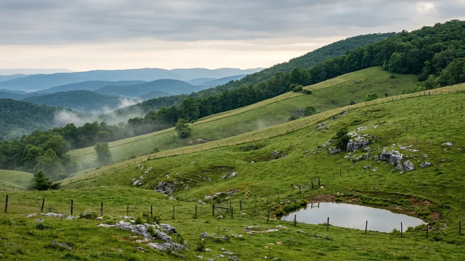
Barndominium Builders in Pulaski & Floyd Counties, VA
Pulaski and Floyd share a county line and almost nothing else. Pulaski is a Valley and Ridge county on I-81, underlain by carbonate bedrock, with a 189-page Unified Development Ordinance, a zoning permit required alongside every building permit, and a rule that an accessory building may not exceed the height of the house it serves. Floyd sits on the Blue Ridge plateau between 2,000 and 3,000 feet, on Precambrian granite, gneiss and schist, and has no zoning ordinance at all: its minimum lot size comes from a Land Division Ordinance re-adopted in November 2025, and its setbacks come off the building department's own permit checklist. The two counties even publish different design criteria, agreeing on wind speed and seismic category and disagreeing on ground snow load and frost depth. Two building departments, two fee schedules fourteen years apart, and one page that keeps them apart.
Pulaski & Floyd Counties at a glance
- County
- Pulaski County
- Cities & counties covered
- Pulaski County 33,586 · Floyd County 15,789
- Site visits
- Site visits across both counties, from Dublin and the I-81 corridor up onto the Floyd plateau
Building conditions in Pulaski & Floyd Counties
The building code itself is the same in every Virginia locality, and no county, city or town may amend it. What changes from one to the next is who issues the permit and inspects the work, what that office charges, how the parcel is zoned, and the Table R301.2 design criteria the locality publishes — the 2021 Virginia Residential Code prints that table blank, with the instruction that additional criteria shall be established by the local jurisdiction. Those local numbers are what your drawings have to satisfy.
Pulaski County Building Office, "Information for Designers — Local Design Criteria for Pulaski County" (2025), pulaskicounty.org/documents/building/applications/information-for-designers-2025.pdf
Floyd County Department of Inspections, Building Inspections page and Garage/Carport Permit application, floydcova.gov/building-inspections
Floyd County Code of Ordinances Part II Land Development Code (Municode client 5339, product 13477); floydcova.gov/code-of-ordinances; floydcova.gov/building-inspections; Floyd County Land Division Ordinance (adopted 18 November 2025)
Pulaski County Unified Development Ordinance, Article 12 Definitions, "Accessory Building or Structure" (amended 27 July 2025)
Pulaski County Building Department, "Accessory Structure Guide — Sheds, Carports, Garages", pulaskicounty.org/documents/building/resources/accessory-structures.pdf
Belo, "Natural Hazard Mitigation Planning For Karst Terrains in Virginia", Virginia Tech, May 2003, Table 3.1 (Virginia Speleological Survey, 2003); Floyd County Comprehensive Plan; USDA NRCS Soil Data Access, survey areas VA155 and VA063, queried 2 September 2026
Also worth knowing before you build in Pulaski & Floyd Counties
- The two tables disagree, and not in the direction you would guess
- Pulaski and Floyd publish the same 115 mph wind speed and the same seismic design category B. They part company on the other two rows that matter to a slab and a footing: Floyd asks for 30 psf of ground snow against Pulaski's 25, and Pulaski asks for a 24 inch frost depth against Floyd's 18. The higher, colder county publishes the shallower footing. Montgomery County next door publishes 30 psf with 110 mph and 24 inches, so there is no neighbour whose numbers can be borrowed for either one.
- Where Floyd's minimum lot size actually comes from
- Floyd County repealed and re-adopted its Land Division Ordinance on 18 November 2025, effective 1 January 2026, and that ordinance rather than any zoning map carries the numbers. Table 4-2-0 sets 2 acres with 100 feet of road frontage and 175 feet of width at the building setback for a lot served by private water and wastewater, 0.5 acre where one public utility reaches the lot and 0.25 acre where both do. A Large Lot Division needs 25 acres, with one limited access lot per plat allowed at 1 acre if it already holds a dwelling, well and septic and 2 acres otherwise. Any plat is capped at ten new lots including the residual.
- Floyd's setbacks come off a permit checklist
- With no zoning ordinance to set them, Floyd County's setbacks are published by the building department on its own page and repeated on the building permit package: 35 feet from the edge of any roadway, state-maintained or private, 60 feet from the centre of the road, and 5 feet from structures and property lines on residential work. That is the whole of it. There is no separate accessory-structure setback, because there is no ordinance that defines an accessory structure.
- Pulaski's districts and lot sizes
- Pulaski County zones to three rural districts. Agricultural takes a 1 acre minimum lot, Conservation 2 acres and Rural Residential 0.75 acre; all three cap the principal building at 40 feet and lot coverage at 50 percent, and all three cap an accessory building at 35 feet. Setbacks are 35 front, 20 side and 35 rear in Agricultural and Conservation, and 25, 15 and 35 in Rural Residential, with an accessory building over 256 square feet taking 10 feet at the side and rear. Agricultural structures may break the 40 foot height limit if every setback grows a foot for each foot of extra height.
- Pulaski's living quarters rules, live now
- Pulaski County's ordinance already handles the shop-with-an-apartment question. Its definition of a single-family detached dwelling says a garage apartment or other accessory dwelling can be attached to the principal dwelling with an approved building permit if the apartment is for the same family unit. A separate accessory dwelling unit is capped at 2,000 heated square feet and at two storeys or the height of the primary structure, whichever is less, with one per lot, placed in the side or rear yard no closer to the frontage road than the house, and meeting the primary structure's setbacks. Virginia's statewide accessory dwelling statute does not commence until 1 July 2027, so Pulaski's own rule is the one that applies today.
- What Pulaski's sinkhole rule actually requires
- Pulaski County's only codified sinkhole provision is section 7.9 of its erosion and sediment control ordinance. Where stormwater runoff to a sinkhole increases as a result of improvements, a certified professional geologist registered in Virginia must produce a study showing the sinkhole can take the post-development volume and rate, and that report goes in with the erosion and sediment control plan. It also wants a drainage easement for the whole ten-year storm and a vegetated flow path at least 80 feet long to the sinkhole floor. The trigger is a plan, and disturbances under 10,000 square feet are exempt. Nothing in the county requires a geotechnical or geophysical investigation before a foundation permit is issued.
- The county says the excavation cost is unpredictable
- Pulaski County's Comprehensive Plan 2030, adopted 16 December 2019, carries a section headed Karst Topography: much of the county is underlain by carbonate bedrock, soil cover is thin, and surface water infiltrates rapidly through sinkholes. It then says the sentence a builder needs — that in karst terrain pinnacle erosion is common, and therefore excavation costs may vary within a relatively small area — and adds that small cave-ins are not uncommon after heavy rain. That is a plan rather than an ordinance, so it guides rather than binds, but it is the county telling you in its own words why the same footing trench can cost differently at two ends of the same slab.
- What Floyd sits on instead
- Floyd County's own comprehensive plan describes almost the whole county as underlain by Precambrian igneous and metamorphic rock — the granites, gneisses and schists of the Leatherwood granite and the Wissachickon and Lynchburg gneiss formations — and says the rock substrate generally possesses load bearing capacities acceptable for development. It also says the county lacks true aquifers and relies on water-filled fractures: granite and granite gneiss weathered to a sandy soil 75 to 100 feet deep in the northwest, gneisses and schists weathered 25 to 50 feet in the southeast, and a granitic band one to three miles wide weathered less than 25 feet where the rock below has been virtually non-productive. Wells must be cased through the saprolite. During the 1998 to 2002 drought 500 replacement wells were drilled, dispersed across the county rather than clustered.
- Shrink-swell runs the opposite way to the intuition
- Measured across the soil survey, the county with the voids under it also has the clay. Map units with a horizon at linear extensibility of 6 percent or more cover 55,153 of Pulaski County's 188,300 mapped acres, 29 percent of it, against 19,085 of Floyd County's 244,000 acres, under 8 percent. That is what carbonate residuum does: the limestone dissolves and the clay left in it stays. Neither county is among the areas Virginia's own geological survey names for expansive soils, but between these two neighbours the difference is nearly fourfold and it is on the side nobody expects.
- Half of each county has rock within a metre
- The one row where the two counties agree is the one that decides how a footing trench goes in. Bedrock is mapped within 100 centimetres of the surface on 125,034 acres of Floyd County, 51.2 percent of it, and on 96,293 acres of Pulaski County, 51.1 percent. The reason differs completely: shallow crystalline rock under Floyd, pinnacled carbonate under Pulaski where the depth to rock can change by feet across a slab. The same excavator hits rock on half of either county; only in Pulaski is the depth unpredictable.
- No acre in either county rates well for a drainfield
- Against the NRCS septic tank absorption field interpretation, zero acres in either county rate Not limited. Floyd County has 174,915 acres Very limited against 28,568 Somewhat limited; Pulaski County has 143,913 against 15,227. The dominant limitations are slope and shallow bedrock in both — 130,457 acres of Floyd and 100,280 of Pulaski are limited by slopes of 8 percent or more. Where they split is percolation: 47,496 acres of Pulaski are limited by slow percolation in the 24 to 72 inch band against 7,820 acres of Floyd, six times as much, which is the carbonate clay again. Virginia sizes a drainfield at 150 gallons per day per bedroom with no row for a shop, garage or barn at all, and the Health Department issues the permit.
- Two towns with land-use power, and one with 458 people
- Pulaski County's planning office states that the incorporated towns of Pulaski and Dublin administer their own land use ordinances and should be consulted for development inside town limits, and the Town of Pulaski goes further and runs its own building department, where one officer is both the certified building official and the zoning administrator. Together those two towns hold 11,459 of the county's 33,586 people. Floyd County is the mirror image: its only incorporated town has 458 residents, 97 percent of the county's 15,789 people live outside it, and Floyd County itself issues the building permit inside the town, with the town reviewing the application against its own zoning ordinance first.
- The land, counted
- The 2022 Census of Agriculture puts 100,913 acres of Floyd County in farms, 41.4 percent of its land, spread across 668 farm operations with a median size of 71 acres and 252 of them operating under 50 acres. Pulaski County has 74,264 acres in farms, 36.3 percent, across 390 operations with a median of 80 acres and 144 under 50. Floyd runs 71 percent more farm operations than Pulaski on a county only 19 percent larger, at 41 people per square mile against Pulaski's 105. Floyd grew 2.1 percent between 2020 and 2025 while Pulaski fell 0.7 percent.
- Two fee schedules, fourteen years apart
- Floyd County charges 30 cents a square foot with a 150 dollar minimum on new residential work, on a schedule effective 1 July 2022 whose covered list names a workshop outright, and exempts a non-livable detached building under 256 square feet. Pulaski County charges 16 cents a square foot plus 50 dollars per trade on a schedule adopted 22 September 2008, routes an accessory structure over 150 square feet through a miscellaneous permit at 30 dollars for the first thousand dollars of value plus 5 dollars per additional thousand, and adds a 25 dollar zoning permit. Both add the 2 percent state levy. Neither county levies an impact fee, a proffer or a capacity charge.
- The farm building exemption, on the counties' own forms
- Both counties hand out a farm structure affidavit, and Floyd's quotes the definition in full: a farm building or structure means one not used for residential purposes, located where farming operations take place. Floyd's form is notarised and warns that a false affidavit is a violation of the building code carrying a fine up to 2,500 dollars. Floyd also charges a farm permit fee with a 100 dollar minimum, so the exemption is from the code, not from telling the county. A building anyone is going to live in fails the first words of the definition, in both counties, on paper the counties print themselves.
- Neither county is a Bay Act locality, and the water explains it
- The Chesapeake Bay Preservation Act reaches a closed statutory list of 29 counties and 17 cities, and neither Pulaski nor Floyd is on it — nor is any county next to them. The reason is which way the water runs: the New River drains north and west to the Ohio, and Floyd County's own plan puts it in a sentence, that the county sits atop the Blue Ridge plateau and thus all water flows out. So there is no 100 foot resource protection area buffer, no 2,500 square foot land disturbance trigger, no five-year pump-out and no Bay Act reserve drainfield here. What does apply is each county's own erosion and sediment control ordinance, which Floyd triggers at 10,000 square feet of disturbance.
- Radon: a zone difference with no rule attached
- Pulaski County is in the highest predicted radon zone and Floyd County is in the middle one, and neither difference changes what a builder must do. Pulaski publishes a document headed 2021 Residential New Construction Radon Requirements, but its text is the state code's own Appendix AF, which begins by saying where radon-resistant construction is required — it presupposes a trigger rather than creating one, and the county's development ordinance contains no radon provision at all. Radon-resistant construction is not required in either county. Appendix AF is still worth reading by anyone who wants to do it voluntarily: testing after the air-tightness test, on the lowest occupied floor, over at least 48 hours with the windows shut for 12 hours beforehand.
- Mountain ridge regulation exists in Virginia law, and neither county uses it
- Virginia lets a locality regulate the height and location of tall buildings on a protected mountain ridge, defined as one at 2,000 feet or more that also stands 500 feet or more above an adjacent valley floor. Pulaski County's development ordinance contains no mountain ridge provision anywhere in its 189 pages. Floyd County's comprehensive plan lists the power among tools available to it and notes the ordinance would be designed as an overlay superimposed on a preexisting base zone — and Floyd has no base zoning to superimpose one on. Neither county has adopted anything under it, which matters on a plateau that generally runs between 2,000 and 3,000 feet with Buffalo Mountain at 3,961.
Pulaski County Information for Designers (2025) and Floyd County Building Inspections page, read side by side 2 September 2026
Floyd County Land Division Ordinance, effective 1 January 2026, sections 4-0, 4-1 and 4-2 with Table 4-2-0
Floyd County Department of Inspections, Building Inspections page (SETBACKS) and Building Permit Package checklist, floydcova.gov
Pulaski County Unified Development Ordinance, Article 4 sections 4.3, 4.4 and 4.5 lot standards (amended 27 July 2025)
Pulaski County Unified Development Ordinance, Article 12 Definitions and section 4.22 A.1 conditional use standards; Va. Code § 15.2-2292.4 (effective 1 July 2027)
Pulaski County Unified Development Ordinance, Article 7 (Erosion and Sediment Control) sections 7.4, 7.9 and the exemption at item (9)
Pulaski County Comprehensive Plan 2030, Land Use chapter, adopted by the Board of Supervisors 16 December 2019
Floyd County Comprehensive Plan, Chapter 3 (General Physiographic Features, Geology and Minerals, General Hydrologic Features)
USDA NRCS Soil Data Access, chorizon linear extensibility by map unit acre, survey areas VA155 and VA063, queried 2 September 2026
USDA NRCS Soil Data Access, muaggatt minimum depth to bedrock by map unit acre, survey areas VA063 and VA155, queried 2 September 2026
USDA NRCS Soil Data Access, interpretation "ENG - Septic Tank Absorption Fields", survey areas VA063 and VA155, queried 2 September 2026; 12VAC5-610-670 Table 5.1; Va. Code § 32.1-163.5
Census Bureau Vintage 2025 subcounty estimates (sub-est2025_51.csv); pulaskicounty.org/planning-zoning.html; pulaskitown.org Building & Occupancy Permit Information; Town of Floyd letter to the Floyd County Building Inspector published on floydcova.gov/building-inspections
USDA 2022 Census of Agriculture, county profiles for Floyd and Pulaski Counties; Census Bureau Vintage 2025 population estimates; 2025 Census Gazetteer land areas
Floyd County Department of Inspections Rates, effective 07-01-22; Pulaski County Building Permit Fee Schedule, adopted 9-22-08, with the zoning fees block
Floyd County Application for a Farm Building (Farm Permit) and Department of Inspections Rates; Pulaski County Farm Structure Affidavit, pulaskicounty.org/documents/building/applications/farm-structure-affidavit.pdf; Va. Code § 36-97
Va. Code § 62.1-44.15:68; Floyd County Comprehensive Plan; Floyd County Building Inspections page; Pulaski County Unified Development Ordinance Article 7
Pulaski County Building Office, "2021 Residential New Construction Radon Requirements" (2021 VRC Appendix AF text), pulaskicounty.org; Pulaski County Unified Development Ordinance; EPA/VDH county radon zones
Va. Code § 15.2-2295.1; Pulaski County Unified Development Ordinance (searched in full); Floyd County Comprehensive Plan, planning tools chapter

The expensive surprises are in the ground, not the building
What moves a Virginia budget is usually below grade, and it is soil rather than rock. Five localities already treat a soil answer as a condition of the permit rather than a recommendation — Fauquier, Chesterfield, Isle of Wight, Madison and Culpeper each require a soil report, an engineered foundation design, or both before the footings are approved. Chesterfield asks for one on every new house with no opt-out, on its own published reasoning that small amounts of shrink-swell soil may turn up anywhere in the county. Virginia Energy puts the same point bluntly: standard homeowner's insurance does not cover damage from expansive or compressive soils. Along the Interstate 81 corridor the question changes shape entirely — Virginia Energy counts twenty-seven Virginia counties in the karst zone that follows that road, where what matters is what is under the slab rather than what the slab sits in, and karst does not stay west of the Blue Ridge: Loudoun County publishes karst terrain of its own, on the other side of it. The same ground then sizes the septic system, because 12VAC5-610 works from bedrooms and soil texture — 150 gallons a day per bedroom, with no row in the table for a shop, a garage or a barn at all, and clay assigned to the slowest texture group at 91 minutes per inch or worse, past the 45 minutes per inch that makes a reserve drainfield mandatory. The soil that needs a foundation engineer multiplies the drainfield. So the site work, the foundation and the drainfield get resolved together rather than one at a time. We price the dirt before we price the building.
What we build in Pulaski & Floyd Counties
All nine services are available in Pulaski & Floyd Counties. What a build costs depends far more on the parcel than on square footage, so we price against your land rather than publishing a rate card.
Custom Plans
Barndominium floor plans drawn to your parcel and to the design criteria your own Virginia locality publishes, not to a generic national spec.
Barndominium Kits
Engineered barndominium shell packages delivered to your Virginia land, drawn to the criteria your own building department fills in.
Turnkey Builds
Start to finish barndominium construction: permits, site work, shell and full interior finish, under one contract and one schedule.
What a build looks like
Three stages every Pulaski & Floyd Counties project passes through, from a raw parcel to a finished home. Site work first, because that is where the budget is decided.

The parcel
Zoning, setbacks, flood zone and utility access get checked before anything is drawn.
Pad and permit
Clearing, grading and a compacted pad, while the submittal works through whichever office issues the permit where you are building.

Frame to finish
Shell erected and dried in, then systems, insulation and interior finish through to CO.
Those are the rules where you are building in Pulaski & Floyd Counties. Tell us what you want to build and we will draw it to them.
Where we build around Pulaski & Floyd Counties
Pulaski County and the rural land around it. The buildable acreage for a project this size usually sits outside the city limits, which is frequently what changes who issues your permit.
Keep reading
The questions that usually come next once you know what Pulaski & Floyd Counties allows.
Barndominium Cost Guide
Sourced per-square-foot ranges by tier and by size, with a calculator built on the same figures.
Read itIs It Legal in Virginia?
Classification, zoning, the HOA gate, and why "nonresidential farm building" does not cover a home.
Read itHow Long Does It Take?
Census build-duration data, and what actually sets the permit clock where you are building.
Read itNearby areas we build in
Others we cover nearby. One may be a county, another an independent city that belongs to no county at all, and another a town inside a county — so the office that issues the permit, the fees it charges, the zoning and the design criteria each locality publishes can all differ from one card to the next.
Building in Pulaski & Floyd Counties: common questions
7 questions we get asked most often about building in Pulaski & Floyd Counties. If yours is not on the list, ask it directly.
Does Floyd County really have no zoning?
In Pulaski County, can the shop be bigger than the house?
Which numbers do I give a kit supplier for a building in each county?
Who issues the permit if I build inside one of the towns?
How much does the karst under Pulaski County actually affect my foundation?
What will the drainfield do to my plan?
Which of the two counties has land, and what does it cost me in travel?
Building in Pulaski & Floyd Counties?
Start with the plan. Tell us what you want to build and we will draw it, then confirm which office issues the permit for your parcel, what it will let you put there, and what wind load it has to meet. That conversation costs nothing.