Barndominium Builders in Washington County, VA
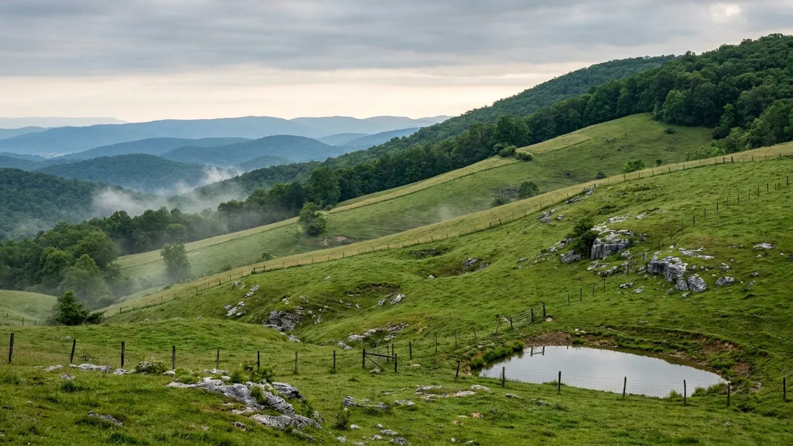
Washington County, Virginia is the state's south-western land market: 169,761 acres in farms, 46.2% of the county, and a median farm of 40 acres, with 766 of its 1,358 farm operations smaller than 50 acres. It is also limestone country. The county's own Comprehensive Plan says limestone is the dominant rock under the valley and names Washington County as a Virginia county containing karst topography, and the county maps its own sinkholes. Two things decide how a build here starts: which district the parcel sits in, and which of four building departments issues the permit.
Washington County at a glance
- County
- Washington County
- Population
- 53,357
- ZIP codes
- 24210, 24211, 24236, 24270, 24327, 24340, 24361, 24202
Building conditions in Washington County
The building code itself is the same in every Virginia locality, and no county, city or town may amend it. What changes from one to the next is who issues the permit and inspects the work, what that office charges, how the parcel is zoned, and the Table R301.2 design criteria the locality publishes — the 2021 Virginia Residential Code prints that table blank, with the instruction that additional criteria shall be established by the local jurisdiction. Those local numbers are what your drawings have to satisfy.
Washington County Department of Building & Development Services, washcova.com/building-development/, and Code of the County of Washington, Virginia section 14-2 (Ord. No. 2016-002, 11 May 2016); Town of Abingdon Community Development Schedule of Fees
Washington County Zoning Department, washcova.com/zoning/, and Washington County Residential Permit Application (Required Submittal Documents for New Construction)
Belo, Natural Hazard Mitigation Planning For Karst Terrains in Virginia, Virginia Tech, May 2003, Table 3.1 (Virginia Speleological Survey 2003); Washington County Comprehensive Plan Chapter 4, Natural and Cultural Resources; Virginia Energy, Sinkholes and Karst
Code of the County of Washington, Virginia section 30-205 and Chapter 66 (Municode, codified through Ord. No. 2025-02, 8 April 2025); DCR Natural Heritage Karst Program, Karst Landscapes and Virginia Karst Geology Map; Virginia Cave Board, Karst Assessment Standard Practice
Code of the County of Washington, Virginia, Chapter 66, sections 66-1, 66-297, 66-299 to 66-303 (Municode, codified through Ord. No. 2025-02, 8 April 2025)
Code of the County of Washington, Virginia, Appendix A fee schedule (Ord. No. 2016-002, 11 May 2016) and the county's published Fee Schedule Effective June 1, 2016; Town of Abingdon Community Development Schedule of Fees
Also worth knowing before you build in Washington County
- The land that is actually here
- 169,761 acres in farms - 46.2 percent of the county, seventh most farm acreage of any Virginia locality. The median farm is 40 acres and 766 of the county's 1,358 farm operations are smaller than 50 acres, a majority. Density is 96 people per square mile across 561 square miles, and the population has been flat rather than falling: 53,357 on 1 July 2025.
- Elevation sets the wind speed, and this county spans the line
- Virginia amends the residential code at 13VAC5-63-210 so that wind speeds for localities near mountainous terrain are set by elevation: 140 mph ultimate at or above 4,000 feet and 110 mph below it. The county's Comprehensive Plan gives its range as 1,330 feet near Mendota to 5,524 feet at the summit of Whitetop Mountain, the second highest peak in Virginia. Ninety-five percent of the county is Valley and Ridge; the Whitetop corner is Blue Ridge. Very few Virginia counties contain ground on both sides of that 4,000-foot line, and this is one of them.
- The county publishes no Table R301.2
- The 2021 Virginia Residential Code prints Table R301.2 blank, with em-dashes in every cell and the instruction that additional criteria shall be established by the local jurisdiction. Washington County has not published one - not on its building department pages, not in its Code, and not on its permit application. So the ground snow load, frost depth and seismic design category for a parcel here come from the county Building Official, and no figure should be taken off a national map or borrowed from a neighbouring county. Ask by name: Building Official Jason McCall, (276) 525-1340.
- Eighteen months in the camper, and then it goes
- Section 66-205 lets one camper trailer, recreational vehicle or manufactured home sit on the same lot as the permanent dwelling being built, in districts where manufactured homes are permitted without a special exception. It must be removed within 30 days of the certificate of occupancy and no later than 18 months after the building permit was issued - 90 days after the certificate where the permanent dwelling is a manufactured or modular home. The county publishes a dedicated RV application form for it.
- Most of the flood-prone ground has no published flood elevation
- The county participates in the National Flood Insurance Program and its Flood Hazard district rules sit in Chapter 66, Article V, Division 15, with the FEMA maps folded into the official zoning map. The county's own zoning page states that most flood-prone areas of Washington County are designated as Zone A - an approximate zone, which means no base flood elevation has been published for it. On those parcels the designer has to establish the elevation rather than read one off a map, which is why the county links FEMA's guide to managing floodplain development in approximate Zone A areas. Manufactured homes are prohibited in the FH district outright.
- A well setback most rural parcels here trigger
- Virginia's private well regulation sets a 50-foot separation between a well and a property line adjoining a property of three acres or more used for an agricultural operation, instead of the ordinary five feet. In a county 46.2 percent of whose land is in farms, most rural parcels adjoin one. Relief needs either a notarised letter from that neighbour, recorded and indexed in the circuit court land records, or a professional's certification that no complying location exists. On sloping ground a second rule compounds it: within a 60-degree arc directly downslope of a septic system the minimum separation increases by 25 feet for every 5 percent of slope, which is usually why the well ends up uphill of the house.
- Septic is sized on bedrooms, and the shop counts for nothing
- Virginia sizes a drainfield at 75 gallons per day per person and two persons per bedroom - 150 gallons per bedroom - with no living-area band and no row anywhere in the table for a shop, a garage or a barn. A four-bedroom barndominium is 600 gallons a day whether the shop is 1,200 square feet or 4,000. What does move the number is soil: 12VAC5-610-490 assigns a design percolation rate by soil texture, and clay sits in Texture Group IV at 91 minutes per inch or more, past the 45-minute threshold that makes a 50 percent reserve area mandatory. The Chesapeake Bay Preservation Act's stricter 100 percent reserve does not apply here - that Act reaches a statutory list of localities and Washington County is not on it.
- Two working days, and then a third party can inspect
- In a rural county with one building official, scheduling is the risk. The building code answers it: where the building official is unable to make a required inspection within two working days of a request or an agreed date, the official shall accept third-party reports for review, and must reject one in writing within two working days if there is cause. Every building official in Virginia is also required to have a written policy setting the minimum acceptable qualifications for third-party inspectors. That policy is a document worth asking the county for by name at the start of a project.
- Mount Rogers land is zoned against living on it
- The Highland Recreation district covers the Mount Rogers National Recreation Area inside the county, with boundaries the ordinance makes concurrent with the NRA's. Its statement of intent says it is not intended that these lands should develop intensively for residence, either yearround or second homes. Minimum lot is two acres, or one with public water, with a 50-foot street setback, 150 feet of frontage and 25-foot side yards. Land in the Konnarock and Whitetop corner is worth checking against that before an offer.
- The small rules that only show up on the form
- A zoning permit has to be in hand before construction starts, and the certificate of occupancy is applied for at the same time. A permit will not issue on a parcel the zoning office considers nonconforming until the division or boundary adjustment is approved. A land-disturbing permit and an erosion and sediment control plan are required past 10,000 square feet of grading, with an agreement in lieu accepted for residential. Where main water pressure exceeds 80 psi the county requires a pressure-reducing valve, enforced by the county building inspector. And after the footing inspection passes, the county collects GPS data and assigns the 911 address through the Department of Emergency Services.
2022 Census of Agriculture, county-level acres operated and area-operated series; 2024 Census Gazetteer counties file; Weldon Cooper Center for Public Service, Virginia population estimates for 1 July 2025 (published 24 February 2026)
13VAC5-63-210 (Virginia Uniform Statewide Building Code amendment to IRC R301.2.1) and 13VAC5-63-270 E; Washington County Comprehensive Plan Chapter 4, Natural and Cultural Resources
2021 Virginia Residential Code Table R301.2; Washington County Department of Building & Development Services, washcova.com/building-development/
Code of the County of Washington, Virginia, section 66-205 (Municode); Washington County RV Application, washcova.com/building-development/
Washington County Zoning Department floodplain management page, washcova.com/zoning/; Code of the County of Washington, Virginia sections 66-546 to 66-563
12VAC5-630-380, Well location, Table 1 and subsection C, as amended effective 6 November 2024
12VAC5-610-670 Table 5.1 and footnote 1; 12VAC5-610-490 C; 12VAC5-610-710; Va. Code section 62.1-44.15:68
13VAC5-63-130, Virginia Uniform Statewide Building Code Sections 113.7 and 113.7.1
Code of the County of Washington, Virginia, Chapter 66, Article V, Division 2, sections 66-221 to 66-227 (Municode)
Code of the County of Washington, Virginia sections 66-96, 66-97 and 14-6; Washington County Department of Building & Development Services and Zoning Department pages, washcova.com

The expensive surprises are in the ground, not the building
What moves a Virginia budget is usually below grade, and it is soil rather than rock. Five localities already treat a soil answer as a condition of the permit rather than a recommendation — Fauquier, Chesterfield, Isle of Wight, Madison and Culpeper each require a soil report, an engineered foundation design, or both before the footings are approved. Chesterfield asks for one on every new house with no opt-out, on its own published reasoning that small amounts of shrink-swell soil may turn up anywhere in the county. Virginia Energy puts the same point bluntly: standard homeowner's insurance does not cover damage from expansive or compressive soils. Along the Interstate 81 corridor the question changes shape entirely — Virginia Energy counts twenty-seven Virginia counties in the karst zone that follows that road, where what matters is what is under the slab rather than what the slab sits in, and karst does not stay west of the Blue Ridge: Loudoun County publishes karst terrain of its own, on the other side of it. The same ground then sizes the septic system, because 12VAC5-610 works from bedrooms and soil texture — 150 gallons a day per bedroom, with no row in the table for a shop, a garage or a barn at all, and clay assigned to the slowest texture group at 91 minutes per inch or worse, past the 45 minutes per inch that makes a reserve drainfield mandatory. The soil that needs a foundation engineer multiplies the drainfield. So the site work, the foundation and the drainfield get resolved together rather than one at a time. We price the dirt before we price the building.
What we build in Washington County
All nine services are available in Washington County. What a build costs depends far more on the parcel than on square footage, so we price against your land rather than publishing a rate card.
Custom Plans
Barndominium floor plans drawn to your parcel and to the design criteria your own Virginia locality publishes, not to a generic national spec.
Barndominium Kits
Engineered barndominium shell packages delivered to your Virginia land, drawn to the criteria your own building department fills in.
Turnkey Builds
Start to finish barndominium construction: permits, site work, shell and full interior finish, under one contract and one schedule.
What a build looks like
Three stages every Washington County project passes through, from a raw parcel to a finished home. Site work first, because that is where the budget is decided.

The parcel
Zoning, setbacks, flood zone and utility access get checked before anything is drawn.
Pad and permit
Clearing, grading and a compacted pad, while the submittal works through whichever office issues the permit where you are building.

Frame to finish
Shell erected and dried in, then systems, insulation and interior finish through to CO.
Those are the rules where you are building in Washington County. Tell us what you want to build and we will draw it to them.
Where we build around Washington County
Washington County and the rural land around it. The buildable acreage for a project this size usually sits outside the city limits, which is frequently what changes who issues your permit.
Keep reading
The questions that usually come next once you know what Washington County allows.
Barndominium Cost Guide
Sourced per-square-foot ranges by tier and by size, with a calculator built on the same figures.
Read itIs It Legal in Virginia?
Classification, zoning, the HOA gate, and why "nonresidential farm building" does not cover a home.
Read itHow Long Does It Take?
Census build-duration data, and what actually sets the permit clock where you are building.
Read itNearby areas we build in
Others we cover nearby. One may be a county, another an independent city that belongs to no county at all, and another a town inside a county — so the office that issues the permit, the fees it charges, the zoning and the design criteria each locality publishes can all differ from one card to the next.
Building in Washington County: common questions
6 questions we get asked most often about building in Washington County. If yours is not on the list, ask it directly.
Who issues the building permit for a barndominium in Washington County, Virginia?
How much of Washington County is karst, and does anyone make me check?
What wind speed and snow load do I design to here?
Can my shop with living quarters be an accessory building?
How big does the lot have to be, and what does the permit cost?
Can I live in an RV on the land while the barndominium goes up?
Building in Washington County?
Start with the plan. Tell us what you want to build and we will draw it, then confirm which office issues the permit for your parcel, what it will let you put there, and what wind load it has to meet. That conversation costs nothing.