Barndominium Builders in Clarke & Warren Counties, VA
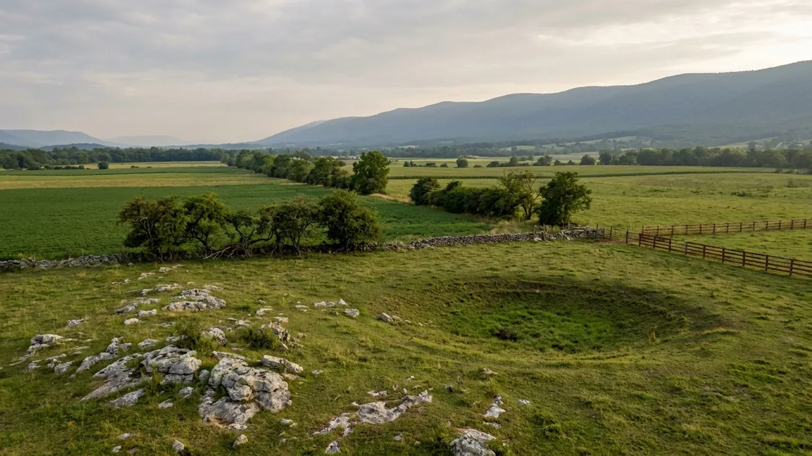
Clarke and Warren adjoin across the Shenandoah River, sit in the same planning district and the same health district, and are both recorded at thirty percent karst on the same 2003 table. Almost nothing in their rulebooks matches. Clarke County has run a mandatory shrink/swell soil-testing ordinance since 1999: if the site falls within 500 feet of soils its own map calls moderate or high, the building permit does not issue until a soils professional has bored the ground or the owner builds to a prescribed four-foot foundation instead. Warren County has no soils ordinance at all, publishes a complete set of design figures Clarke does not publish, and caps accessory buildings in its residential districts at 1,200 square feet across two structures. Clarke's zoning ordinance names sinkholes in its building setback table at 100 feet; Warren's names them only in its well and septic setbacks. Measured, the two counties are not even the same soil problem: Clarke's expansive clay is limestone residuum and Warren's is greenstone. Two building departments, two zoning ordinances, two fee schedules, one page that keeps them apart.
Clarke & Warren Counties at a glance
- County
- Clarke County
- Cities & counties covered
- Clarke County 15,609 · Warren County 42,740
Building conditions in Clarke & Warren Counties
The building code itself is the same in every Virginia locality, and no county, city or town may amend it. What changes from one to the next is who issues the permit and inspects the work, what that office charges, how the parcel is zoned, and the Table R301.2 design criteria the locality publishes — the 2021 Virginia Residential Code prints that table blank, with the instruction that additional criteria shall be established by the local jurisdiction. Those local numbers are what your drawings have to satisfy.
Code of Clarke County, Chapter 71 Building Construction, section 71-6 Shrink/Swell Soil Testing
Clarke County Building Department, Standard Policy for Dwellings with Moderate/High Shrink Swell Soils; Code of Clarke County section 71-6 A(2)
USDA NRCS Soil Data Access, chorizon.lep_r joined to component and mapunit for survey areas VA043 and VA187, queried 2 September 2026
USDA NRCS Soil Data Access, copm.pmorigin and copm.pmkind for components with a horizon at lep_r of 6 or more, survey areas VA043 and VA187, queried 2 September 2026
Clarke County Zoning and Subdivision Ordinances (Code of Clarke County Chapter 200), 2026 edition, Tables 4.1.1[2] and 4.1.2[3] and section 4.1.3 C
Warren County Code sections 180-31 and 180-21, eCode360
Also worth knowing before you build in Clarke & Warren Counties
- Neither county lets you live in the shop
- The two ordinances reach the same answer in almost the same words. Warren County Code section 180-10 A: use of accessory buildings as dwellings or lodgings is expressly prohibited except as specifically provided for in the chapter. Clarke County's zoning ordinance, in the use regulations for Accessory Structure: use of accessory structures as dwellings or lodgings is expressly prohibited. Warren adds section 180-11 B, that in all residential and agricultural districts only one principal structure housing a use permitted by right may be erected on a single lot. So a shop with living quarters is lawful in both counties as one principal building containing a dwelling, and unlawful in both as a second detached building someone sleeps in.
- Clarke allocates dwelling rights by 1980 tract size, not by acres today
- Section 3 of the Clarke County Zoning Ordinance is sliding-scale zoning. Single-family detached dwelling unit rights are allocated to each tract by the size it was on the Clarke County Real Property Identification Map as of 17 October 1980: one right for 0 to 14.99 acres, two for 15 to 39.99, three for 40 to 79.99, four for 80 to 129.99, five for 130 to 179.99, and on up a decelerating scale to fifteen at 1,030 acres or more. A hundred-acre parcel carries four houses, not fifty. Rights can be voluntarily and permanently terminated by recorded instrument, and a boundary line adjustment may move no more than one right. The AOC district's two-acre minimum lot size is a floor on lot geometry; the allocation table is what decides whether a house may be built at all.
- Clarke's AOC district has a maximum lot size, not just a minimum
- Table 4.1.1[1] of the Clarke County Zoning Ordinance sets, for new lots created through subdivision in the Agricultural-Open Space-Conservation district, a minimum area of 2 acres and a maximum area of 4 acres, with a maximum average area across the new lots of 3 acres. Existing lots carry the 2-acre minimum and no maximum. An AOC lot of 4 acres or less may not even be enlarged past 4 acres by boundary line adjustment without a variance from the Board of Zoning Appeals, and the only two hardships that qualify are correcting a minor encroachment or repairing a failing onsite sewage disposal system. The design intent is visible in the number: Clarke wants small building lots and unbroken farm blocks, and it uses a ceiling to get them.
- Warren publishes its Table R301.2 figures; Clarke publishes none
- Warren County's Detached Single Family Dwelling guideline, revised 1 February 2024, requires a list of design load criteria on the plans and supplies the county's own numbers in the same sentence: ground snow load 35 psf, wind speed 115 mph, and a default lateral soil pressure of 60 pcf. It also fixes a minimum footing depth of 24 inches. The same 35 psf and 115 mph appear again in the county's Residential Garages, Sheds, and Playhouses guideline. Clarke County publishes no equivalent table: its building chapter, its permit handouts, its general information sheets and its user fee schedule carry no wind speed, snow load, frost depth or seismic category. Both counties sit in climate zone 4A under the residential code's own county table.
- Zero acres in either county rate Not limited for a drainfield
- The NRCS septic tank absorption field interpretation, queried on 2 September 2026, rates 79,759 of Clarke County's 114,200 acres and 103,946 of Warren County's 140,100 as Very limited, with a further 8,199 and 13,014 acres Somewhat limited. Neither county has a single acre rated Not limited. What drives the rating differs and it matters: Clarke's leading limitation is percolation between 60 and 180 centimetres across 51,951 acres, which is the clay, followed by slope on 41,438 acres. Warren's leading limitation is slope on 96,296 acres, better than two thirds of the county, with percolation second at 69,806. Shallow bedrock is third in both, on 38,022 acres in Clarke and 60,994 in Warren.
- Half of Warren is steeper than 15 percent
- Measured against the NRCS component slope figures, land with a representative slope over 15 percent covers 70,246 of Warren County's 140,100 acres, just over half, and land over 25 percent covers 43,754 acres, close to a third. Clarke's equivalents are 21,642 acres and 7,905 acres, 19 percent and 6.9 percent of the county. Shallow bedrock tracks it: components with a lithic or paralithic restriction reach 60,994 acres in Warren against 42,918 in Clarke. Clarke's own ordinance reads the same geography from the other side, requiring that no lot be created in the Forestal-Open Space-Conservation district east of the Shenandoah River unless it contains at least one acre of ground with slopes under 25 percent.
- Warren's karst rules are about water, and only water
- Warren County Code section 179-1 opens by declaring the county to have fragile hydrogeology. Its setback table at section 179-8 D then requires 100 feet from the discernible edge of a sinkhole to a well and 100 feet from the discernible edge of a sinkhole to a drain field or absorption area, alongside 100 feet well to drain field and 100 feet upslope or 200 feet downslope from a spring. Section 179-8 C limits new wells to Class IIIB with 50 feet of casing and 50 feet of grout, and section 179-9 B requires a 100 percent reserve drain field on every newly constructed structure served by an onsite system, as a matter of county ordinance rather than state rule. Outside that chapter the word karst appears once in the whole Warren County Code, in the Conservation Easement Program's ranking criteria at section 81-7, where a parcel showing sinkholes or karst topography scores one point.
- Clarke does have a karst plan, and it is triggered by a plan
- Clarke County's zoning ordinance carries a full geotechnical karst regime at section 7.2.7 D. A qualified geotechnical engineer inspects the site, may be directed to fracture trace analysis, electrical resistivity, cone sounding, core samples or microgravity, and where karst features are found those tests are required within a 100-foot radius, measured for a sinkhole from the discernable edge. A karst plan then goes to the Zoning Administrator mapping every feature with 25-foot and 100-foot setbacks drawn, no construction inside 25 feet, and engineering to establish structural stability between 25 and 100 feet. Mitigation follows the Virginia Department of Transportation's Location and Design Division memorandum IIM-LD-228 by name, and where features are found a consumer disclosure statement about possible future collapse goes into the deed of dedication. The district regulations for the Berryville annexation districts apply the same IIM-LD-228 standard and split it on whether the lot was platted before or after 17 February 2004. But section 6.2.2 A of the same ordinance exempts single-family dwellings, their accessory structures and agricultural buildings from site development plan review, and section 7.2.7 is a site development plan design standard. So the karst plan governs subdivisions and commercial sites here, and what reaches a one-off house is the 100-foot sinkhole setback in the district tables.
- Two published fee schedules, two completely different formulas
- Clarke County computes a building permit as square footage times a published construction cost per square foot, divided by 1,000, times a multiplier of $4.50, on the county's user fee schedule approved 21 April 2026 and effective 1 July 2026. The published costs are $140.81 per square foot for residential finished living space, $52.58 for a residential garage, $37.50 for residential storage sheds and accessory buildings and $18.75 for an unfinished basement, with a $50 minimum on any residential permit. Warren County charges a flat $0.30 per square foot for new construction, additions, alterations and renovations alike, with a $100 minimum residential fee, on a schedule effective 1 July 2023, and the same $0.30 applies to an attached or detached garage and to a storage building larger than 256 square feet. Both add the 2 percent Virginia Building Code Academy levy. On zoning, Clarke charges $300 for a single-family dwelling permit and $200 for an accessory structure requiring a building permit; Warren charges $100 and $50.
- Clarke stops the job once the footers are set
- The Clarke County Building Department's Residential: New Dwelling in County checklist adds two steps a builder in most Virginia counties will not have seen. The well must be drilled before the building permit application is submitted at all, not merely permitted. And once the footers have been set the applicant contacts Planning and Zoning for an as-built survey, which the checklist says must be completed before any other work can take place. Warren County's analogue arrives at the same moment from a different direction: a foundation location survey is required for single-family dwellings on lots of two acres or less and on every lot inside the Town of Front Royal.
- Berryville and Front Royal zone their own land and neither inspects it
- Both towns run planning and zoning offices and neither runs a building department. The Clarke County Building Department's own page says it reviews and approves permits throughout Clarke County including the incorporated towns of Berryville and Boyce, and Berryville's new-construction handout confirms that after the town zoning permit, the lot grading plan and, in the historic district, Architectural Review Board approval, the applicant must obtain a Clarke County building permit before construction. Warren County's building inspections page says it covers the entirety of Warren County including the Town of Front Royal, and the town's own page tells an applicant to get zoning approval from the town's Planning and Zoning Department and a building permit from the Warren County Building Inspector's Office. Front Royal does seat its own five-member Local Board of Building Code Appeals, and Warren County maintains a Board of Building Code Appeals of its own.
- Radon zone 1 in both, adopted in neither
- EPA's own county table puts both Clarke and Warren in radon Zone 1, the band predicted to average above 4 picocuries per litre indoors, on a map EPA states was developed in 1993. Virginia Residential Code section R331.1 makes radon-resistant construction apply only where a locality is in Zone 1 and has taken official action under Article 7 of Chapter 22 of Title 15.2, which is the zoning article. A text search of the complete Code of Clarke County and of its zoning and subdivision ordinances returns the word radon zero times, and the same search across the Warren County Code returns zero hits. So the measures are worth building in both counties and required in neither, which makes it the owner's decision rather than the inspector's.
- Clarke protects one spring with rules no neighbouring county has
- The Spring Conservation Overlay District in Clarke County's zoning ordinance covers the groundwater recharge area of Prospect Hill Spring, the source of the Sanitary Authority's Boyce-Millwood-White Post water system. Inside it, no onsite sewage disposal system or drain field may be located within 1,000 feet of the spring; within 1,500 feet the system must be an alternative treatment level 3 with a drain field oversized to 1.5 times normal; between 1,500 and 3,000 feet, treatment level 2 with the same 1.5 times oversizing. Everywhere in the district a 100 percent reserve area is required, alternative systems must be inspected annually and conventional ones at least every five years, and the reports go to the county's online records system. A new dwelling on an individual septic system in the AOC part of the district must sit on a lot of at least 2 and at most 4 acres, with impervious coverage capped at 20 percent.
- Clarke buffers every perennial stream by 100 feet, and more on a slope
- The Stream Protection Overlay District in Clarke County's zoning ordinance requires all lots to retain a vegetated buffer a minimum of 100 feet from each side of a perennial stream or adjacent non-tidal wetland, dropping to 35 feet only for lots too small to qualify for land use taxation that were platted or site-planned after 1 January 2000. Those widths then increase with the slope of the bank: a 35-foot buffer becomes 45 feet at 15 to 25 percent and 55 feet above 25 percent, and a 100-foot buffer becomes 125 feet and 150 feet on the same steps. Neither Clarke nor Warren is on the Chesapeake Bay Preservation Act's statutory list at Virginia Code section 62.1-44.15:68, so this buffer is Clarke's own instrument and not a Bay Act one. Warren County has no equivalent riparian overlay.
- An accessory dwelling is by right in Warren only if it is inside the house
- Warren County Code section 180-21 C lists an accessory dwelling unit as an accessory use permitted by right in the Agricultural district provided it is accessory to an existing single-family dwelling and attached to or located within the existing principal structure. Detached, the same unit moves to section 180-21 D and needs a conditional use permit from the Board of Supervisors. Section 180-30.2 then sets the terms: a minimum lot area of 3.5 acres for a detached unit, one unit per lot, a floor area between 450 and 1,500 square feet, rising to 3,000 square feet only where the unit is principally below grade or is a conversion of space inside an existing principal structure, two additional off-street parking spaces, and Health Department operation permits for both water and sewage as a condition of the certificate of occupancy. Using it as a short-term tourist rental is prohibited. Clarke County's parallel is the minor dwelling: AOC or FOC land, six acres or more, under 600 square feet of separate living space, not more than two occupants, within 300 feet of the main house, and it consumes no dwelling unit right.
- Clarke has more farmland than Warren in a smaller county
- The 2022 Census of Agriculture puts 50,182 acres of Clarke County in farms, 44.6 percent of its 176 square miles, across 421 operations with a median farm size of 40 acres and 234 operations under 50 acres. Warren County, larger at 215 square miles, has 37,759 acres in farms, 27.5 percent of its land, across 316 operations with a median of 27 acres and 193 under 50 acres. Clarke grew 5.3 percent between 2020 and 2025 and Warren 4.8 percent, and both sit inside the Washington-Arlington-Alexandria statistical area, in the Northern Shenandoah Valley Regional Commission, and in the Lord Fairfax Health District, which is where the septic permit is issued for both.
- Thirty percent karst in both, on the same 2003 table
- The Virginia Speleological Survey's 2003 figures, tabulated in Bradley Paul Belo's Virginia Tech thesis on natural hazard mitigation planning for karst terrains, put both Clarke and Warren at 30 percent of the county in karst, in the same band as Alleghany, Craig, Frederick, Page, Smyth and Wythe. That number is a 2003 estimate for a county, not a statement about any parcel. What differs is what each county then did about it: Clarke wrote sinkhole setbacks into its building requirements tables and a karst plan into its site development standards, and Warren wrote sinkhole setbacks into its well and septic ordinance and nothing else.
Warren County Code sections 180-10 A and 180-11 B, eCode360; Clarke County Zoning Ordinance section 5.2, Accessory Structure use regulations
Clarke County Zoning Ordinance section 3.2, Table 3.2[1] Dwelling Unit Right (DUR) Allocation, 2026 edition
Clarke County Zoning Ordinance Table 4.1.1[1] and section 4.1.1 A(4), 2026 edition
Warren County Department of Building Inspections, Detached Single Family Dwelling and Residential Garages, Sheds, and Playhouses guidelines, both revised 1 February 2024
USDA NRCS Soil Data Access, cointerp ENG - Septic Tank Absorption Fields at ruledepth 0 and 1, survey areas VA043 and VA187, queried 2 September 2026
USDA NRCS Soil Data Access, component.slope_r and corestrictions for survey areas VA043 and VA187, queried 2 September 2026; Clarke County Zoning Ordinance section 4.1.2 A(2)
Warren County Code sections 179-1, 179-8, 179-9 and 81-7, eCode360
Clarke County Zoning and Subdivision Ordinances (Code of Clarke County Chapter 200), 2026 edition, sections 7.2.7 D, 6.2.2 A and 4.3.1 C
Clarke County User Fee Schedule approved 21 April 2026; Warren County Building Permit Fees, Residential, effective 1 July 2023; Warren County Planning and Zoning Department Fee Schedule revised 8 August 2025
Clarke County Building Department, Residential: New Dwelling in County; Warren County Detached Single Family Dwelling guideline revised 1 February 2024
Clarke County Building Department page; Berryville Department of Planning and Zoning, New Construction handout; Warren County Building Inspections / Permits page; Town of Front Royal, Zoning Approval and Building Permits
EPA Map of Radon Zones county table; Virginia Residential Code R331.1; full-text search of the Code of Clarke County, Clarke County Chapter 200, and the Warren County Code on eCode360
Clarke County Zoning Ordinance section 4.2.2, Spring Conservation (SC) Overlay District, 2026 edition
Clarke County Zoning Ordinance section 4.2.3 and Table 4.2.3[1], 2026 edition; Va. Code section 62.1-44.15:68
Warren County Code sections 180-21 and 180-30.2, eCode360; Clarke County Zoning Ordinance section 5.2, Minor Dwelling use regulations
USDA 2022 Census of Agriculture; U.S. Census Bureau county population estimates; Virginia Department of Health, Lord Fairfax Health District
Belo, Bradley Paul, Natural Hazard Mitigation Planning For Karst Terrains in Virginia, Virginia Tech, May 2003, Table 3.1, attributed to the Virginia Speleological Survey (2003)

The expensive surprises are in the ground, not the building
What moves a Virginia budget is usually below grade, and it is soil rather than rock. Five localities already treat a soil answer as a condition of the permit rather than a recommendation — Fauquier, Chesterfield, Isle of Wight, Madison and Culpeper each require a soil report, an engineered foundation design, or both before the footings are approved. Chesterfield asks for one on every new house with no opt-out, on its own published reasoning that small amounts of shrink-swell soil may turn up anywhere in the county. Virginia Energy puts the same point bluntly: standard homeowner's insurance does not cover damage from expansive or compressive soils. Along the Interstate 81 corridor the question changes shape entirely — Virginia Energy counts twenty-seven Virginia counties in the karst zone that follows that road, where what matters is what is under the slab rather than what the slab sits in, and karst does not stay west of the Blue Ridge: Loudoun County publishes karst terrain of its own, on the other side of it. The same ground then sizes the septic system, because 12VAC5-610 works from bedrooms and soil texture — 150 gallons a day per bedroom, with no row in the table for a shop, a garage or a barn at all, and clay assigned to the slowest texture group at 91 minutes per inch or worse, past the 45 minutes per inch that makes a reserve drainfield mandatory. The soil that needs a foundation engineer multiplies the drainfield. So the site work, the foundation and the drainfield get resolved together rather than one at a time. We price the dirt before we price the building.
What we build in Clarke & Warren Counties
All nine services are available in Clarke & Warren Counties. What a build costs depends far more on the parcel than on square footage, so we price against your land rather than publishing a rate card.
Custom Plans
Barndominium floor plans drawn to your parcel and to the design criteria your own Virginia locality publishes, not to a generic national spec.
Barndominium Kits
Engineered barndominium shell packages delivered to your Virginia land, drawn to the criteria your own building department fills in.
Turnkey Builds
Start to finish barndominium construction: permits, site work, shell and full interior finish, under one contract and one schedule.
What a build looks like
Three stages every Clarke & Warren Counties project passes through, from a raw parcel to a finished home. Site work first, because that is where the budget is decided.

The parcel
Zoning, setbacks, flood zone and utility access get checked before anything is drawn.
Pad and permit
Clearing, grading and a compacted pad, while the submittal works through whichever office issues the permit where you are building.

Frame to finish
Shell erected and dried in, then systems, insulation and interior finish through to CO.
Those are the rules where you are building in Clarke & Warren Counties. Tell us what you want to build and we will draw it to them.
Where we build around Clarke & Warren Counties
Clarke County and the rural land around it. The buildable acreage for a project this size usually sits outside the city limits, which is frequently what changes who issues your permit.
Keep reading
The questions that usually come next once you know what Clarke & Warren Counties allows.
Barndominium Cost Guide
Sourced per-square-foot ranges by tier and by size, with a calculator built on the same figures.
Read itIs It Legal in Virginia?
Classification, zoning, the HOA gate, and why "nonresidential farm building" does not cover a home.
Read itHow Long Does It Take?
Census build-duration data, and what actually sets the permit clock where you are building.
Read itNearby areas we build in
Others we cover nearby. One may be a county, another an independent city that belongs to no county at all, and another a town inside a county — so the office that issues the permit, the fees it charges, the zoning and the design criteria each locality publishes can all differ from one card to the next.
Building in Clarke & Warren Counties: common questions
7 questions we get asked most often about building in Clarke & Warren Counties. If yours is not on the list, ask it directly.
Do I need a soil test before I can get a building permit in Clarke County?
Can I build a shop with an apartment in it in Clarke or Warren County?
How big can a detached shop be in Warren County?
What design figures do I put on the drawings in Clarke and Warren?
Do the towns of Berryville and Front Royal issue their own building permits?
Is a sinkhole on the property a problem in either county?
How long does a permit take and what will it cost?
Building in Clarke & Warren Counties?
Start with the plan. Tell us what you want to build and we will draw it, then confirm which office issues the permit for your parcel, what it will let you put there, and what wind load it has to meet. That conversation costs nothing.