Barndominium Builders in Shenandoah County, VA
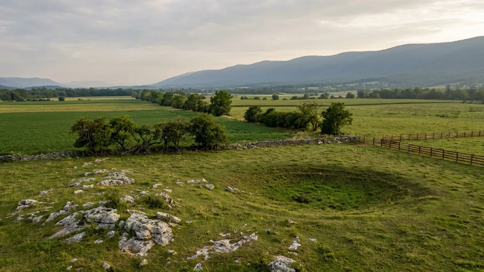
Shenandoah County is the one Valley county with no independent city inside it. Harrisonburg is carved out of Rockingham, Staunton and Waynesboro out of Augusta, and Winchester sits beside Frederick — but Shenandoah has none, so the county is the answer everywhere within it, including inside Woodstock, Strasburg, Edinburg, Mount Jackson, New Market and Toms Brook, which run zoning and send you to the county for the building permit. The land is there: 120,653 acres in farms, 37.1% of the county, 859 operations with a median size of 46 acres, split down the middle by I-81. What the county asks in return is the Valley's own list. Forty pounds of ground snow and a 24-inch frost line on the county's published design page. Fifty percent of the county underlain by soluble limestone, on the 2003 Virginia Speleological Survey figure — the highest band in the state. A zoning ordinance that keeps every drainfield 50 feet clear of a sinkhole and bans discharging septic systems outright on new construction. And, measured rather than assumed, bedrock inside two feet of the surface across roughly 39,000 acres, which is exactly where the footing wants to be.
Shenandoah County at a glance
- County
- Shenandoah County
- Population
- 45,839
- ZIP codes
- 22644, 22652, 22657, 22660, 22664, 22810, 22824, 22842, 22844, 22847
- Site visits
- Site visits the length of the I-81 corridor from Strasburg to New Market, usually within the week
Building conditions in Shenandoah County
The building code itself is the same in every Virginia locality, and no county, city or town may amend it. What changes from one to the next is who issues the permit and inspects the work, what that office charges, how the parcel is zoned, and the Table R301.2 design criteria the locality publishes — the 2021 Virginia Residential Code prints that table blank, with the instruction that additional criteria shall be established by the local jurisdiction. Those local numbers are what your drawings have to satisfy.
US Census Bureau, sub-est2025_51.csv, Vintage 2025 subcounty population estimates; Shenandoah County Code Section 71-6, Code Enforcement in incorporated towns, via eCode360 SH1548
2022 Census of Agriculture (USDA NASS), county series: acres operated, area operated as a percent of total land, acres per operation and median, and the 1.0-9.9 and 10.0-49.9 acre area-operated categories; US Census Bureau Vintage 2025 population estimates; 2025 Census Gazetteer land area
Shenandoah County, Design Information, shenandoahcountyva.gov/218/Design-Information; Shenandoah County Building Inspection, New Residential Application Packet, Construction Documents Required for Plan Review
Belo, Bradley Paul, Natural Hazard Mitigation Planning For Karst Terrains in Virginia, Virginia Tech, May 2003, Table 3.1, attributed to the Virginia Speleological Survey (2003); Virginia Energy, Division of Geology and Mineral Resources, Sinkholes and Karst
Shenandoah County Code Chapter 165, Zoning, Section 165-85.2 On-site sewage disposal systems, and Section 165-4 Definitions, via eCode360 SH1548
Shenandoah County Code Chapter 165, Zoning, Section 165-85.2, amended 4-14-2020 by Ord. No. 2020-10 and 2-25-2025, via eCode360 SH1548; Shenandoah County Community Development fee schedule, updated 7/1/23
Also worth knowing before you build in Shenandoah County
- An accessory building may never be taller than the house, in any district
- Section 165-12G(2) of the county zoning ordinance says that all accessory buildings shall be less than the main building in height, and the identical sentence appears in the height regulations of every other district in the ordinance: Conservation, both Rural Residential districts, and R-1 through R-4. Neighbouring Rockingham County does the opposite, expressly permitting an accessory structure to exceed the principal one in its agricultural and rural village districts. Shenandoah permits that nowhere. For a shop and house on one parcel it decides the design: either the living space goes under the same roof so there is only one main building, or the shop's ridge has to come in under the house's. The 35-foot overall cap does not reach farm silos, barns and other farm-related structures, but that carve-out is written against the 35-foot rule alone, not against the accessory-height rule.
- The minimum lot is 1.5 acres and the binding number is 10
- A-1 Agriculture states a minimum lot area of 1.5 acres, which is not the number that binds. Section 165-12C(1)(b), amended 13 June 2023 by Ord. No. 2023-02, requires the average parcel size across the primary parcel and any sub parcels created from it to be no less than 10 acres, found by adding the primary parcel and the sub parcels and dividing by the number of parcels. Conservation, C-1, uses the same 1.5-acre minimum against a 15-acre average, reducible to 10 under the Article X open-space cluster provisions. Rural Residential - Agriculture is a flat 3.5 acres and Rural Residential - Conservation is 10. Grandfathering routes exist: a parcel of 10 to 20 acres existing on 14 December 2010 may split into two and one of 20 to 30 acres into three, none below 1.5 acres. Then Section 165-25 overrides all of it in a sentence, requiring the Health Official's higher standard for lot area or width to apply wherever there is no public water or sewer.
- The farm-building exemption here is notarised, district-limited and revocable
- Shenandoah County publishes a Farm Building Application Packet built on Va. Code Section 36-99. It restates the statutory definition, whose first clause is a building not used for residential purposes, which a barndominium fails at the door. Two county conditions narrow it further: the property must be zoned A-1 Agricultural or C-1 Conservation and be approved by the Zoning Department first, and a farm building inside the flood zone needs a building permit regardless. The affidavit is sworn before a notary and carries a conversion clause in terms, stating that should the farm building or structure be converted to any other use not subject to the exemption, it shall be brought into compliance with the Virginia Uniform Statewide Building Code and other applicable codes and regulations, including submitting the corresponding permit applications. Building exempt and moving in later is not a loophole here; it is a deferred obligation the county has written down and had the owner swear to.
- Measured: the expansive clay here is limestone clay, and it is moderate
- Virginia Energy names the Shenandoah Valley among the areas most likely to have expansive or frost-heave-susceptible soils, which surprises readers who associate shrink-swell with the Piedmont basins, and the state adds in the same sentence that the distribution can only be approximated from current soil maps and that field visits to specific areas are necessary. Queried against the NRCS soil survey for this county, 76,853 component-weighted acres carry a horizon at a linear extensibility of 6% or more, and the highest linear extensibility anywhere in the county is 7.5%, which is moderate rather than the vertic clay of the diabase country. The seven series that reach it are Frederick, Poplimento, Endcav, Chilhowie, Carbo, Opequon and Maurertown, and the survey's own parent-material records describe every one as weathered from dolomitic limestone, limestone or calcareous shale. The clay and the caves are the same rock. Virginia Energy also notes that standard homeowner's insurance does not cover damage from expansive or compressive soils or frost heave.
- Bedrock inside two feet of the surface across roughly 39,000 acres
- The county's published frost depth is 24 inches from grade to the bottom of the footing. Measured against the NRCS soil survey, 38,979 component-weighted acres in Shenandoah County carry lithic, paralithic or densic bedrock within 61 centimetres, which is that same 24 inches, and 152,908 acres have bedrock within two metres of the surface out of 270,366 weighted acres in total. Slope is the other half of it: 129,103 weighted acres sit at 25% or steeper, on Massanutten and Great North Mountain, and only 43,283 acres fall under 8%. That is why the trench matters more than the mix here. The footing has to reach frost depth, and across a large share of the county it will find rock on the way.
- 245,727 acres rate Very limited for a drainfield, and no acre rates Not limited
- Across the Shenandoah County soil survey, 245,727 component-weighted acres rate Very limited for septic tank absorption fields and 20,668 rate Somewhat limited. Zero acres rate Not limited. The limitations named are not the ones people expect: slope of 8 to over 15% accounts for 150,854 acres, shallowness to bedrock for 138,843, and seepage in the bottom layer for 120,099, all well ahead of percolation rate at 51,963. In the Valley the drainfield problem is fall, rock and fast drainage into limestone rather than slow clay. Seepage is the karst problem restated in soil-survey language, which is why the county's own 50-foot sinkhole setback sits in the sewage section of its zoning ordinance and not in a building chapter.
- A 100-foot stream buffer, in a county the Chesapeake Bay Act never reached
- Shenandoah County is not on the closed statutory list of Chesapeake Bay Preservation Act localities at Va. Code Section 62.1-44.15:68, so none of the Resource Protection Area machinery applies here. It has a buffer anyway. Section 165-85.1 of the zoning ordinance, amended 25 February 2025, protects a 100-foot buffer on both sides of any perennial stream shown on the current USGS seven-and-a-half-minute quadrangle, measured from the nearest bank, and requires it to be kept in natural or established vegetation on all building lots. Development inside it needs a site plan, and land disturbance over 2,500 square feet inside it triggers the county erosion and sediment control ordinance. Where the buffer would leave no buildable area on a lot recorded before 26 November 1996 the Zoning Administrator may narrow it, but never below 50 feet.
- The county maps its ridgelines and its critical slopes, and neither stops a house
- Chapter 165 carries an Official Ridgeline Map and a Critical Slopes map as published attachments, with definitions to match: a ridge area is all land within 100 vertical feet of a mapped ridgeline, and a critical slope is 15% or greater, graded Class III at 15 to 20%, Class II at 20 to 25% and Class I at 25% and above. Both definitions were added on 25 April 2023. Read where they operate and they bind two things only. Large-scale energy facilities may not be sited in a ridge area, on critical slopes, in the floodplain or in the 100-foot stream buffer. And a preliminary site plan must show sinkholes, caves, springs, critical slopes and ridgelines. Section 165-97B lists the uses requiring a site plan and a single-family detached dwelling is not among them. Virginia's protected mountain ridge statute at Va. Code Section 15.2-2295.1, reaching ridges at least 2,000 feet high and at least 500 feet above the valley floor, has not been used here to restrict dwellings, even though Massanutten and the Blue Ridge both bound this county.
- Two county rules that catch a wide, tall metal building
- The county's own construction-documents sheet requires that bearing walls more than 10 feet in height be designed for wind bracing by a Virginia registered design professional, which is precisely the case for a shop bay with a tall door. The same sheet requires a registered design professional for log structures, and for retaining walls carrying more than 48 inches of unbalanced backfill or subject to hydrostatic pressure, while exempting retaining walls holding back less than three feet of unbalanced fill from needing a permit at all. Separately, Section 165-104B(2)(b) of the zoning ordinance requires a surveyor's plat certifying the location of the foundation footer on any lot of 1.5 acres or less. On larger lots that plat is only required where a new primary structure lands within 20 feet of a setback line, or where the Zoning Administrator calls for one because of the 100-year floodplain, a stream buffer or a conservation easement.
- Radon control is codified in the zoning ordinance, and this is a Zone 1 county
- Shenandoah County is one of a small number of Virginia localities that adopted radon control by ordinance rather than leaving it to the permit desk. Chapter 165 Article XX, Section 165-161, added 27 March 2001 by Ord. No. 01-1, states that the radon control methods in the Virginia Uniform Statewide Building Code shall apply to all new dwellings governed by such standards. The county is an EPA Zone 1 area, meaning a predicted average indoor screening level above 4 pCi/L. A slab-on-grade shop and house is the exposed case, because the code's exception is written for crawl space foundations ventilated to the exterior, which a slab is not. The passive sub-slab depressurisation system costs far less laid in during the pour than retrofitted after.
- Third-party inspectors are allowed, on the first four inspections only
- Shenandoah County adopted a Third Party Inspections Policy on 3 September 2019 and publishes both the policy and its report form. The county's own inspection list marks four stages as open to a third party: footings after excavation and before pouring, slabs before pouring with all steel in place, concrete walls before pouring with all steel in place, and backfill or foundation drainage before burying a habitable basement or crawl space. Everything after that stays with county inspectors, including the trades before concealment, framing, insulation, the electrical service before the power company connects, and the final. On a large slab those early stages are exactly where a schedule usually slips.
- The Town of Shenandoah is not in Shenandoah County
- There is an incorporated Town of Shenandoah in Virginia and it is in Page County, over the Massanutten from here, with its own town government and Page County's building department above it. Virginia has sixteen towns sharing a county's name, and in every case but two the town sits in the county it is named for; the exceptions are Buchanan, a town in Botetourt County rather than Buchanan County, and Shenandoah. Search results and mapping apps mix the two constantly. Shenandoah County's own towns are Woodstock, the county seat, plus Strasburg, Edinburg, Mount Jackson, New Market and Toms Brook. Working from a listing, check the county on the deed and the tax map number rather than the mailing address.
- What the county charges, published rather than estimated
- Shenandoah County's Community Development fee schedule, updated 1 July 2023, sets the building permit for a dwelling, addition, remodel or residential accessory building at the estimated total project cost multiplied by 0.00155 with a $100 minimum, and instructs that a new building be valued at square feet times 100 for that calculation. Each trade permit for HVAC, plumbing or electrical is 1% of its estimated cost with a $50 minimum. A 2% Virginia state levy is added to the total of each permit unless otherwise noted. The zoning permit is separate and carries no levy: $100 for new residential, $50 for an addition or accessory structure. Septic is $375, the erosion and sediment permit under 10,000 square feet is $50, a re-inspection is $50, and an appeal to the Building Code Appeals Board is $500. All fees are due at the time of application.
Shenandoah County Code Chapter 165, Zoning, Sections 165-11G, 165-11.1G, 165-12G, 165-12.1G, 165-13G, 165-14G, 165-15G and 165-15.1G, via eCode360 SH1548
Shenandoah County Code Chapter 165, Zoning, Sections 165-11C, 165-11.1C, 165-12C, 165-12.1C and 165-25, via eCode360 SH1548
Shenandoah County Community Development, Farm Building Application Packet, Farm Building or Structure Exemption and Affidavit (Ver. 02/2020)
USDA NRCS Soil Data Access, survey area VA171 Shenandoah County, Virginia: chorizon.lep_r, component.comppct_r, mapunit.muacres and copmgrp.pmgroupname; Virginia Energy, Division of Geology and Mineral Resources, Expansive Soils
USDA NRCS Soil Data Access, survey area VA171: corestrictions.resdept_r for Lithic, Paralithic and Densic bedrock, and component.slope_r, weighted by comppct_r against mapunit.muacres
USDA NRCS Soil Data Access, survey area VA171: cointerp for ENG - Septic Tank Absorption Fields, headline ratings and sub-rules at interphr >= 0.9, weighted by comppct_r against mapunit.muacres
Shenandoah County Code Chapter 165, Zoning, Section 165-85.1 Stream buffers, via eCode360 SH1548; Va. Code Section 62.1-44.15:68
Shenandoah County Code Chapter 165, Zoning, Section 165-4 Definitions, Sections 165-97B and 165-98, Article XXII, and Attachments 2 and 3, via eCode360 SH1548; Va. Code Section 15.2-2295.1
Shenandoah County Building Inspection, New Residential Application Packet, Construction Documents Required for Plan Review; Shenandoah County Code Chapter 165, Zoning, Section 165-104 Zoning permits, amended 9-24-2024, via eCode360 SH1548
Shenandoah County Code Chapter 165, Zoning, Article XX, Section 165-161 Radon control methods, added 3-27-2001 by Ord. No. 01-1, via eCode360 SH1548; EPA Map of Radon Zones, Virginia county list
Shenandoah County Building Inspection department page and Third Party Inspection Policy (PDF), effective 3 September 2019
US Census Bureau, sub-est2025_51.csv, Vintage 2025 subcounty population estimates, incorporated place records under Page County and Shenandoah County
Shenandoah County Community Development Fees schedule (PDF), updated 7/1/23, shenandoahcountyva.gov DocumentCenter/View/514

The expensive surprises are in the ground, not the building
What moves a Virginia budget is usually below grade, and it is soil rather than rock. Five localities already treat a soil answer as a condition of the permit rather than a recommendation — Fauquier, Chesterfield, Isle of Wight, Madison and Culpeper each require a soil report, an engineered foundation design, or both before the footings are approved. Chesterfield asks for one on every new house with no opt-out, on its own published reasoning that small amounts of shrink-swell soil may turn up anywhere in the county. Virginia Energy puts the same point bluntly: standard homeowner's insurance does not cover damage from expansive or compressive soils. Along the Interstate 81 corridor the question changes shape entirely — Virginia Energy counts twenty-seven Virginia counties in the karst zone that follows that road, where what matters is what is under the slab rather than what the slab sits in, and karst does not stay west of the Blue Ridge: Loudoun County publishes karst terrain of its own, on the other side of it. The same ground then sizes the septic system, because 12VAC5-610 works from bedrooms and soil texture — 150 gallons a day per bedroom, with no row in the table for a shop, a garage or a barn at all, and clay assigned to the slowest texture group at 91 minutes per inch or worse, past the 45 minutes per inch that makes a reserve drainfield mandatory. The soil that needs a foundation engineer multiplies the drainfield. So the site work, the foundation and the drainfield get resolved together rather than one at a time. We price the dirt before we price the building.
What we build in Shenandoah County
All nine services are available in Shenandoah County. What a build costs depends far more on the parcel than on square footage, so we price against your land rather than publishing a rate card.
Custom Plans
Barndominium floor plans drawn to your parcel and to the design criteria your own Virginia locality publishes, not to a generic national spec.
Barndominium Kits
Engineered barndominium shell packages delivered to your Virginia land, drawn to the criteria your own building department fills in.
Turnkey Builds
Start to finish barndominium construction: permits, site work, shell and full interior finish, under one contract and one schedule.
What a build looks like
Three stages every Shenandoah County project passes through, from a raw parcel to a finished home. Site work first, because that is where the budget is decided.

The parcel
Zoning, setbacks, flood zone and utility access get checked before anything is drawn.
Pad and permit
Clearing, grading and a compacted pad, while the submittal works through whichever office issues the permit where you are building.

Frame to finish
Shell erected and dried in, then systems, insulation and interior finish through to CO.
Those are the rules where you are building in Shenandoah County. Tell us what you want to build and we will draw it to them.
Where we build around Shenandoah County
Shenandoah County and the rural land around it. The buildable acreage for a project this size usually sits outside the city limits, which is frequently what changes who issues your permit.
Keep reading
The questions that usually come next once you know what Shenandoah County allows.
Barndominium Cost Guide
Sourced per-square-foot ranges by tier and by size, with a calculator built on the same figures.
Read itIs It Legal in Virginia?
Classification, zoning, the HOA gate, and why "nonresidential farm building" does not cover a home.
Read itHow Long Does It Take?
Census build-duration data, and what actually sets the permit clock where you are building.
Read itNearby areas we build in
Others we cover nearby. One may be a county, another an independent city that belongs to no county at all, and another a town inside a county — so the office that issues the permit, the fees it charges, the zoning and the design criteria each locality publishes can all differ from one card to the next.
Building in Shenandoah County: common questions
10 questions we get asked most often about building in Shenandoah County. If yours is not on the list, ask it directly.
Who issues my building permit in Shenandoah County, and does it change inside Woodstock or Strasburg?
Half this county is on limestone. Does that mean I need a geotechnical study before I build?
I want a shop with living quarters. How does Shenandoah County zoning read that?
How much land do I actually need to build here?
Why do two Shenandoah County documents give different snow loads, and what does the design table mean for a metal building?
Can I build it as a farm building and skip the code?
What will the septic evaluation turn up on Shenandoah County land?
Is the Shenandoah Valley really an expansive-soil area, and does it matter for my slab?
I keep seeing the Town of Shenandoah. Is that in Shenandoah County?
Are there ridge or steep-slope restrictions on building in the mountains here?
Building in Shenandoah County?
Start with the plan. Tell us what you want to build and we will draw it, then confirm which office issues the permit for your parcel, what it will let you put there, and what wind load it has to meet. That conversation costs nothing.