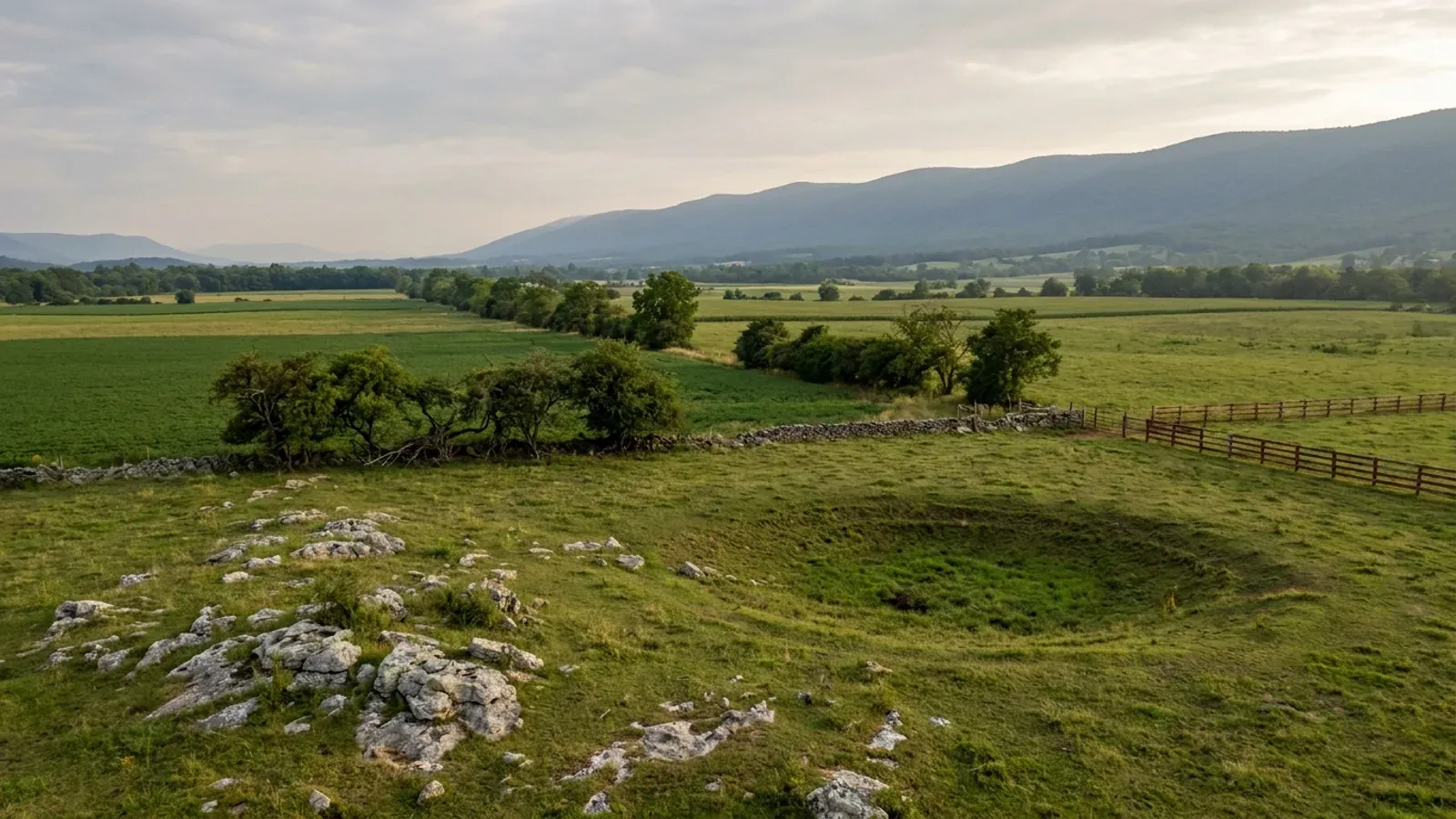
Barndominium Builders in Harrisonburg, VA
Harrisonburg is one of Virginia's 38 independent cities, which means it belongs to no county: Rockingham County wraps it completely and has no authority whatsoever inside the city line, and the city has none outside it. The permit comes from the Building Inspections Division of the city's Department of Community Development at 409 South Main Street, through the city's own LAMA portal, on a fee schedule that prices declared value where Rockingham prices square feet. The city is 17.3 square miles, its zoning ordinance contains no agricultural district of any kind, its largest minimum lot in any district is 10,000 square feet, and a detached shop may not occupy more than 30 percent of the required rear yard. The city's own comprehensive plan counts 126 acres of parcels over two acres with a house on them and calls them nonconforming farms. The land is over the line, in Rockingham, Augusta and Shenandoah.
Harrisonburg at a glance
- Independent city
- Harrisonburg
- Population
- 50,839
- ZIP codes
- 22801, 22802, 22807
Building conditions in Harrisonburg
The building code itself is the same in every Virginia locality, and no county, city or town may amend it. What changes from one to the next is who issues the permit and inspects the work, what that office charges, how the parcel is zoned, and the Table R301.2 design criteria the locality publishes — the 2021 Virginia Residential Code prints that table blank, with the instruction that additional criteria shall be established by the local jurisdiction. Those local numbers are what your drawings have to satisfy.
City of Harrisonburg Code § 11-1-1(a); City of Harrisonburg Building Inspections page; Rockingham County Administration Center address; Census 2024 Gazetteer place file, GEOID 5135624
City of Harrisonburg Code § 11-1-1(c), Climatic and Geographic Design Criteria; City of Harrisonburg Building Inspections, Design Criteria; Rockingham County, Climate and Geographic Design Criteria (2023 sheet)
City of Harrisonburg Building Inspections, Design Criteria; City of Harrisonburg Code § 11-1-1(c); Rockingham County, Climate and Geographic Design Criteria (2023 sheet)
City of Harrisonburg Zoning Ordinance §§ 10-3-5, 10-3-35, 10-3-41, 10-3-59.5; Rockingham County Code Table 17-806.01
City of Harrisonburg Zoning Ordinance § 10-3-114; City of Harrisonburg Building Permit page, Accessory Structures
City of Harrisonburg Code § 11-1-11 and Fees Directory; Rockingham County FY26 Fee Compendium, revised 25 June 2025
Also worth knowing before you build in Harrisonburg
- A non-reducible 30 psf roof live load, and a 10 psf dead load to match
- The city publishes a roof live load of 30 pounds per square foot minimum, non-reduced, and a roof dead load of 10 pounds per square foot, non-reduced, with a note that loads exceeding these minimums require a registered design professional to address the actual loads. Rockingham County adds the same 30 psf as a footnote of its own on its criteria sheet and repeats it on its plan review page as a submission requirement. Two neighbouring authorities, the same number, both of them stating it as non-reducible — which matters on a wide-span metal roof, because a reducible live load is exactly what a long-span truss design would otherwise take advantage of.
- The two air freezing indexes differ by more than four times
- Harrisonburg's codified table prints an air freezing index of 1500. Rockingham County's sheet prints 350. Air freezing index is what sizes a frost-protected shallow foundation under IRC R403.3, which is a real option for a slab-on-grade building. Two adjoining jurisdictions on the same valley floor publishing 1500 and 350 is not a rounding difference, and a design has to follow whichever authority is issuing the permit. Frost depth, at least, they agree on: 24 inches on both sides, which is Virginia's deep end against 12 inches on the Tidewater coast.
- The one rule that makes a barndominium shape legal is on the county side of the line
- Rockingham County Code § 17-805(a) says that in the A-1, A-2 and RV districts accessory structures may be taller than the primary structure, and that in every other district they may not. Harrisonburg has no A-1, no A-2 and no RV district, and its § 10-3-111 lifts the storey limit only for unoccupied accessory structures in nonresidential districts. A tall shop bay standing beside a lower house is legal by right in the county's agricultural districts and is a height violation in every residential district in the city.
- A second kitchen is allowed, and it comes with an affidavit
- The city states that its zoning ordinance does not prohibit a secondary kitchen inside a single-family dwelling but limits its use: it cannot be rented or leased as part of a second dwelling unit or efficiency apartment, it may only be used by a member of the family residing at the property, and the dwelling must remain accessible and free flowing throughout rather than enclosed as a separate unit. Anyone installing one must sign an affidavit to that effect, published in English and Spanish. Occupying it as a second unit is a zoning violation punishable as a misdemeanor.
- Where the fee comparison actually lands
- Take a 2,400 square foot living area with a 1,600 square foot attached shop bay at a declared value of $400,000. The city's building permit computes to $2,448 and the county's to $696. Trade permits reverse it: the city charges $54 each for electrical, mechanical and plumbing on a new single-family dwelling, where the county charges $75 plus a per-square-foot rate on two of the three, so $162 against about $385. With levies, roughly $2,660 in the city and roughly $1,140 in the county for the same building. Every assumption there is on the face of two published schedules and can be redone with different numbers.
- The city publishes a karst map of itself, and the county does not
- The city's comprehensive plan carries a map titled Environmentally Significant Areas — Carbonate Karst and Steep Slopes, created 30 September 2018, with a carbonate karst layer from the U.S. Geological Survey and a slopes layer built from 2015 lidar terrain data flown over Harrisonburg. It is a planning map, not a regulatory overlay, and being inside the karst layer triggers nothing. But it is drawn at city scale, which the statewide karst map is not: the state's own conservation department publishes that one with a caveat that it rests on a 1:500,000 geologic map and is not meant to inform land use decisions at the locality scale.
- The city describes its own soils, in words the county never published
- Comprehensive plan chapter 10 says the city's soils are dominated by clayey soils formed from limestone, and that the primary issues for construction are depth to bedrock, the presence of limestone seams or ledges surrounded by clay soils, and the tendency of these soils to shrink and swell with changing moisture levels. It names the mechanism, not just a region. Virginia Energy puts the whole Shenandoah Valley on its expansive-soils list, and adds that standard homeowner's insurance does not cover damage from expansive or compressive soils or frost heave. No comparable county-specific statement is published for Rockingham.
- A sinkhole detention rule with no distance limit
- The city's Design and Construction Standards Manual, chapter 2, section 2.4.2.1, requires that any runoff from a development which drains to an existing sinkhole, on-site or off-site, be detained to pre-development rates for the two-year and ten-year storms considered individually, regardless of any other considerations such as outfall adequacy or distance to the sinkhole, and that grading be sequenced so no increase in flow to sinkholes occurs during construction. It applies to work going through site plan or subdivision review rather than to every single-lot house, and the manual says the most stringent requirement always wins where it conflicts with another ordinance.
- Both stormwater ordinances define karst; only the county adds an adjustment factor
- The city's erosion control and stormwater chapter, adopted 27 August 2024, defines a karst area as land predominantly underlain at the surface or shallow subsurface by limestone, dolomite or other soluble bedrock regardless of any obvious surface features, and requires a stormwater plan to identify the karst features a facility discharges into. Rockingham County's post-construction stormwater chapter carries the same definitions and one sentence the city's does not: anything designed in Rockingham County will need to use the karst adjustment factor unless a geotechnical study has been performed. Neither jurisdiction forces a karst investigation before a building permit.
- Steep slope is defined at 15 percent and then barely used
- Section 10-3-24 defines steep slopes as natural slopes before disturbance that exceed fifteen percent, measured between contour lines at a five-foot interval or less. Across the whole ordinance that definition does operative work in only three places, all of them planned-community districts where a master plan must show adequate area to build with minimal impact on steep slopes and floodplains. It is not a by-right constraint on an ordinary lot. The city's comprehensive plan is more useful in practice: 0 to 15 percent presents few limitations, 15 to 25 percent is appropriate for residential use, and 25 percent and over is usually considered unsuitable for development.
- The floodplain rule that is stricter than the map
- The city's floodplain article, re-enacted in full by ordinance of 24 June 2014, delineates its districts from the FEMA flood study and FIRM dated 6 February 2008 — the same date printed in the city's design criteria table, which also records entry into the National Flood Insurance Program on 24 October 1989. Section 10-3-163 goes further than the map: where a field survey shows ground below the base flood elevation, that area is treated as a special flood hazard area even if the FIRM does not show it. The zoning administrator is the floodplain administrator.
- Three divisions review a permit before it exists
- The city states that once an application is submitted it is forwarded to the Planning, Zoning and Engineering Divisions for review against zoning requirements and site plan issues, and only then returned to Building Inspections for final review, approval and issuance. Pre-approvals from city departments are required, along with a completed Building Permit Application Checklist and an Impervious Square Footage Form on every building and demolition permit. Plans go in at quarter-inch scale with a site plan at one inch to twenty feet drawn to the actual bearings of the lot.
- Land disturbance is regulated at 10,000 square feet
- Section 10-4-4 of the city code makes any land-disturbing activity of 10,000 square feet or more a regulated activity under the Virginia Erosion and Stormwater Management Regulation, and section 10-4-7 requires a land disturbing permit before any land-disturbing activity begins unless one of the listed exemptions applies. Rockingham County uses the same 10,000 square foot threshold. A house, a shop, a driveway and the grading around them pass it without much trouble on either side of the line.
- 126 acres, and the city calls them nonconforming farms
- The city's own comprehensive plan counts 2,538 acres of vacant land, 26.3 percent of city land outside road and rail rights of way, and just 126 acres of single-family parcels larger than two acres — 1.3 percent. The plan describes those larger parcels as nonconforming farms in many cases, and treats them together with the vacant land as the remaining developable land in the city, 23.9 percent of it. Of the vacant and minimally developed acreage, 806 acres sit in R-1. That is the whole acreage story inside a 17.3 square mile city.
- Rockingham County is the best land county in Virginia, and it starts at the city line
- 191,588 acres in farms across 1,722 farms, the highest farm count of any Virginia county, covering 34.5 percent of 849.8 square miles. The median farm is 46 acres and 886 operations sit under 50 acres — a majority of the county's farms, and the largest count of sub-50-acre tracts in the state. Pittsylvania has more acreage and only 283 tracts that size. Population grew 6.6 percent since 2020. It is also the one place nearby whose zoning lets an accessory structure stand taller than the house, on a one-acre minimum lot.
- Augusta County has the acreage and the heavier snow
- 243,974 acres in farms across 967 square miles, second only to Pittsylvania in the state, with 1,460 farms, a median farm of 47 acres and 741 operations under 50 acres — 38.1 percent of the county in farmland. It publishes 43 psf ground snow, the second heaviest figure any Virginia jurisdiction publishes, and answers yes on ice barrier underlayment where Harrisonburg and Rockingham both answer no. It is also where nine miles of Interstate 81 closed in March 2001 after three sinkholes opened, the largest 20 feet by 11 feet and 22 feet deep. Grottoes straddles the Augusta and Rockingham line, so a parcel there may be Augusta's to permit.
- Shenandoah County is the one with no city carved out of it
- 120,653 acres in farms, 37.1 percent of its 508 square miles, 859 farms, a median farm of 46 acres and 440 operations under 50 acres, growing 3.6 percent since 2020. No independent city sits inside it at all, so the jurisdiction question this page is about never arises — the county permits everywhere. It carries the highest karst share of the three, 50 percent on the 2003 Virginia Speleological Survey table against 40 percent for Rockingham and Augusta, publishes 40 psf ground snow, and answers yes on ice barrier underlayment. Note that the town of Shenandoah is in Page County, not this one.
City of Harrisonburg Building Inspections, Design Criteria; Rockingham County, Climate and Geographic Design Criteria (2023 sheet), footnote L; Rockingham County Plan Review page
City of Harrisonburg Code § 11-1-1(c); Rockingham County, Climate and Geographic Design Criteria (2023 sheet)
Rockingham County Code § 17-805(a); City of Harrisonburg Zoning Ordinance §§ 10-3-111, 10-3-35
City of Harrisonburg Building Inspections page, Second Kitchen Installations; Affidavit for the Installation of a Second Kitchen within a Single-Family Dwelling
City of Harrisonburg Code § 11-1-11; Rockingham County FY26 Fee Compendium, revised 25 June 2025
City of Harrisonburg 2018 Comprehensive Plan (amended 14 July 2022), Chapter 10, Carbonate Karst and Steep Slopes map; Virginia DCR Natural Heritage Karst Program, Virginia Karst Geology Map caveat
City of Harrisonburg 2018 Comprehensive Plan (amended 14 July 2022), Chapter 10, Geology and Soils; Virginia Energy, Expansive Soils
City of Harrisonburg Design and Construction Standards Manual, Chapter 2 § 2.4.2.1 (chapter last updated 30 October 2017) and Chapter 1 § 1.2.1
City of Harrisonburg Zoning and Development Code §§ 10-4-2 and 10-4-9 (ordinance of 27 August 2024); Rockingham County Code §§ 6C-2 and 6C-7
City of Harrisonburg Zoning Ordinance §§ 10-3-24, 10-3-48.6, 10-3-57.6, 10-3-58.6; 2018 Comprehensive Plan (amended 14 July 2022), Chapter 10, Topography
City of Harrisonburg Zoning Ordinance §§ 10-3-160 to 10-3-170 (ordinance of 24 June 2014); City of Harrisonburg Code § 11-1-1(c)
City of Harrisonburg Building Inspections page, Building Permit Documentation and Site Plan
City of Harrisonburg Zoning and Development Code §§ 10-4-4 and 10-4-7 (ordinance of 27 August 2024); Rockingham County Land Disturbing Permit page
City of Harrisonburg 2018 Comprehensive Plan (amended 14 July 2022), Chapter 6, Tables 6-1 and 6-3
2022 Census of Agriculture, county series (acres operated, acres per operation median, area-operated categories under 50 acres); Census Vintage 2025 population estimates; Rockingham County Code Table 17-806.01 and § 17-805(a)
2022 Census of Agriculture, county series; Augusta County Residential Permit Process page, design criteria; Virginia Energy, Sinkholes and Karst
2022 Census of Agriculture, county series; Shenandoah County Design Information page; Belo, Natural Hazard Mitigation Planning For Karst Terrains in Virginia, Virginia Tech, May 2003, Table 3.1, attributed to the Virginia Speleological Survey (2003)

The expensive surprises are in the ground, not the building
What moves a Virginia budget is usually below grade, and it is soil rather than rock. Five localities already treat a soil answer as a condition of the permit rather than a recommendation — Fauquier, Chesterfield, Isle of Wight, Madison and Culpeper each require a soil report, an engineered foundation design, or both before the footings are approved. Chesterfield asks for one on every new house with no opt-out, on its own published reasoning that small amounts of shrink-swell soil may turn up anywhere in the county. Virginia Energy puts the same point bluntly: standard homeowner's insurance does not cover damage from expansive or compressive soils. Along the Interstate 81 corridor the question changes shape entirely — Virginia Energy counts twenty-seven Virginia counties in the karst zone that follows that road, where what matters is what is under the slab rather than what the slab sits in, and karst does not stay west of the Blue Ridge: Loudoun County publishes karst terrain of its own, on the other side of it. The same ground then sizes the septic system, because 12VAC5-610 works from bedrooms and soil texture — 150 gallons a day per bedroom, with no row in the table for a shop, a garage or a barn at all, and clay assigned to the slowest texture group at 91 minutes per inch or worse, past the 45 minutes per inch that makes a reserve drainfield mandatory. The soil that needs a foundation engineer multiplies the drainfield. So the site work, the foundation and the drainfield get resolved together rather than one at a time. We price the dirt before we price the building.
What we build in Harrisonburg
All nine services are available in Harrisonburg. What a build costs depends far more on the parcel than on square footage, so we price against your land rather than publishing a rate card.
Custom Plans
Barndominium floor plans drawn to your parcel and to the design criteria your own Virginia locality publishes, not to a generic national spec.
Barndominium Kits
Engineered barndominium shell packages delivered to your Virginia land, drawn to the criteria your own building department fills in.
Turnkey Builds
Start to finish barndominium construction: permits, site work, shell and full interior finish, under one contract and one schedule.
What a build looks like
Three stages every Harrisonburg project passes through, from a raw parcel to a finished home. Site work first, because that is where the budget is decided.

The parcel
Zoning, setbacks, flood zone and utility access get checked before anything is drawn.
Pad and permit
Clearing, grading and a compacted pad, while the submittal works through whichever office issues the permit where you are building.

Frame to finish
Shell erected and dried in, then systems, insulation and interior finish through to CO.
Those are the rules where you are building in Harrisonburg. Tell us what you want to build and we will draw it to them.
Where we build around Harrisonburg
Harrisonburg and the rural land around it. The buildable acreage for a project this size usually sits outside the city limits, which is frequently what changes who issues your permit.
Keep reading
The questions that usually come next once you know what Harrisonburg allows.
Barndominium Cost Guide
Sourced per-square-foot ranges by tier and by size, with a calculator built on the same figures.
Read itIs It Legal in Virginia?
Classification, zoning, the HOA gate, and why "nonresidential farm building" does not cover a home.
Read itHow Long Does It Take?
Census build-duration data, and what actually sets the permit clock where you are building.
Read itNearby areas we build in
Others we cover nearby. One may be a county, another an independent city that belongs to no county at all, and another a town inside a county — so the office that issues the permit, the fees it charges, the zoning and the design criteria each locality publishes can all differ from one card to the next.
Building in Harrisonburg: common questions
9 questions we get asked most often about building in Harrisonburg. If yours is not on the list, ask it directly.
Does Rockingham County issue the building permit for a property with a Harrisonburg address?
The city says 115 mph and the city code says 105 mph. Which wind speed do I design to?
What ground snow load applies in Harrisonburg?
Can I put up a big detached shop on a lot in Harrisonburg?
Is there anywhere in Harrisonburg zoned agricultural?
How much does a building permit cost in the city compared with the county?
Is sinkhole risk regulated in Harrisonburg?
Does Harrisonburg use a different building code from Rockingham County?
Where should I actually be looking for land near Harrisonburg?
Building in Harrisonburg?
Start with the plan. Tell us what you want to build and we will draw it, then confirm which office issues the permit for your parcel, what it will let you put there, and what wind load it has to meet. That conversation costs nothing.