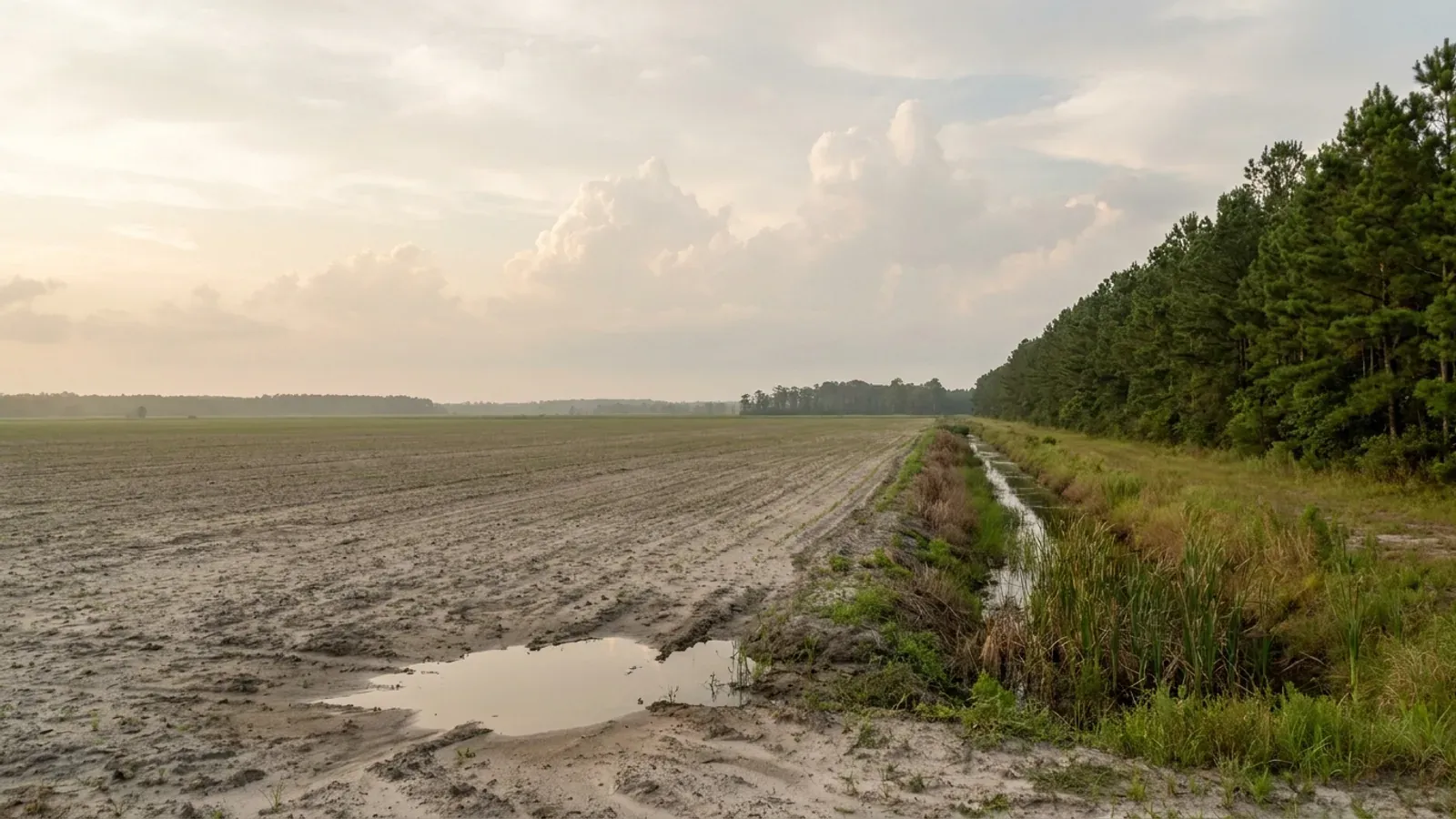
Flat Coastal Plain farmland inland of Hampton Roads with sandy soil, a drainage ditch and a loblolly pine edge.
Isle of Wight County One statewide code, no local amendments

Barndominium Builders in Isle of Wight County, VA

Isle of Wight is the county the rest of this market points at. Norfolk, Portsmouth, Newport News, Hampton, Chesapeake and Suffolk are independent cities — county equivalents belonging to no county at all — and five of them have almost nothing left to build on. Isle of Wight has 80,316 acres in farms, 39.8 percent of its land area, and it grew 6.7 percent between 2020 and 2025. It is also a different kind of jurisdiction from every page next to it: there is a county zoning ordinance, a county Department of Inspections, and two incorporated towns inside it, Smithfield and Windsor, each with its own zoning administrator and neither with its own building department. And the county is cut in half by a watershed line: the Chesapeake Bay Preservation Area rules that dominate the eastern side stop where the land starts draining west, which is why an interior parcel near Zuni and a waterfront parcel at Rushmere are two completely different projects.

Isle of Wight County at a glance

County
Isle of Wight County
Population
41,321
ZIP codes
23430, 23431, 23487, 23314, 23315, 23304, 23898, 23866
Site visits
Site visits across Hampton Roads, usually inside the week

Building conditions in Isle of Wight County

The building code itself is the same in every Virginia locality, and no county, city or town may amend it. What changes from one to the next is who issues the permit and inspects the work, what that office charges, how the parcel is zoned, and the Table R301.2 design criteria the locality publishes — the 2021 Virginia Residential Code prints that table blank, with the instruction that additional criteria shall be established by the local jurisdiction. Those local numbers are what your drawings have to satisfy.

Build conditions for Isle of Wight County , Virginia : design wind speed Not published by the county. BUILD CONDITIONS ISLE OF WIGHT COU…Isle of Wight CountyONE STATEWIDE CODEDESIGN WIND SPEEDNot published by th…The 2021 Virginia Residential Code prints Table R301.2 blank in every cell with the instructionthat additional criteria shall be established by the local jurisdiction, and Isle of Wight…ZONING · RURAL AGRICULTURAL CONSERVATION (RAC…40,000 sq ft in RAC, with 150 ft of…Zoning Ordinance (Appendix B) Sec. 4-2005 sets the RAC minimum lotat 40,000 square feet. Sec. 4-2006 caps building height at 35 feet…PERMIT REVIEW CLOCK10 business daysPublished review target of the issuing authorityWHO ISSUES THE PERMITIsle of Wight County Department of C…17140 Monument Circle, Suite 101, Isle of Wight, VA 23397.Applications, plan uploads, inspection scheduling and fee payment… Design criteria are filled in by the jurisdiction under Table R301.2 and are confirmed per parcel before any drawing is sealed.
Build conditions for Isle of Wight County, drawn from the sourced facts on this page. Every figure above is cited in the quick-facts panel below, with its source and vintage.
You are in a county, and your neighbours are not
Every city page next to this one — Norfolk, Portsmouth, Newport News, Hampton, Chesapeake, Suffolk — is an independent city, a county equivalent belonging to no county at all. Isle of Wight is the opposite case and it changes the whole process. There is a county zoning ordinance with a rural agricultural district in it, a county Department of Inspections issuing the permit, and two incorporated towns inside the county line. Neither town runs a building department: Smithfield tells applicants that most jobs needing a town zoning permit will also need a building permit from Isle of Wight County, and Windsor's own zoning permit application states that a copy of the town permit must be presented to the Isle of Wight County Department of Inspections in order to obtain a building permit. So the town handles the land-use question and the county handles the building.

Isle of Wight County, Building Inspections and Plan Review Narrative item 2, www.isleofwight.gov/departments/building_inspections/ (read 2 Sep 2026); Town of Smithfield, Zoning Permit page, www.smithfieldva.gov/316/Zoning-Permit (read 2 Sep 2026); Town of Windsor Zoning Permit Application PDF, www.windsor-va.gov (read 2 Sep 2026); Va. Code § 36-105(A)

The shop may not be bigger than the house
Zoning Ordinance Sec. 5-2000.A.1: "The square footage of an accessory building shall not exceed the square footage of the primary structure." Sec. 5-2000.B adds that no accessory structure is permitted on a lot until the principal structure exists or its construction has started — with one narrow exception for a one-storey tool and storage shed of no more than 256 square feet with an eave height of 10 feet or less on a vacant RAC lot, and a conditional use permit route to go larger. Read together, those two sentences rule out the common plan of putting up a big detached shop first and adding the house later. The design that works here is one building: shop and living space under a single roof, permitted as the dwelling, so the accessory-building cap never applies to it.

Isle of Wight County Code, Appendix B Zoning, Art. V Secs. 5-2000.A.1 and 5-2000.B, read via api.municode.com (product 14449, job 491158, codified through the ordinance of 15 January 2026, Supp. No. 89)

A soil report is a condition of the permit, and the county says why
The county's plan review narrative lists a soil report and footing design among the submittal items for a single-family dwelling, and states the reason in its own words: "there are many areas throughout the County that have moderate or severe 'shrink-swell' soils." Plan reviewers consult the Soil Survey of Isle of Wight County, and where that survey shows shrink-swell potential the applicant must supply a soils report from a certified soil scientist or licensed engineer that includes design requirements for the footing or foundation system. The NRCS survey backs it up: Peawick and Chickahominy soils across roughly 22,000 acres of the county carry a linear extensibility of 7.5 percent. Virginia Energy names the Coastal Plain among the state's likeliest areas for expansive and frost-heave-susceptible soils, and adds that standard homeowner's insurance does not cover damage from expansive soils or frost heave.

Isle of Wight County, Plan Review Narrative item 4, www.isleofwight.gov/departments/building_inspections/plan_review_narrative.php (read 2 Sep 2026); USDA-NRCS Soil Data Access, survey area VA093 Isle of Wight County (queried 2 Sep 2026); Virginia Energy, Division of Geology and Mineral Resources, Expansive Soils, energy.virginia.gov/geology/ExpansiveSoils.shtml

A third of the county has water within a foot of the surface
On the NRCS soil survey of Isle of Wight County, 68,320 acres — about a third of the roughly 198,700 acres of mapped land — sit in map units whose minimum annual water table is 30 centimetres or less, that is within a foot of the ground. Myatt fine sandy loam alone covers 30,770 acres at about 6 inches, and Nawney loam covers 16,955 acres at about 3 inches, with frequent flooding. Only 25,545 acres have a water table deeper than 42 inches. The largest single unit in the county, Slagle fine sandy loam on 0 to 2 percent slopes at 35,310 acres, is moderately well drained with the table at about 27 inches. This is the constraint that decides a slab-versus-crawlspace question, sets the footing depth conversation, and governs where a drainfield will actually work — long before shrink-swell does.

USDA-NRCS Soil Data Access, SSURGO survey area VA093 (Isle of Wight County, Virginia), map unit aggregated attributes and component tables, queried 2 September 2026

The Bay Act stops at a line drawn across the county
Isle of Wight is on the closed statutory list of Tidewater localities at Va. Code § 62.1-44.15:68, but its own ordinance does not blanket the county. It applies "to all lands within the Chesapeake Bay drainage basin," and the Resource Management Area is "all areas within the Chesapeake Bay watershed" — so the county's western corner, which drains away from the Bay, sits outside it. The county maps the divide: its GIS publishes a Chesapeake Bay Watershed layer described as the "Isle of Wight County, Virginia, portion of the Chesapeake Bay Watershed" and a Chesapeake Bay Watershed Line, the "watershed dividing line in Isle of Wight County," drawn from USGS National Hydrography Dataset boundaries in 2013, plus a public map for determining whether a particular property is inside. Queried against that layer, Smithfield, Carrollton, Rushmere, Battery Park, Benns Church, the courthouse area and the Town of Windsor fall inside; Zuni and Walters, toward the Blackwater, fall outside. The county's own permitting guidance turns on it: land disturbance triggers review at 2,500 square feet inside a designated Preservation Area and 10,000 square feet outside one.

Isle of Wight County Code, Appendix B-1 Chesapeake Bay Preservation Area Ordinance, Secs. 1004 and 3000(b), via api.municode.com (product 14449, job 491158); Isle of Wight County GIS, Chesapeake Bay Watershed and Chesapeake Bay Watershed Line feature services, services.arcgis.com/Dc6hhMQCpvLlOmSY (queried 2 Sep 2026); Isle of Wight County, Applying for a Land Disturbing Permit, quoting 9VAC25-875-250

No detached shop inside the flood zone, and no variance
The county's Floodplain Management Overlay district, as amended 20 November 2025, repeats one sentence in every flood zone it regulates: "Accessory structures of any size shall be prohibited within the SFHA and no variance shall be granted for accessory structures." In the coastal A zone seaward of the limit of moderate wave action, new construction is prohibited outright. Where building is allowed, the lowest floor must be elevated to the base flood level plus 18 inches, and Sec. 6-4012.E.2 bars filling a property solely to raise it enough to meet minimum lot area and create a buildable residential lot. Any plan or plat covering land in the district must be prepared and sealed by a licensed surveyor or engineer. On a waterfront parcel this is the provision that decides the whole layout, and it is another reason the shop and the living space usually have to be one building here.

Isle of Wight County Code, Appendix B Zoning, Art. VI Secs. 6-4011 to 6-4013, Floodplain Management Overlay (FPMO) District (11-19-15; 7-19-18; 11-20-25), read via api.municode.com (product 14449, job 491158)

Also worth knowing before you build in Isle of Wight County

What the rural district actually allows
The Rural Agricultural Conservation district exists, in the ordinance's own words, to "preserve and protect areas of Isle of Wight County that are presently, predominantly in agricultural use," and it tells non-farm buyers plainly that "the right to farm has been established as county policy." Minimum lot is 40,000 square feet with 150 feet of width and 120 feet of frontage. Height is capped at 35 feet or three storeys, whichever is less — though buildings used in conjunction with a bona fide agricultural use in RAC are exempt from that cap. Front setback is 60 feet from the property line where the right-of-way is wider than 50 feet, side setbacks 15 feet on one side and 35 feet combined for a principal structure, rear setback 35 feet for a principal structure and 5 feet for an accessory one. A single-family dwelling and a private garage are by-right uses; splitting land is where it gets strict — a 100-acre RAC tract yields four divisions under the sliding scale, one more for each additional 40 acres, and new lots are capped at ten acres each with 70 percent of the original tract preserved.

Isle of Wight County Code, Appendix B Zoning, Art. IV Part 2, Secs. 4-2001, 4-2002, 4-2004, 4-2005 and 4-2006, read via api.municode.com (product 14449, job 491158)

Living quarters in an outbuilding have their own rulebook
A residential accessory apartment is a by-right use in RAC, and Sec. 5-5002.A.1 says it may sit in the primary dwelling, in a separate accessory building, or as part of an accessory structure. The conditions are specific: the lot must carry 100 percent of the district's minimum lot size, the owner must occupy one of the units on the premises, no more than two bedrooms, no more than one per parcel, one extra parking space, and water and sewage approval from the Isle of Wight County Health Department or the department of public utilities. An accessory apartment inside an accessory building is capped at 50 percent of the principal dwelling's floor area, and a stand-alone accessory apartment that is not part of the principal dwelling or an accessory structure is capped at 15 feet or one storey. A guest house is a different animal again: it needs 150 percent of the district's minimum lot size, must meet primary-structure setbacks, may not be built before the main house is occupied, and may never be rented.

Isle of Wight County Code, Appendix B Zoning, Art. V Secs. 5-5002.A.1 and 5-5002.H, read via api.municode.com (product 14449, job 491158)

The county charges by the square foot, not the valuation
On the fee schedule effective 1 July 2026, new construction of a single-family dwelling, multifamily dwelling or accessory dwelling unit is a $300 base fee plus $0.20 per square foot up to 40,000 square feet, and $0.15 per square foot above that. A deck, addition or accessory structure is $0.20 per square foot with no base fee. Residential plan review is $150, an accessory structure over 256 square feet adds $50, a resubmittal after the second review is $150, and the minimum permit fee is $85. Every permit carries a 5 percent technology fee and a 2 percent state surcharge, each assessed separately on the subtotal. A county zoning permit is $35, and building without one costs $500 as an after-the-fact permit fee on all types. Because the fee follows floor area rather than the contractor's valuation, a large shop under the same roof as the living space is priced very differently here than in a locality that bills off construction cost.

Isle of Wight County, 2026-2027 Adopted Fee Schedule — Building Inspections and Planning & Zoning, effective 1 July 2026, www.isleofwight.gov/2026.2027%20COMBINED.pdf (retrieved and read 2 Sep 2026); 13VAC5-63-70 Section 107.2

Hampton Roads is not a wind-borne debris region
This is the claim the market gets wrong most often, and the localities' own documents settle it. Only three Virginia jurisdictions were found publishing the wind-borne debris column at all — the City of Chesapeake, Southampton County next door, and Fluvanna — and all three answer NO. Chesapeake publishes the highest design wind speed found anywhere in Virginia, 117 to 123 mph ultimate, against a code threshold of 130 mph at the coast, and answers NO in the same sheet. Southampton publishes 115 mph, seismic design category A, a 20 psf ground snow load and a 12-inch frost line, and answers NO. Accomack County, the most exposed county on the seaside, requires rafter-to-plate tie-downs and gable-end bracing and no opening protection at all. Sites advertising "130 to 145 mph Hampton Roads" and impact-rated glazing are contradicted by the localities' own published columns.

City of Chesapeake Residential Plan Review Checklist (2021 code); Southampton County Climate and Geographic Table 1, southamptoncounty.org; Fluvanna County 2021 IRC design criteria worksheet; Accomack County design loads criteria, accomack.gov/333 — all as recorded in research/statewide/design-criteria-and-climate.md §2c

Two drainfields, and you cannot build on either
Inside the Chesapeake Bay Preservation Area the county requires a reserve sewage disposal site "with a capacity at least equal to that of the primary" — a full second drainfield, not the 50 percent the rest of Virginia only reaches above a 45-minute-per-inch percolation rate — and Isle of Wight goes further than the state text by barring "building or the construction of any impervious surface" on any sewage disposal site until public sewer arrives. Add the well and its protective radius, the house, the shop and the parking, and a Bay Act parcel here needs materially more usable ground than the same building elsewhere in Virginia. The five-year septic pump-out is enforced by the county under Article 6 of its own Chesapeake Bay Preservation Area Ordinance, not by the Virginia Department of Health — the twelve counties where VDH took that over on 1 July 2023 do not include Isle of Wight.

Isle of Wight County Code, Appendix B-1 Secs. 4000(b)7 and 4000(b)8 and Art. 6, via api.municode.com (product 14449, job 491158); Isle of Wight County, Septic Pump-Out Program page, www.isleofwight.gov (read 2 Sep 2026); 9VAC25-830-130(7); 12VAC5-610-670 Table 5.1; 12VAC5-610-710

Slopes, wetlands and floodplain come off the buildable acreage first
Isle of Wight's net developable area calculation in Sec. 5-4000 removes environmentally sensitive land from a parcel before density and building coverage are worked out: 100 percent of tidal wetlands, 100 percent of the 100-year floodplain, 100 percent of Resource Protection Areas including the 100-foot buffer, 100 percent of slopes over 30 percent, 50 percent of non-tidal wetland, and 50 percent of slopes between 15 and 30 percent. Separately, the Bay Act ordinance prohibits development on slopes greater than 15 percent unless it is demonstrated to be the only effective way to maintain or improve slope stability, and caps impervious cover at the district's lot coverage limit and in no case above 60 percent of the site. That 15 percent figure is Isle of Wight's own, published in its own ordinance — it is not a statewide number, and Virginia has no single state slope threshold for houses.

Isle of Wight County Code, Appendix B Zoning Sec. 5-4000 and Appendix B-1 Sec. 4000(b)3 and 4000(b)4, read via api.municode.com (product 14449, job 491158)

A new dwelling is not a permitted use in the RPA
Where the Bay Act does reach, the Resource Protection Area is the tidal wetlands, tidal shores, connected non-tidal wetlands and perennial water bodies, plus a 100-foot vegetated buffer on both sides, and the ordinance states the buffer "is not reduced in width." Land development in an RPA is allowed only if it is water-dependent, is redevelopment, is a road or driveway crossing, or is a regional stormwater facility — a house is none of those. The two administrative ways in turn on when the lot was recorded: before 1 October 1989, or between 1 October 1989 and 1 March 2002, and in both cases the encroachment "may not extend into the seaward fifty (50) feet of the buffer area." A water quality impact assessment is required for any land disturbance in an RPA, the applicant pays for the site-specific delineation and it is good for five years, and where the buffer does not exist a landscaping plan must be approved before any zoning or building permit issues and implemented before the certificate of occupancy.

Isle of Wight County Code, Appendix B-1 Secs. 3000(b), 3001, 4001 and 4002, read via api.municode.com (product 14449, job 491158)

The land supply, in numbers
80,316 acres in farms — 39.8 percent of the county's 316 square miles — across 212 farms, with an average farm of 379 acres and a median of 88, and 91 operations under 50 acres. Population rose from 38,711 in 2020 to 41,321 in 2025, up 6.7 percent, at 131 people per square mile. Against that, Newport News is 2,656 per square mile and Norfolk 4,336, with no agricultural reporting at all in Norfolk. Suffolk is the other genuine land answer in this metro at 70,920 farm acres over 399 square miles, and Southampton, further out, has 155,013 acres at 39.9 percent of its land. Isle of Wight is the closest of the three to the Peninsula: it borders Newport News across the James and Suffolk to the east.

2022 Census of Agriculture, USDA NASS, county-level file; U.S. Census Bureau Vintage 2025 population estimates, 2020-2025 change; as compiled in research/statewide/geography-and-population.md §4.3 and §6

An excavator grading a compacted building pad on a cleared lot, with survey stakes and a drainage swale visible.
Below the slab

The expensive surprises are in the ground, not the building

What moves a Virginia budget is usually below grade, and it is soil rather than rock. Five localities already treat a soil answer as a condition of the permit rather than a recommendation — Fauquier, Chesterfield, Isle of Wight, Madison and Culpeper each require a soil report, an engineered foundation design, or both before the footings are approved. Chesterfield asks for one on every new house with no opt-out, on its own published reasoning that small amounts of shrink-swell soil may turn up anywhere in the county. Virginia Energy puts the same point bluntly: standard homeowner's insurance does not cover damage from expansive or compressive soils. Along the Interstate 81 corridor the question changes shape entirely — Virginia Energy counts twenty-seven Virginia counties in the karst zone that follows that road, where what matters is what is under the slab rather than what the slab sits in, and karst does not stay west of the Blue Ridge: Loudoun County publishes karst terrain of its own, on the other side of it. The same ground then sizes the septic system, because 12VAC5-610 works from bedrooms and soil texture — 150 gallons a day per bedroom, with no row in the table for a shop, a garage or a barn at all, and clay assigned to the slowest texture group at 91 minutes per inch or worse, past the 45 minutes per inch that makes a reserve drainfield mandatory. The soil that needs a foundation engineer multiplies the drainfield. So the site work, the foundation and the drainfield get resolved together rather than one at a time. We price the dirt before we price the building.

What a build looks like

Three stages every Isle of Wight County project passes through, from a raw parcel to a finished home. Site work first, because that is where the budget is decided.

Aerial view of an undeveloped rural lot with cleared grass, a oak and hickory treeline with a few loblolly pines, and a pale gravel access track.
Stage one

The parcel

Zoning, setbacks, flood zone and utility access get checked before anything is drawn.

An excavator grading a compacted building pad on a cleared lot, with survey stakes and a drainage swale visible.
Stage two

Pad and permit

Clearing, grading and a compacted pad, while the submittal works through whichever office issues the permit where you are building.

A finished barndominium at dusk with warm interior lighting glowing through its large windows.
Stage three

Frame to finish

Shell erected and dried in, then systems, insulation and interior finish through to CO.

Those are the rules where you are building in Isle of Wight County. Tell us what you want to build and we will draw it to them.

Where we build around Isle of Wight County

Isle of Wight County and the rural land around it. The buildable acreage for a project this size usually sits outside the city limits, which is frequently what changes who issues your permit.

The Isle of Wight County service area, including the rural acreage outside the built-up edge, which is where the parcels big enough for a build like this usually sit. The map marks the territory we build in. It is not a branch location, and there is no office at this pin.

Nearby areas we build in

Others we cover nearby. One may be a county, another an independent city that belongs to no county at all, and another a town inside a county — so the office that issues the permit, the fees it charges, the zoning and the design criteria each locality publishes can all differ from one card to the next.

Building in Isle of Wight County: common questions

9 questions we get asked most often about building in Isle of Wight County. If yours is not on the list, ask it directly.

Who issues the building permit in Isle of Wight County — and what about Smithfield and Windsor?
The county does, through the Department of Community Development's Inspections Division at 17140 Monument Circle, and it does so everywhere in the county including inside both town limits. That is worth spelling out because the answer is genuinely different a few miles away: Suffolk, Chesapeake, Portsmouth, Norfolk, Hampton and Newport News are independent cities, county equivalents belonging to no county at all, and each permits its own work with no county above it. Isle of Wight is a county, so there is a county building department and a county zoning ordinance. Inside it, Smithfield and Windsor are incorporated towns, which unlike a Virginia city stay inside their county. Each town runs its own zoning and its own zoning administrator, and neither runs a building department. Smithfield's own page tells applicants that most jobs needing a town zoning permit will also need a building permit from Isle of Wight County, at a phone number the town publishes. Windsor's zoning permit application says on its face that a copy of the town permit must be presented to the Isle of Wight County Department of Inspections in order to obtain a building permit. So on a town parcel you deal with two desks; on a rural parcel, one. The code itself is identical either way — the Uniform Statewide Building Code supersedes local building codes across Virginia and no locality may amend it.
Can I build a big detached shop and add the house later?
No, and the two provisions that stop it are worth reading before you buy. Zoning Ordinance Sec. 5-2000.A.1 says the square footage of an accessory building shall not exceed the square footage of the primary structure. Sec. 5-2000.B says no accessory use or structure is permitted on a lot unless the principal structure already exists or its construction has started. The only thing you may put on a vacant RAC lot first is a one-storey tool and storage shed of 256 square feet or less with an eave height of 10 feet or under, sitting no more than 18 inches above grade, anchored for wind, and there is a conditional use permit route if you need something larger for property maintenance. What works instead is the design most people actually want anyway: one building, shop and living space under a single roof, permitted as the dwelling. Then the accessory-building cap never applies, because there is no accessory building. If you do want them separate, the house has to be at least as large in footprint as the shop, the accessory building may not exceed the district height limit or the height of the principal structure — whichever is less, though a structure accessory to a single-storey house may reach 125 percent of its height if it sits at least 20 feet away — and one exemption is worth knowing: buildings used in conjunction with a bona fide agricultural use in the RAC district are exempt from the height limits altogether.
Does the Chesapeake Bay Preservation Act apply to my parcel here?
It depends where in the county you are, and this is the question that most needs answering honestly. Isle of Wight is named in the closed statutory list of Tidewater localities at Va. Code § 62.1-44.15:68, so the Act reaches the county. But the county's ordinance does not simply cover the county: it applies to all lands within the Chesapeake Bay drainage basin, and it defines the Resource Management Area as all areas within the Chesapeake Bay watershed. The county's western corner drains the other way, toward the Blackwater, and sits outside. The county maps the divide itself — its GIS publishes a Chesapeake Bay Watershed layer for the county's portion of the basin, a Chesapeake Bay Watershed Line described as the watershed dividing line in Isle of Wight County, and a public map whose stated purpose is determining whether a particular property is in the Chesapeake Bay Protection Area. Queried against that layer, Smithfield, Carrollton, Rushmere, Battery Park, Benns Church, the courthouse area and the Town of Windsor are inside; Zuni and Walters are outside. The practical difference shows up immediately in the permit thresholds the county publishes: land disturbance is regulated from 2,500 square feet inside a designated Preservation Area and from 10,000 square feet outside one, and a single-family house with its septic tank and drainfield clears 2,500 square feet comfortably. Being inside the basin is still not the same as being in the Resource Protection Area — that is the tidal water, the perennial streams and the 100 feet either side of them. A parcel can be inside the watershed, well away from any RPA, and face nothing more than the disturbance threshold and the reserve drainfield rule.
I am looking at land on the James River. What will actually stop me?
Three things, in this order. First, the Resource Protection Area. A new dwelling is not on the list of uses allowed in an RPA — that list is water-dependent development, redevelopment, a road or driveway crossing, and regional stormwater facilities. The 100-foot buffer, in the ordinance's own words, is not reduced in width. There are two administrative encroachment routes and both turn on when the lot was recorded, before 1 October 1989 or between 1 October 1989 and 1 March 2002, and neither may reach into the seaward 50 feet of the buffer. Any land disturbance in an RPA needs a water quality impact assessment, and you pay for the site-specific delineation, which is good for five years. Second, the floodplain overlay, amended by the Board of Supervisors on 20 November 2025. In every flood zone it regulates it says accessory structures of any size are prohibited within the Special Flood Hazard Area and no variance shall be granted for them — so a separate shop is simply not available on flood-zone land, which is another reason to design one building. Where you can build, the lowest floor goes to the base flood elevation plus 18 inches, and in the coastal A zone seaward of the limit of moderate wave action new construction is prohibited. You also cannot fill land solely to raise it enough to meet minimum lot area and manufacture a buildable lot. Third, the drainfields. Inside the Preservation Area the reserve site must equal the primary, and you may not build or place any impervious surface on either of them.
What wind speed, snow load and frost depth does Isle of Wight use?
The county does not publish them, and that is a finding rather than a gap. The 2021 Virginia Residential Code prints Table R301.2 blank — em-dashes in every cell — with the instruction that additional criteria shall be established by the local jurisdiction. Most Virginia localities fill it in and publish it. Isle of Wight's Building Inspections pages carry a heading literally called Design Criteria that defines what design criteria are and gives no numbers, so the figures for a project here get settled with the county plan reviewers. What you should not accept is a number handed to you off a national map, and you should be sceptical of the wind figures circulating for this market. Look at what the neighbours actually publish: Southampton County, immediately west, publishes 115 mph with a 20 psf ground snow load, seismic design category A and a 12-inch frost line. The City of Chesapeake publishes 117 to 123 mph ultimate — the highest published figure found anywhere in Virginia. Newport News, across the James, publishes 118 mph. All three sit well below the 130 mph coastal threshold for a wind-borne debris region, and the three Virginia localities that publish that column at all — Chesapeake, Southampton and Fluvanna — every one of them answers no. Marketing sites quoting 130 to 145 mph for Hampton Roads and telling you that you need impact-rated glazing are contradicted by the localities' own documents. The one design figure that is fixed for Isle of Wight is the climate zone: the energy code's own county table puts it in 3A, and no locality may change that. Statewide and safe alongside it: 5 ACH50 on the blower door and R-15, or R-13 plus R-1 continuous, in the walls.
Is the soil a problem here? I thought shrink-swell was a Piedmont thing.
It is a real question in Isle of Wight, and the county answers it in its own plan review narrative: there are many areas throughout the county that have moderate or severe shrink-swell soils, and where the Soil Survey of Isle of Wight County shows that potential, the applicant must supply a soils report from a certified soil scientist or licensed engineer including design requirements for the footing or foundation. So this is a permit condition, not just prudence. Virginia Energy names the Coastal Plain — along with the Shenandoah Valley and the Mesozoic basins around Culpeper, Farmville, Danville and Richmond — as the areas most likely to carry expansive or frost-heave-susceptible soils, while saying plainly that the exact distribution can only be approximated from soil maps and that field visits are necessary to determine the actual extent. In the NRCS survey the high-extensibility units here are Peawick and Chickahominy, about 22,000 acres between them at a linear extensibility of 7.5 percent. But the more common constraint by far is water. Sixty-eight thousand acres of the county — roughly a third of the mapped land — is poorly or very poorly drained, with the seasonal high water table within a foot of the surface: Myatt at about 6 inches over 30,770 acres, Nawney at about 3 inches over 16,955 acres. Only about 25,500 acres have the table deeper than 42 inches. For a wide, slab-heavy building that shapes the foundation, the site grading and the drainfield all at once, and it is the reason a soil investigation on your own parcel is the cheapest money you will spend. Worth knowing before you break ground: standard homeowner's insurance does not cover damage from expansive or compressive soils, or from frost heave.
What will the permit cost, and how long does it take?
The county publishes its schedule and it is unusual in a useful way: the building fee follows floor area, not the contractor's valuation. On the schedule effective 1 July 2026, new construction of a single-family dwelling, multifamily dwelling or accessory dwelling unit is a $300 base fee plus $0.20 per square foot up to 40,000 square feet, then $0.15 per square foot above that. A deck, addition or accessory structure is $0.20 per square foot with no base fee. Residential plan review is $150, an accessory structure over 256 square feet adds $50, a resubmittal after the second review is $150, re-inspection is $125, and the minimum permit fee is $85. Every permit carries a 5 percent technology fee and a 2 percent state surcharge, each assessed separately on the subtotal — the 2 percent is the statewide levy set by regulation, and it is the only permit-fee number that is the same in every Virginia locality. A county zoning permit is $35; a Town of Smithfield zoning permit is $75 for a residence and $30 for an addition, deck or shed; a Town of Windsor zoning permit is $25. Starting work without a permit costs $500 as an after-the-fact fee on all types. On timing, the county publishes a residential application review time of approximately ten days, longer if the submittal is incomplete, and applications, plan uploads, inspection scheduling and fees all run through its OpenGov portal, with paper plans still accepted.
How much land do I need, and what can I do with it?
In the Rural Agricultural Conservation district the minimum lot is 40,000 square feet — a shade over nine-tenths of an acre — with 150 feet of width and 120 feet of frontage. Height is capped at 35 feet or three storeys, whichever is less. Setbacks are 60 feet at the front where the right-of-way is over 50 feet, 15 feet to one side and 35 feet combined, 35 feet at the rear for a principal structure and 5 feet for an accessory one. But the minimum lot is not the number that matters most. Two things eat into what you can actually use. Sec. 5-4000 subtracts environmentally sensitive land before density and coverage are calculated: all of the tidal wetlands, all of the 100-year floodplain, all of the Resource Protection Area including its buffer, all slopes over 30 percent, half of non-tidal wetland and half of slopes between 15 and 30 percent. And on well and septic you need room for the house, the shop, the well with its protective radius, the primary drainfield and — inside the Bay Act area — a reserve drainfield of equal size that must stay permanently clear of buildings and impervious surface. Septic is sized at 150 gallons per day per bedroom under 12VAC5-610-670, with no allowance made for living area and no row at all for a shop, garage or barn, so it is the bedroom count that drives the field. If you want to subdivide rather than just build, RAC is deliberately restrictive: a 100-acre tract yields four divisions under the sliding scale with one more per additional 40 acres, new lots are capped at ten acres, and 70 percent of the original tract must be preserved.
Can I put living quarters in the shop, or a second small home on the land?
Yes, by two different routes, and they are worth separating. A residential accessory apartment is a by-right use in the RAC district, and the ordinance expressly allows it to sit in the primary dwelling, in a separate accessory building, or as part of an accessory structure — which is the provision that lets a shop building carry living space. The conditions: the lot must have 100 percent of the district's minimum lot size, the owner must occupy one of the units on the premises, no more than two bedrooms, no more than one accessory apartment per parcel, one additional parking space, and water and sewage approval from the county Health Department or public utilities. An accessory apartment inside an accessory building is capped at 50 percent of the principal dwelling's floor area, and a stand-alone accessory apartment that is not part of the principal dwelling or an accessory structure is capped at 15 feet in height or one storey. A guest house is the other route and it is stricter: 150 percent of the district's minimum lot size, primary-structure setbacks, the owner must occupy the main house, it cannot be built before the main house is finished and occupied, no guest may stay more than three consecutive months in a twelve-month period, and it may never be rented or made available for compensation of any kind. One thing that does not work at all: the farm-building exemption. Va. Code § 36-97 defines a farm building as one not used for residential purposes, so the moment anyone lives in it, it is a dwelling and the full statewide code applies.

Building in Isle of Wight County?

Start with the plan. Tell us what you want to build and we will draw it, then confirm which office issues the permit for your parcel, what it will let you put there, and what wind load it has to meet. That conversation costs nothing.