Barndominium Builders in Chesapeake, VA
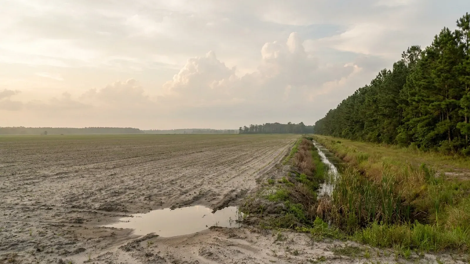
Chesapeake is 338 square miles of independent city belonging to no county at all, and at 754 people per square mile it is the second-largest Virginia city by land area after Suffolk. USDA counts it as one of only three Virginia cities with its own unit in the Census of Agriculture: 180 farms across 37,359 acres, 15.7 percent of the city. All of that acreage sits in the southern and western half, running out toward the Great Dismal Swamp and the North Carolina line under the A-1 agricultural district and the Rural Overlay. It is also the city that ends the Hampton Roads wind argument: Chesapeake publishes the highest design wind speed found anywhere in Virginia and answers no in the wind-borne debris column of the same table. What actually governs a build down here is the seasonal high water table, the drainfield ditching regime the city runs to deal with it, and which side of the drainage divide the parcel sits on.
Chesapeake at a glance
- Independent city
- Chesapeake
- Population
- 255,332
- ZIP codes
- 23320, 23321, 23322, 23323, 23324, 23325
- Site visits
- Same-week site visits across the city, from Western Branch and Deep Creek down through Great Bridge, Hickory, Fentress and the Northwest River corridor
Building conditions in Chesapeake
The building code itself is the same in every Virginia locality, and no county, city or town may amend it. What changes from one to the next is who issues the permit and inspects the work, what that office charges, how the parcel is zoned, and the Table R301.2 design criteria the locality publishes — the 2021 Virginia Residential Code prints that table blank, with the instruction that additional criteria shall be established by the local jurisdiction. Those local numbers are what your drawings have to satisfy.
City of Chesapeake, Residential R-5 Construction Information List for the 2021 VRC Code, Table R301.2 and section R301.2.1 (dated 3-25-24; linked from cityofchesapeake.net/782/Residential-Plan-Approval). Corroborated at line 118 of the city's Residential Plan Review Checklist - 2021, "Wind load 117-123, R301.2.1"
Chesapeake Zoning Ordinance sections 10-501 (Ord. No. 24-O-064, 18 June 2024), 10-502, 10-602 use table and 6-302; City of Chesapeake handout Residential Districts - Single Family Dwelling Development Standards
Chesapeake Zoning Ordinance sections 5-100(C), 5-202(A), 5-402, 5-502, 5-600 and 5-800 (overlays established 1993; countryside overlay abolished and suburban overlay extended south by Ord. No. 05-O-014, 8 March 2005)
Chesapeake City Code sections 26-513, 26-516, 26-517 (Ord. No. 24-O-070, 25 June 2024) and 26-601 through 26-607 (Ord. No. 05-O-077, 21 June 2005); Chesapeake 2045 Comprehensive Plan, Environment and Resilience chapter (adopted 20 January 2026)
City of Chesapeake Public Facilities Manual, Volume 1, Chapter 15, Soil Drainage Management Plan Design (rev. 11/18), reproducing 12VAC5-610-600 through 12VAC5-610-640; City of Chesapeake Soil Drainage Management Plan FAQs
USDA NASS 2022 Census of Agriculture, county-level file; 2025 Census Gazetteer place file for Virginia (GEOID 5116000, ALAND 338.456 sq mi); Census Vintage 2025 population estimates; Chesapeake 2045 Comprehensive Plan, Growth Management and Rural Areas chapter
Also worth knowing before you build in Chesapeake
- No county above the city
- Chesapeake is one of Virginia's 38 independent cities, a county equivalent that belongs to no county at all. There is no county building department with authority here, no county zoning ordinance reaching inside the city line, and no county tier to appeal to. The permit, the inspections, the zoning, the floodplain review, the Chesapeake Bay Preservation Area review and the drainage plan review are all done by the City of Chesapeake, and the appeal on a building code decision runs to the city's own Local Board of Building Code Appeals within 30 days.
- One dwelling unit means one principal building
- The rule that decides how a shop with living quarters is treated is short: no more than one principal building may sit on a residential lot, and any building or structure containing a dwelling unit is deemed a principal building. Everything else must be accessory to it. A single barndominium with the house and the shop under one roof is one principal building. A second detached building with living quarters in it would be a second principal building. An accessory structure must also be detached and separated from the principal structure by at least six feet, and no physical connection between them is permitted unless both meet principal-structure setbacks, so a breezeway is a decision rather than a detail.
- A big detached shop is far easier on A-1 than on a residential lot
- In Chesapeake's residential districts the combined lot coverage of all accessory structures may not exceed 75 percent of the lot coverage of the principal building, and an accessory structure's height may not exceed the district limit or 1.25 times the height of the dwelling, whichever is less, unless a buffer yard is installed and approved by the city arborist or a conditional use permit is granted. Accessory structures on an A-1 lot with a house go to the agricultural subsection instead, which imposes the principal structure's setbacks and nothing more. And in A-1 there is no height limitation at all on buildings used in conjunction with a bona fide agricultural use; everything else is capped at 35 feet.
- The farm building affidavit takes two signatures and does not skip zoning
- Chesapeake runs a Farm Use Structure Affidavit Exemption Form, revised 19 April 2023. It must be notarised, it must be accompanied by a site plan and an image of each structure, each structure must be listed separately, and it must be signed by both the Zoning Administrator and the Building Official. The property's use must fall under the OSHA SIC codes in Division A, Agriculture, Forestry and Fishing, and the owner must affirm that the structures will not be used for residential purposes. Two lines on the form matter most: any non-farm use of the structure may require a new building permit, final inspection and certificate of occupancy, and even where the exemption is granted a permit from the Zoning Division is still required. State law defines a farm building as one not used for residential purposes, so a building meant to be lived in is outside the exemption from the start.
- A farm building is priced at half a dwelling
- The city's published fee schedule charges $10 per 100 square feet for a residential one- and two-family dwelling, addition, garage or shed, and $5 per 100 square feet for a farm building, so the classification changes the fee as well as the inspection regime. On top of that sit a $50 administrative fee to issue any permit, a $10 technology fee, a $100 plan review fee for a new residential structure, a $50 certificate of occupancy, a $10 zoning review of residential plans, a $209 land disturbance permit on new construction and a 2 percent state levy on each fee. Reinspection is $50 and beginning work without a permit adds $150. The city's own worked example: a 2,200 square foot house is 22 by $10 plus the $50 administrative fee, a $270 base.
- The Fentress noise test is done at the end, by measurement
- The Fentress Airfield Overlay District covers every lot lying partly or wholly inside the 65-70, 70-75 and greater than 75 DNL contours on the 2010 Composite AICUZ map for NALF Fentress, and it reaches deep into rural southern Chesapeake. Dwellings at 65 DNL or more must be built to the sound transmission control and airport noise attenuation standards in the state code. The city's own information sheet turns that into a test: a noise attenuation test conducted by a registered design professional, showing no greater than 45 Ldn over a 24-hour period, before the certificate of occupancy is issued, with walls and ceilings at an STC rating of 49. Every plat and site plan in the overlay must also carry an aircraft noise disclosure statement, and all lighting must be directed downward.
- Inside the Bay area, land disturbance triggers at 2,500 square feet
- Where a parcel is inside the Chesapeake Bay Preservation Area District, any land disturbance of 2,500 square feet or more, expressly including construction of the house, the septic tank and the drainfield, requires an approved erosion and sediment control plan and an approved stormwater plan. The limits of clearing must be shown as a construction footprint on the plan and physically fenced on site, with one construction access point. Single-family lots in the Resource Management Area carry a 20 percent tree canopy requirement, capped at 20 large canopy trees per lot; the Resource Protection Area requirement is 50 percent. Outside the district the city's general land disturbing licence threshold is 10,000 square feet.
- Reserve drainfield, and the city keeps the pump-out records
- In the Chesapeake Bay Preservation Area District a new onsite sewage system must be backed by a reserve disposal site of at least equal capacity, excused only for a parcel recorded before 1 October 1989 that cannot physically fit one, and building is prohibited on the area of all sewage disposal sites until the structure is served by public sewer or a lawfully permitted system. Every such system must be pumped out at least once every five years, with documentation to the Chesapeake Health Department within 30 days. Chesapeake is not one of the twelve localities where the Virginia Department of Health took over pump-out enforcement in 2023; those are all counties, and here it stays local.
- Flood vents on every house in a flood zone, whatever the elevation
- The city's table gives flood zone AE at various locations with 1.5 feet of freeboard, so the design flood elevation is base flood elevation plus 18 inches for the lowest finished floor. Mechanical equipment and electrical devices go at or above that; exterior equipment stands must be anchored against both wind and flood loads on flood-resistant materials to ASCE 24. Flood vents are required on all homes located in a flood zone regardless of the elevation of the enclosed area, on at least two different exterior wall sides of each enclosed area including crawl spaces and attached garages, and no more than 12 inches above the highest adjacent grade. Two FEMA elevation certificates are required, one under construction before any vertical work and one at finished construction before the certificate of occupancy.
- Special inspections are a real regional bloc that mostly misses a house
- Chesapeake is one of twenty localities participating in the Hampton Roads Regional Special Inspection Guidelines and Procedures, revised 18 January 2024, and its plan review and codes administrator helped draft them. Section 4 of that document, however, exempts occupancies in Groups R-3, R-4 and R-5 and Group U occupancies accessory to a residential occupancy, along with one-storey buildings under 20 feet in height not exceeding 5,000 square feet, and portions built to the cold-formed steel light-frame or conventional light-frame provisions. A one- and two-family dwelling is Group R-5 and a detached shop accessory to it is Group U, so most barndominiums fall outside the regional regime, subject to the building official's discretion to require it anyway.
- Selling the development rights is voluntary, and the soil list is the tell
- City Council created the Open Space and Agriculture Preservation programme in February 2003. It is strictly voluntary: the city buys the development rights, the landowner keeps title and keeps the ability to have a home on the land. Minimum enrolment is 10 acres, or a batch of contiguous parcels. The eligibility rule is the useful part for anyone buying land here, because it names the soils that fail: agricultural land is ineligible if any portion of it is Mixed Alluvial Land, Mucky Peat, Mucky Peat shallow over loams, Mucky Peat shallow over sands, or Tidal Marsh, determined from the most current USDA soil survey.
- Septic is sized on bedrooms, and the shop does not count
- Virginia sizes an onsite sewage system on bedrooms alone, 150 gallons per day per bedroom, with no living-area band and no row for a shop, garage or barn anywhere in the table. A four-bedroom barndominium is 600 gallons per day whether the shop is 1,200 square feet or 4,000. Soil is normally classified by texture rather than measured in a pit, and clay falls into Texture Group IV at 91 minutes per inch or slower, past the point at which reserve area is triggered. The health department issues the permit, with 15 working days on a single-lot application before it is deemed approved. Chesapeake's own table adds a row most Virginia localities do not publish at all: shrink swell, limited based on reports.
- Coastal Plain soils, and the state's own caution about them
- Virginia Energy names the Coastal Plain, the Shenandoah Valley and the Mesozoic basins around Culpeper, Farmville, Danville and Richmond as the areas most likely to have expansive or frost-heave-susceptible soils, and adds in the same sentence that the exact distribution can only be approximated from current soil maps and that field visits to specific areas are necessary to determine the actual extent of these hazards. It also notes that standard homeowner's insurance does not cover damage from expansive or compressive soils or frost heave. The state has not singled Chesapeake out; what Chesapeake publishes about itself is narrower and more useful, and points at the same answer, which is that the soil report is done on the parcel rather than read off a map.
Va. Code section 15.2-102; Va. Code section 36-105(A); Chesapeake City Code sections 14-31, 14-32 and 14-34; USBC Part I section 119.5
Chesapeake Zoning Ordinance sections 6-2001(A) and (B), 14-102(B)(5), applied to A-1 lots by sections 10-502(A)(2) and (3)
Chesapeake Zoning Ordinance sections 14-102(B)(1), 14-102(B)(2), 14-102(D), 10-502(A)(1) and 10-503(A)(6)
City of Chesapeake Zoning Administration, Farm Use Structure Affidavit Exemption Form (rev. 4/19/2023); Va. Code section 36-97
City of Chesapeake published fee schedule (Business, Development, Land Use and Construction Project Planning, Fees) and New Residential Building Construction Permits page; City Code section 14-33, under which City Council adopts the schedule in its annual budget ordinance
Chesapeake Zoning Ordinance sections 12-404 and 12-408 (Ord. No. 98-O-158, 20 Oct 1998; last amended Ord. No. 24-O-103, 17 Sept 2024); City of Chesapeake R-5 Construction Information List, Noise Zones page; Residential Plan Requirements handout
Chesapeake City Code section 26-520(b)(1) and (b)(3); City of Chesapeake Residential Plan Approval page
Chesapeake City Code section 26-520(b)(5); 9VAC25-830-130(7)(a)(3), effective 1 July 2023; Va. Code section 62.1-44.15:68, on which Chesapeake is named in the statutory Tidewater list
City of Chesapeake R-5 Construction Information List, Flood Zone Requirements page and Table R301.2; Chesapeake Floodplain Management Ordinance, City Code Chapter 26 Article IV
Hampton Roads Regional Special Inspection Guidelines and Procedures, 2021 USBC Edition, revision date 18 January 2024, sections 3 and 4, citing VCC 1704.2
Chesapeake City Code Chapter 26 Article X, sections 26-571 through 26-583; City of Chesapeake Open Space and Agricultural Preservation Program page
12VAC5-610-670 Table 5.1; 12VAC5-610-490; 12VAC5-610-710; Va. Code section 32.1-163.5; City of Chesapeake R-5 Construction Information List, Table R301.2
Virginia Energy, Division of Geology and Mineral Resources, Expansive Soils; City of Chesapeake R-5 Construction Information List, Table R301.2 shrink swell row

The expensive surprises are in the ground, not the building
What moves a Virginia budget is usually below grade, and it is soil rather than rock. Five localities already treat a soil answer as a condition of the permit rather than a recommendation — Fauquier, Chesterfield, Isle of Wight, Madison and Culpeper each require a soil report, an engineered foundation design, or both before the footings are approved. Chesterfield asks for one on every new house with no opt-out, on its own published reasoning that small amounts of shrink-swell soil may turn up anywhere in the county. Virginia Energy puts the same point bluntly: standard homeowner's insurance does not cover damage from expansive or compressive soils. Along the Interstate 81 corridor the question changes shape entirely — Virginia Energy counts twenty-seven Virginia counties in the karst zone that follows that road, where what matters is what is under the slab rather than what the slab sits in, and karst does not stay west of the Blue Ridge: Loudoun County publishes karst terrain of its own, on the other side of it. The same ground then sizes the septic system, because 12VAC5-610 works from bedrooms and soil texture — 150 gallons a day per bedroom, with no row in the table for a shop, a garage or a barn at all, and clay assigned to the slowest texture group at 91 minutes per inch or worse, past the 45 minutes per inch that makes a reserve drainfield mandatory. The soil that needs a foundation engineer multiplies the drainfield. So the site work, the foundation and the drainfield get resolved together rather than one at a time. We price the dirt before we price the building.
What we build in Chesapeake
All nine services are available in Chesapeake. What a build costs depends far more on the parcel than on square footage, so we price against your land rather than publishing a rate card.
Custom Plans
Barndominium floor plans drawn to your parcel and to the design criteria your own Virginia locality publishes, not to a generic national spec.
Barndominium Kits
Engineered barndominium shell packages delivered to your Virginia land, drawn to the criteria your own building department fills in.
Turnkey Builds
Start to finish barndominium construction: permits, site work, shell and full interior finish, under one contract and one schedule.
What a build looks like
Three stages every Chesapeake project passes through, from a raw parcel to a finished home. Site work first, because that is where the budget is decided.

The parcel
Zoning, setbacks, flood zone and utility access get checked before anything is drawn.
Pad and permit
Clearing, grading and a compacted pad, while the submittal works through whichever office issues the permit where you are building.

Frame to finish
Shell erected and dried in, then systems, insulation and interior finish through to CO.
Those are the rules where you are building in Chesapeake. Tell us what you want to build and we will draw it to them.
Where we build around Chesapeake
Chesapeake and the rural land around it. The buildable acreage for a project this size usually sits outside the city limits, which is frequently what changes who issues your permit.
Keep reading
The questions that usually come next once you know what Chesapeake allows.
Barndominium Cost Guide
Sourced per-square-foot ranges by tier and by size, with a calculator built on the same figures.
Read itIs It Legal in Virginia?
Classification, zoning, the HOA gate, and why "nonresidential farm building" does not cover a home.
Read itHow Long Does It Take?
Census build-duration data, and what actually sets the permit clock where you are building.
Read itNearby areas we build in
Others we cover nearby. One may be a county, another an independent city that belongs to no county at all, and another a town inside a county — so the office that issues the permit, the fees it charges, the zoning and the design criteria each locality publishes can all differ from one card to the next.
Building in Chesapeake: common questions
10 questions we get asked most often about building in Chesapeake. If yours is not on the list, ask it directly.
Is Hampton Roads a wind-borne debris region, and what wind speed does Chesapeake actually use?
Can I actually buy land and build in Chesapeake, or is the southern half locked up?
Does the Chesapeake Bay Preservation Act apply to my parcel, or does the southern part of the city drain the other way?
Why does everyone here talk about ditches before they talk about the house?
How is a shop with living quarters classified in Chesapeake?
Can I put it up as a farm building and finish it as a house later?
What does the city charge, and what else has to be produced at the counter?
Does the Fentress airfield reach the rural south, and what does it cost me?
Do I need special inspections because Chesapeake is in the Hampton Roads regional programme?
How much of the acreage on the deed will actually count?
Building in Chesapeake?
Start with the plan. Tell us what you want to build and we will draw it, then confirm which office issues the permit for your parcel, what it will let you put there, and what wind load it has to meet. That conversation costs nothing.