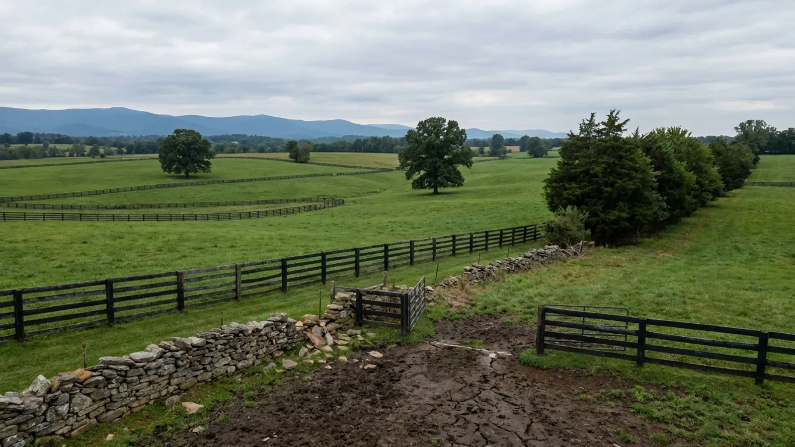
Barndominium Builders in Prince William County, VA
Prince William is two counties wearing one name. East of Manassas it is Woodbridge, Dale City and Lake Ridge at fifteen hundred people a square mile, and there is nothing there to buy. Northwest and southwest of that, in what the county's own 2040 Comprehensive Plan now calls Rural Communities, the Agriculture and Forestry designation still carries ten-acre lots by right and the A-1 district still asks ten acres for a new lot. That is where a barndominium here gets built. Three things make this county unlike its neighbours. It designates its entire territory a Chesapeake Bay Preservation Area, so the hundred-foot buffer rules and the hundred percent reserve drainfield reach every parcel, and a land disturbance over 2,500 square feet triggers the county's erosion requirements by name for a single-family house. Its building official signed a dated policy on the printed snow-load error in the 2021 construction code, which is the sharpest question a kit buyer in Virginia can ask a supplier. And it is the type locality for three shrink-swell soil series established here in 1985, with the county running its own three-category problem-soils policy on top.
Prince William County at a glance
- County
- Prince William County
- Population
- 502,966
- ZIP codes
- 20109, 20112, 20136, 20143, 20155, 20169, 20181, 22025, 22026, 22125, 22134, 22172, 22191, 22192, 22193
- Site visits
- Same week across the county
Building conditions in Prince William County
The building code itself is the same in every Virginia locality, and no county, city or town may amend it. What changes from one to the next is who issues the permit and inspects the work, what that office charges, how the parcel is zoned, and the Table R301.2 design criteria the locality publishes — the 2021 Virginia Residential Code prints that table blank, with the instruction that additional criteria shall be established by the local jurisdiction. Those local numbers are what your drawings have to satisfy.
Prince William County Department of Development Services, Building Development Division, Policies and Procedures, "Ground Snow Load (Virginia Uniform Statewide Building Code 2021)," issued by Eric M Mays P.E., effective 16 December 2024, https://www.pwcva.gov/assets/2024-12/GroundSnowLoad.pdf (PDF retrieved and read 2 September 2026); linked from the county's own VUSBC page
Prince William County Code Ch. 32 Zoning, Art. V, Part 504, Chesapeake Bay Preservation Area Overlay District, Secs. 32-504.05 and 32-504.10, as amended by Ord. No. 25-49 Att., adopted 9 September 2025 (Municode job 492570, codified through Ord. No. 26-32 of 2 June 2026); Design and Construction Standards Manual Sec. 741.01 E; Va. Code Sec. 62.1-44.15:68
Prince William County 2040 Comprehensive Plan, Land Use Plan chapter, adopted 13 December 2022, printable PDF published by the Planning Office at https://eservice.pwcgov.org/planning/documents/CompPlandocuments/Chapter%20PDFs/Printable%20Land%20Use%20Plan%20PDF.pdf (226 pages, retrieved and read 2 September 2026); Zoning Ordinance Secs. 32-300.40 and 32-301.06.2
Prince William County Code Ch. 32 Zoning, Secs. 32-300.03, 32-300.05 and 32-301.05, codified through Ord. No. 26-32 adopted 2 June 2026 (read via api.municode.com, client 5478 "Prince William County", product 14114, job 492570, and cross-read on princewilliamcounty.elaws.us)
USDA NRCS Soil Data Access, SDMDataAccess.sc.egov.usda.gov/Tabular/post.rest, survey area VA153 Prince William County, Virginia, queried 2 September 2026 (control: bogus areasymbol returns HTTP 200 with an empty result); Official Series Descriptions for JACKLAND, WAXPOOL and HAYMARKET, soilseries.sc.egov.usda.gov
Prince William County Department of Development Services, "Areas We Serve," https://www.pwcva.gov/department/development-services/areas-we-serve (read rendered 2 September 2026); Virginia Department of Health, Prince William Health District, https://www.vdh.virginia.gov/prince-william/
Also worth knowing before you build in Prince William County
- Not one acre rates "not limited" for a drainfield
- Run the NRCS septic tank absorption field interpretation across the whole Prince William County survey area and the result is stark: 142,398 acres rate Very limited, 29,339 acres rate Somewhat limited, 18,094 acres are not rated because they are urban land or water, and zero acres rate Not limited. The dominant limiting features are not what a shrink-swell county would suggest. Shallow to bedrock at 100 to 180 centimetres accounts for 70,528 acres, a water table near the surface for 69,684 acres, a seepy bottom layer for 65,346 acres and percolation for 44,088 acres, with slope of 8 percent and above on 26,390 acres. Clay is a foundation problem here more than a drainfield problem, and depth to rock and depth to water are the drainfield problem. That matters because Virginia sizes a drainfield at 150 gallons per day per bedroom under 12VAC5-610-670 Table 5.1, with no living-area band and no row for a shop, garage or barn at all, and because the Chesapeake Bay overlay adds a full 100 percent reserve area on top that cannot be built on.
- The county's own three-category problem-soils policy
- Section 770 of the Design and Construction Standards Manual is the most specific soils instrument found in any Virginia county on this build. It takes the 1989 Soil Survey of Prince William County, which describes 56 kinds of soil that expand to 91 mapped units once slope class and erodibility are added, and sorts all 91 into three engineering categories. Category I is good soil. Category II is potential problem soil, triggered by a high seasonal or perched groundwater table, shallow rock, natural asbestos formations, or ground in the western coastal plain unit. Category III is problem soil, triggered by high shrink/swell potential, compressible soils, existing uncontrolled or undocumented fills, floodplain and perennial high groundwater, or "eastern coastal plain/marine clay soils." The consequence for a house is direct. Category II soils, unmapped areas outside the eastern coastal plain unit, or ground disturbed without a compaction record all warrant a limited geotechnical study. Category III soils warrant a detailed one. Either way the report is prepared, sealed and signed by a professional engineer registered in the Commonwealth as the geotechnical engineer of record, and its recommendations are transposed onto the plan. The categorised table and digitised map are held at the Department of Public Works rather than published online.
- A county grant fund for foundation failure, live since July
- On 16 December 2025 the Board of County Supervisors adopted Ordinance No. 25-77, adding Chapter 34 to the county code and creating a Foundation and Soil Management Fund under Va. Code Sec. 15.2-958.7. It took effect on 1 July 2026. The fund makes grants to a private property owner or a common interest community for foundation management and soil settlement repairs on previously developed land, and its own definitions section splits the work between departments: Development Services if the issue is a foundation, Public Works if it is a slope. An individual owner may receive up to 50 percent of estimated project cost capped at $25,000, and a common interest community up to 50 percent capped at $100,000, for construction, design, permitting and special inspection costs. A foundation must be at least 10 but no more than 40 years old, and an applicant must show that research and testing already done identifies the original construction as the source of the problem. This is a repair programme for existing buildings, not help with a new build. Its value to someone choosing a site is what it proves: a Northern Virginia county has just legislated and funded a foundation-failure grant scheme, which is the county telling you what its ground does.
- Encroaching on the buffer, and the two dates that decide it
- Because every parcel is in the overlay, the exception route matters. Section 740.06 of the Design and Construction Standards Manual sends any proposed RPA encroachment that is neither exempt nor permitted to the Director of Public Works in writing, with a Water Quality Impact Assessment, and five findings must be made before relief is granted. An administrative exception is available on two grounds keyed to the county's own recordation dates. Lots lawfully recorded before 27 November 1990, where applying the RPA would cost the buildable area, may encroach the minimum necessary "to achieve a reasonable buildable area for a principal structure and necessary utilities," and the manual then adds a line worth reading twice for a barndominium: "accessory structures shall not be allowed if their construction will further reduce the RPA width." Encroachment is capped at 50 feet in width; beyond that it goes to the Chesapeake Bay Preservation Area Review Board at a public hearing. Lots recorded between 27 November 1990 and 1 March 2002 qualify on the same conditions plus compliance with any earlier exception and re-evaluation of any earlier best management practice. A third route exists where encroachment is needed to install a septic drainfield and no alternate percolation sites are available as verified by the Health Department. A denial can be appealed to the Review Board within 30 days.
- Slope: the county's own three-to-one rule
- Prince William writes its grading limits into its own manual rather than leaving them to a code reading. Section 710.01 says grading should be avoided on wooded slopes of 25 percent or more with a continuous area of 10,000 square feet or greater, in wooded 100-year floodplain, and on wooded slopes of 15 percent or more next to a stream. Then the hard lines: "Slopes steeper than three to one (3:1) are not acceptable, unless the existing grades are already in excess of three to one," in which case a geotechnical engineering report by a professional engineer is required and its recommendations must be implemented, and "graded slopes steeper than two to one (2:1) are not permitted." Three to one is 33.3 percent, and this is the county's own standard rather than a statewide one. Section 711.01 goes further for wooded slopes of 25 percent or more abutting perennial streams with a contiguous area of 10,000 square feet: they must be shown on plans as conservation areas and "shall not be disturbed before, during or after development," utilities and approved road crossings aside. Disturbance over 5,000 square feet needs a grading plan certified by a land surveyor or professional engineer; between 2,500 and 5,000 square feet with no other permit required, a land disturbance permit.
- One dwelling to a lot, and the eighteen-month exception
- Zoning Ordinance Sec. 32-300.11 allows no more than one building used for residential purposes on a lot. Three exceptions matter to someone building on rural land. Tenant houses accessory to a bona fide agricultural use are allowed under Sec. 32-300.02.12, which permits, "for lots ten acres or greater in size in agricultural districts, one dwelling unit for farm employees ... as an accessory use for every ten acres of lot area" - farm employees specifically, not a general second house. Temporary family healthcare structures are allowed under Sec. 32-210.16. And the practical one: the prohibition does not apply to "temporary modular or mobile homes used for dwelling purposes while a principal dwelling is being constructed or reconstructed," nor to living in an existing dwelling while a new one goes up, for a maximum of 18 months, subject to zoning approval and a bond or guarantee ensuring diligent construction and removal. Separately, Sec. 32-300.10 bars a nonresidential principal use on a lot carrying a principal residential use, though residential uses on parcels principally in bona fide agricultural use are deemed accessory to the farming. Note also that Virginia's statewide accessory-dwelling provision at Va. Code Sec. 15.2-2292.4 does not commence until 1 July 2027 and is no help before then.
- Radon: Zone 2, and that closes a door
- EPA's own county table puts Prince William in radon Zone 2, the 2 to 4 picocuries per litre band, alongside Loudoun, Arlington, Fauquier and Culpeper. Only Fairfax County is Zone 1 in Northern Virginia. That is not just a risk rating, it is a legal gate. Virginia added Section R331.1 to the Residential Code, which lets a locality bring IRC Appendix AF radon-resistant construction into force only "in areas of high radon potential, as indicated by Zone 1," and only after formal action by the governing body. On that text Prince William is not eligible to adopt it at all, whatever anyone might prefer. So radon-resistant construction here is a voluntary build decision, made at design stage when it is cheap, rather than a code requirement anyone will inspect. A passive sub-slab system on a new slab costs very little to rough in and a great deal to retrofit, which is the argument for doing it anyway.
- What the county publishes of Table R301.2, and what it does not
- The 2021 Virginia Residential Code prints Table R301.2 blank with em-dashes and the instruction that the criteria "shall be established by the local jurisdiction," so these are Prince William's own numbers from its own handout. Design wind speed 90 mph three-second gust. Minimum footer depth 24 inches, or until solid bearing soil is reached. Presumptive soil bearing capacity 1,500 psf on undisturbed soil. Roof 30 psf live plus 17 psf dead; floors 40 plus 10; sleeping areas 30 plus 10; decks and balconies 40 plus 10; attic with limited storage 20 plus 10. Slabs on grade 4 inches thick over a 10 mil polyethylene vapour barrier on 4 inches of wash stone. Concrete 2,500 psi at 28 days unexposed and 3,500 psi air-entrained where exposed. What the county does not publish anywhere found: a ground snow load, which the ASCE 7 policy answers instead, and no seismic design category, weathering class, termite or decay probability, winter design temperature, ice barrier answer, air freezing index, mean annual temperature, topographic effects answer or special wind region answer. Virginia's climate zone table puts the county in Zone 4A.
- The land, in numbers, and where it runs out
- Prince William is Virginia's second-largest county by population at 502,966 people on 335 square miles, 1,500 to the square mile, up 4.2 percent since 2020. The county's own Comprehensive Plan puts its area at 207,621 acres. Set against that, the 2022 Census of Agriculture records 20,388 acres in farms, 9.2 percent of the county, across 316 farms averaging 65 acres with a median of just 15, and 237 of those 316 operations are under 50 acres. Ninety percent of this county is not farmland and the typical farm is a smallholding. That is why the answer here is specifically the Agriculture and Forestry ground in the northwest and southwest, not the county at large. Where a buyer needs more depth of supply than the AF area offers, the named alternative is directly west: Fauquier County has 188,562 acres in farms, 45.5 percent of its land, a median farm of 50 acres, and it is not on the Chesapeake Bay Act statutory list at all, so crossing that county line leaves the RPA buffer and the Act's reserve drainfield behind entirely.
- The paperwork order, and the well-and-septic gate
- Zoning approval comes before construction plans, not after. The county's Residential Plan Review Requirements say zoning approval "for the addition, detached accessory structure, or second kitchen should be obtained before preparing construction plans," with three copies of a scaled house location survey plat showing the proposed structure and all dimensions and setbacks to the property lines, and two copies of that zoning approval submitted with the building plans. Plans go in as two identical sets at 11 by 17 inches or larger with the name and occupation of the designer on them; hand-drawn is accepted if legible, pencil is not. For any pre-manufactured or pre-engineered roof truss or floor joist system, which is most clear-span barndominium roofs, two original shop drawings with calculations and an original seal by a Virginia registered design professional must be approved before close-in inspection, and photocopied seals are not accepted. The gate that surprises people: "Adding a bedroom(s) to a dwelling on a private well and septic system requires written approval of the Prince William Health District prior to the issuance of a building permit." Design the bedroom count once, because changing it later reopens the septic file.
- Rural cluster, and what ten acres really buys
- A-1 asks ten acres for a new lot, but the ordinance offers an alternative shape. Sec. 32-300.40 permits rural cluster developments "in the rural area, as designated in the Comprehensive Plan," on A-1 land, subject to subdivision plan review and with a homeowners' association or recorded covenants responsible for the open space. Permitted uses inside a rural cluster are one-family dwellings, home occupations, home employment, and agricultural uses with their accessory buildings and structures as allowed in A-1. Where the parcel carries an existing farmhouse and its outbuildings, a dwelling designated as a cultural resource in the Comprehensive Plan, or a dwelling eligible for the National Register, that farmstead can sit inside the required open space, and if a separate lot is created for it that lot must be at least three acres. It is worth knowing this exists before assuming a large A-1 parcel divides only one way. It also matters for the accessory-structure rule above: a cluster lot is likely to fall under three acres, which is exactly where the 30 percent cap and the 18-foot height limit on detached buildings bite.
USDA NRCS Soil Data Access, survey area VA153, interpretation "ENG - Septic Tank Absorption Fields", component-weighted acres, queried 2 September 2026; 12VAC5-610-670 Table 5.1; Prince William County Design and Construction Standards Manual Secs. 741.01 F-G and 742.07 B
Prince William County Design and Construction Standards Manual, Section 700 Environmental Systems, Secs. 770.02, 770.10, 770.12 and 712.02 A.23, https://www.pwcva.gov/assets/2021-04/dcsm700_0.pdf, the version the county's Land Development Division links as current (footer: adopted 17 June 2014, effective 1 July 2014; the county's page records updates through 3 February 2020)
Prince William County Code Ch. 34, Foundation and Soil Management Fund, Secs. 34-1 to 34-6, added by Ord. No. 25-77 Att., adopted 16 December 2025, effective 1 July 2026 (Municode client 5478, product 14114, job 492570)
Prince William County Design and Construction Standards Manual, Sec. 740.06, Exceptions for Encroachments into the RPA, https://www.pwcva.gov/assets/2021-04/dcsm700_0.pdf; Zoning Ordinance Sec. 32-504.17
Prince William County Design and Construction Standards Manual, Secs. 710.01, 710.02, 710.03, 710.04 and 711.01 H, https://www.pwcva.gov/assets/2021-04/dcsm700_0.pdf
Prince William County Code Ch. 32 Zoning, Secs. 32-300.02.12, 32-300.10 and 32-300.11, codified through Ord. No. 26-32 adopted 2 June 2026; Va. Code Sec. 15.2-2292.4
EPA Map of Radon Zones county table, radon_zones-spreadsheet.xls, retrieved from the January 2021 EPA snapshot host; 2021 Virginia Residential Code Sec. R331.1 as added by 13VAC5-63-210, VCC Sec. 310.8 items 41-42
Prince William County Department of Development Services, Building Development Division, "Typical Residential Construction Specifications," version 2021-08-12, https://www.pwcva.gov/assets/2021-04/005524.pdf; 2021 Virginia Residential Code Table R301.2 and Table N1101.7
U.S. Census Bureau Vintage 2025 population estimates; 2022 Census of Agriculture, USDA NASS county file; Prince William County 2040 Comprehensive Plan Land Use chapter; Va. Code Sec. 62.1-44.15:68
Prince William County Department of Development Services, Building Development Division, "Residential Plan Review Requirements," version 2019-06-12, https://www.pwcva.gov/assets/documents/development/005526.pdf
Prince William County Code Ch. 32 Zoning, Sec. 32-300.40 Rural cluster development (Ord. No. 99-26, 4-20-99; Ord. No. 06-30, 3-7-06), codified through Ord. No. 26-32 adopted 2 June 2026

The expensive surprises are in the ground, not the building
What moves a Virginia budget is usually below grade, and it is soil rather than rock. Five localities already treat a soil answer as a condition of the permit rather than a recommendation — Fauquier, Chesterfield, Isle of Wight, Madison and Culpeper each require a soil report, an engineered foundation design, or both before the footings are approved. Chesterfield asks for one on every new house with no opt-out, on its own published reasoning that small amounts of shrink-swell soil may turn up anywhere in the county. Virginia Energy puts the same point bluntly: standard homeowner's insurance does not cover damage from expansive or compressive soils. Along the Interstate 81 corridor the question changes shape entirely — Virginia Energy counts twenty-seven Virginia counties in the karst zone that follows that road, where what matters is what is under the slab rather than what the slab sits in, and karst does not stay west of the Blue Ridge: Loudoun County publishes karst terrain of its own, on the other side of it. The same ground then sizes the septic system, because 12VAC5-610 works from bedrooms and soil texture — 150 gallons a day per bedroom, with no row in the table for a shop, a garage or a barn at all, and clay assigned to the slowest texture group at 91 minutes per inch or worse, past the 45 minutes per inch that makes a reserve drainfield mandatory. The soil that needs a foundation engineer multiplies the drainfield. So the site work, the foundation and the drainfield get resolved together rather than one at a time. We price the dirt before we price the building.
What we build in Prince William County
All nine services are available in Prince William County. What a build costs depends far more on the parcel than on square footage, so we price against your land rather than publishing a rate card.
Custom Plans
Barndominium floor plans drawn to your parcel and to the design criteria your own Virginia locality publishes, not to a generic national spec.
Barndominium Kits
Engineered barndominium shell packages delivered to your Virginia land, drawn to the criteria your own building department fills in.
Turnkey Builds
Start to finish barndominium construction: permits, site work, shell and full interior finish, under one contract and one schedule.
What a build looks like
Three stages every Prince William County project passes through, from a raw parcel to a finished home. Site work first, because that is where the budget is decided.

The parcel
Zoning, setbacks, flood zone and utility access get checked before anything is drawn.
Pad and permit
Clearing, grading and a compacted pad, while the submittal works through whichever office issues the permit where you are building.

Frame to finish
Shell erected and dried in, then systems, insulation and interior finish through to CO.
Those are the rules where you are building in Prince William County. Tell us what you want to build and we will draw it to them.
Where we build around Prince William County
Prince William County and the rural land around it. The buildable acreage for a project this size usually sits outside the city limits, which is frequently what changes who issues your permit.
Keep reading
The questions that usually come next once you know what Prince William County allows.
Barndominium Cost Guide
Sourced per-square-foot ranges by tier and by size, with a calculator built on the same figures.
Read itIs It Legal in Virginia?
Classification, zoning, the HOA gate, and why "nonresidential farm building" does not cover a home.
Read itHow Long Does It Take?
Census build-duration data, and what actually sets the permit clock where you are building.
Read itNearby areas we build in
Others we cover nearby. One may be a county, another an independent city that belongs to no county at all, and another a town inside a county — so the office that issues the permit, the fees it charges, the zoning and the design criteria each locality publishes can all differ from one card to the next.
Building in Prince William County: common questions
10 questions we get asked most often about building in Prince William County. If yours is not on the list, ask it directly.
What ground snow load should my building be designed to in Prince William County?
Is my land in the Chesapeake Bay Preservation Area?
Can I put up a big shop that is larger than the house?
Where in Prince William County can I actually buy land to build on?
I am building near Haymarket or Gainesville. Should I worry about the soil?
Who issues my building permit, and does it change if I am in one of the towns?
How much is the building permit, and what does not need one?
My land is on a slope. What does that change?
Can I live in an RV or a mobile home on the land while the barndominium goes up?
Does Prince William require radon-resistant construction?
Building in Prince William County?
Start with the plan. Tell us what you want to build and we will draw it, then confirm which office issues the permit for your parcel, what it will let you put there, and what wind load it has to meet. That conversation costs nothing.